FOR WE CANNOT TARRY HERE:
THE COOPER AND SIMPSON FAMILIES ON THE FRONTIER
Kirke Wilson San Francisco 1990
For my father, Earl Simpson Wilson, and those Coopers, Simpsons and others whose courage and strength inspire the generations who follow.
For we cannot tarry here, We must march my darlings,
We must bear the brunt of danger, We the youthful sinewy races,
All the rest on us depend, Pioneers! 0 Pioneers!
Walt Whitman
“Song of the Pioneer,” 1865
Onward ever, Lovely river,
Softly calling to the sea, Time that scars us, Maims and mars us,
Leaves no track or trench on thee.
Samuel L. Simpson “Beautiful Willamette,” 1868
History abhors determinism but cannot tolerate chance. Why did we become what we are and not something else?
Bernard do Voto, preface to The Course of Empire, 1952
So it is with a family. We carry dead generations with us and pass them on to the future aboard our children. This keeps the people of the past alive long after we have taken them to the churchyard.
Russell Baker
The Good Times, 1989
PART I
THE VIRGINIA, KENTUCKY,
TENNESSEE FRONTIER, 1750-1800
Chapter 1: The Early Frontier 1
Chapter 2: The Frontier Before the Revolutionary War, 1763-1775 24
Chapter 3: The Revolution, 1765-1781 41
Chapter 4: The Revolutionary War on the Frontier 53
Chapter 5: Kentucky in 1782 79
Chapter 6: Life on the Tennessee Frontier 1782-1800 103
Afterward 135
Index 136
Maps
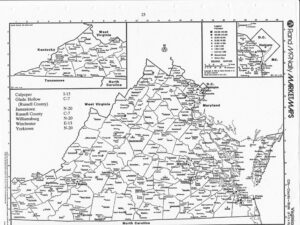
Virginia 23
Tennessee 40
Kentucky 78
i
PREFACE
What follows is the first draft of part of the story of the Simpson family for which I have been collecting information for several years. My interest began as a genealogical investigation simply trying to identify ancestors and plot their travels. As I accumulated more information, I became increasingly interested in how these people lived and why they kept moving. My focus shifted from them to the circumstances in which they lived and I began to realize that their story, the story of common people raising families in uncommon times and settings, might illuminate that part of United States history related to the frontier. The brief family history which I had intended had grown to a broader effort to understand the settlement of the West through the experience of this restless but ordinary family and hundreds of families like them who uprooted themselves repeatedly in the nineteenth century and moved west.
When completed, the story will consist of five sections each comprising several chapters. The first part, which is enclosed, includes the period from the early exploration and settlement of Kentucky and Tennessee in the late eighteenth century. The second part, much of which has been completed, is devoted to the Missouri frontier from 1800 to 1846 and includes chapters on the War of 1812, the fur trade and the Santa Fe Trail. In future years, a third part will follow members of the Cooper and Simpson families across the plains to California and Oregon in 1846. The fourth part will include chapters on the Oregon period 1846 to 1900 including the Cayuse War, the anti missionary Baptists of William Simpson, the peregrinations of Benjamin Simpson in business, politics and Indian affairs, the activities of Sylvester Simpson as legal scholar and education leader as well as a chapter on Samuel Simpson, the pioneer poet. A fifth part will describe the activities and experiences in California of the Coopers and Simpsons during the last decades of the nineteenth century as the frontier closed.
ii
Throughout the story, I will be using the context of the time and place, as best I can describe it from primary and secondary sources, as a frame within which we can picture these families and their lives. Much of the story takes place on the frontier where literacy is limited and documentation is scarce. During the early period there is little direct documentation of the Cooper and Simpson families except as they participate in wars or buy land. As the story moves west into Missouri and Oregon, the trail becomes rich with letters, contemporaneous recollection and official records. Despite the information available about the families, the places and the times, significant aspects of these pioneer lives are missing. The major gaps are in the everyday lives of the people including particularly the lives of the women and the life in the home. The story follows the families who moved and neglects those Coopers and Simpsons who remained in Virginia, Kentucky, Tennessee and Missouri. I am hoping that this preliminary draft will solicit comment and information about sources I may have overlooked and documents of which I am unaware.
Like anyone who inquires about frontier history, I am deeply indebted to the tireless historians of the 19th century, particularly Lyman Copeland Draper and Hubert Howe Bancroft, who preserved the information on which other historians depend by collecting the documents and interviewing the pioneers. I also found myself depending on the work of a group of regional and local historians of the 19th century, many of them anonymous, who had prepared histories at the time of the national centennial in 1876. I am particularly grateful for the assistance and access to historical collections I received at libraries throughout the United States including the Bancroft and Doe Libraries of the University of California, the Boonslick Regional Library in Boonville, Missouri, the California Historical Society, the Culpeper Town and Country Library in Virginia, the Filson ” Club in Louisville, the Joint Collection University of Missouri Western Historical Manuscript Collection – Columbia and the State Historical Society of Missouri Manuscripts, the Library of Congress, the National Park Service, the New Mexico State Historical Society in Santa Fe, the New
iii
York Public Library, the Oregon Historical Society, the Oregon State Archives in Salem, the San Francisco Public Library, the Tennessee State Library and Archives in Nashville, the Transylvania University Library in Lexington, Kentucky, the United States Archives in Washington, D.C., the Wisconsin State Historical Society and the Coe Collection of Western Americana and the Sterling Memorial Library at Yale University.
Like other contemporaries who have written about the Simpsons, I am the beneficiary of a serendipitous contact with my remote cousin C. Melvin Bliven of Wedderburn, Oregon and his generosity which, among other things, led me to Sam L Simpson’s 1981 book Five Couples and Shirlie Simpson’s 1982 book, The Ore2on Pioneer: Benjamin Simpson and his Wife Nancy Cooper.
My brother Bruce Wilson and my cousin Kevin Wilson have been very helpful in bringing obscure sources to my attention and exceedingly patient in awaiting any product.
San Francisco, California
June 1990
iv
INTRODUCTION
The Simpson families who crossed the plains to Oregon by wagon in 1846 were descended from pioneer families who had lived on the frontier since before the Revolutionary War. From the frontier of Virginia, they were early settlers in Tennessee, Kentucky and Missouri. They had fought Indians and British to claim lands which they cleared, settled and farmed before moving on to new opportunities on a new frontier. Members of these families fought in the French and Indian War and Lord Dunmore’s War while in Virginia, the Revolutionary War and subsequent Indian campaigns while in Kentucky, and the War of 1812 while in Missouri before moving to Oregon where they participated in the Cayuse Indian War.
Members of these families were among the first settlers in Kentucky and Tennessee at the time of the Revolutionary War and among the first settlers in Missouri before the War of 1812. They were among the first parties to successfully travel the Santa Fe Trail and among the first parties to use the Barlow Road across the mountains into the Willamette Valley of Oregon. They were elected to public office in the frontier settlements of Tennessee, Kentucky, Missouri and Oregon and were active in the civic and spiritual life of the frontier. These families, named Simpson, Cooper, Kimsey, Higgins, Knight and Smelser, built homes, planted crops and raised chicken on the frontier while continually moving west.
For these pioneers, the frontier was the opportunity to begin anew and the hope they would do better. It was the attraction of cheap land, cheap if you were prepared to invest the effort to clear it and protect it from Indians, and it was the chance that the new land might produce greater prosperity than the old. After frequent moves in each generation, the lure of the new frontier may have simply been the product of recurring dissatisfaction or restless habit.
The idea of the frontier was a significant factor in the American imagination from the early
v
days before the distinguished historian Frederick Jackson Turner pointed out its critical role in American history and social development a century ago. The historical pattern was obvious. The country began along the rugged coast of New England and in the fertile lowlands of Virginia and, as the population expanded, pioneers pushed forward into the wilderness and often into serious political disagreements with foreign countries, Indians or even other parts of our own country over land claims and settlement rights. In nearly every case, the pioneers eventually prevailed, the frontier became settled and opportunities lay out on another new frontier where the pattern would be repeated. This history built the country westward, over the first mountains with Daniel Boone, into the great valleys of the midwest and finally across the plains with the wagon trains.
For much of the past hundred years, historians have debated Turner’s frontier hypothesis. Some have modified or elaborated the thesis while others, including particularly a new generation of young scholars, have vigorously challenged Turner’s formulation. There is little quarrel with the notion that the wilderness created opportunity and required the remaking of democratic institutions out of chaos. The central issue is whether this process of taming the wilderness and settling the frontier resulted in something unique called the American character, that somehow European sophistication was stripped off by primitive simplicity. As critics have pointed out, this romantic view, with its own primitive simplicity, is too grand to reflect the diversity of frontier experience and neglects the frontier roles of women, Indians, traders, trappers and others who fall outside the Daniel Boone archetype. Any contemporary analysis of the frontier experience requires a more complex view of the contributions of those whose history has been neglected and somewhat greater humility about the morality of a process in which Europeans systematically grabbed land from Indians through lies, trickery, force and threat, always resulting in treaties of purchase which were being violated as the ink dried.
As the Cooper-Simpson narrative suggests, the interaction of settler and Indian was formative
vii
seems to be somewhat in conflict with the myth of the independent and self-reliant frontiersman. Like his contemporary counterpart, the frontier entrepreneur saw government as an ally in the achievement of private advantage.
If the frontier hero was far too human and far less independent than the myth, what remains of Turner’s notion that the frontier experience contributed somehow to the creation of national character? If that national character is the mix of optimism, independence and willingness to build anew, the myth of the frontier experience may have been far more powerful than the reality of that experience. Whether it was the availability of relatively unclaimed land or the relative absence of traditional social and institutional constraints; the frontier was briefly a place of hope and opportunity. It was also a place where individual effort and risk might be rewarded and where for a time, people might be judged on their own accomplishments rather than the social status of their families. Finally, the frontier was a place where individuals, seeking personal advantage, acted with confidence that they were also advancing the welfare of their communities and nation.
Much of this jumbled 19th century concept of the national character survives. Some of it remains only a myth. Other parts, particularly the optimism and independence, while not necessarily part of some national character, are essential parts of the national myth. They remain powerful, however we may stray, because they provide a unifying sense of national purpose and national ideals. While a relatively small part of the current United States population has any direct claim to the frontier experience, much of the population, including many of the most recent immigrants, deeply and strongly believe the myth and shares its values of independence and optimism. It may be mostly myth but it may also be central to those values, experiences, expectations and mannerisms which unite us as people and set us apart from others.
1
CHAPTER ONE
THE EARLY FRONTIER
As for the West… the limits are unknowne.
Captain John Smith 1624 1
The western limits of Virginia were indeed “unknowne” to Captain John Smith and the 100 men and four boys who perched precariously on the Chesapeake Bay shore at Jamestown in 1607. Smith and his companions were promptly attacked by Indians and weakened by disease and starvation. Fifty-one died during the first six months, but they would survive to build the first permanent, English-speaking colony on the North American continent. While the western limits were unknown to the British, they were well-known to the Spaniards. The Spaniards had established colonies in the Caribbean soon after Columbus and explored the southern half of what is now the United States during the sixteenth century while the British remained at sea searching for a mythical passage to the East.
The Spaniards settled Hispaniola Island, now known as Santo Domingo, in 1492, Puerto Rico in 1501, Jamaica in 1510 and Cuba in 1512. Hernan Cortes, with about 500 soldiers, conquered the Aztec Empire 1519 to 1521 and claimed Mexico for the Spanish Empire. Within fifteen years, the Spaniards had completed the conquest of the Inca in Peru and the Chibcha in Columbia. Other Spaniards explored the New World by sea and on foot. Juan Ponce de Leon explored the Florida peninsula in 1513 and Alonso Alvarez de Pineda explored the Gulf Coast in 1519. Panfilo de Narvaez died exploring Florida in 1528 and his colleague Alvar Nunez Cabeza de Vaca spent the next eight years crossing Texas and Mexico to the Pacific (1528-1536).2
Hernando de Soto organized an expedition that spent four years exploring what is now the ten states of the southeastern United States (1539-1543) while Friar Marcos de Niza (1539) and
2
Francisco Vasquez de Coronado (1540-1542) were exploring the Southwest including parts of what is now Arizona, New Mexico, Texas, Oklahoma and Kansas. Coronado’s army of ambitious second sons of Spain ranged from the Colorado River through the pueblos of the Zuni and the Hopi to the Indian villages of central Kansas. In the summer of 1540, Coronado’s scouting parties included the first Europeans to see the Grand Canyon in Arizona, the Colorado River along what is now the California-Arizona border and the vast herds of bison on the plains. The following year, while returning to New Mexico from Kansas, Coronado’s small army was guided along an old Indian trade route which 280 years later would become the Santa Fe Trail.3
While the Spaniards explored much of what is now the southern half of the United States during the first half of the sixteenth century, they were slow to establish permanent settlements like those in Mexico and South America. The first Spanish colonies in Florida (1559-1561 and 1566- 1576) were unsuccessful and were abandoned. The French, in a bold move to challenge Spanish hegemony in the region, attempted to establish colonies in Florida in 1562 and 1563. The first French attempt failed and the second was wiped out by the Spaniards in 1565. The same year, the Spaniards established St. Augustine, the first European settlement to survive in what is now the United States. During the following decades, the Spaniards established fortified outposts and missions along the Florida-Georgia-Carolina coast and across northern Florida. Seventy years after the Fray Marcos expedition, the Spaniards established a permanent settlement at Santa Fe in 1609.
British exploration of North America began in 1497 when John Cabot (nee Giovanni Caboto), a Genoese in British service, landed briefly in what was probably Newfoundland. After this early start, the British were inactive in the New World for more than half a century until Elizabeth I became queen in 1558 and the British began to assert their sea power. Sir John Hawkins, Sir Francis Drake and Sir Humfrey Gilbert all sailed the coasts of the New World for their queen. Drake interrupted his around-the-world buccaneering expedition (1577-1580) in June 1579 to land on the
3
California coast where he left a plate of brass and claimed the land he called Albion “…in the name and to the use of Her Most Excellent Majesty.”4
Sir Humfrey Gilbert sailed to Newfoundland in 1583 and his half-brother Sir Walter Raleigh sent ships to the coast of what is now North Carolina in 1584 and 1585 to assess the prospects for colonization. In 1587, Raleigh sent 117 men, women and children to establish a permanent British settlement at Roanoke Island on the coast of what is now North Carolina. The supply ships that were to have been sent to Roanoke in 1588 were diverted to the battle with the Spanish Armada. By 1590, when the first British ships arrived to resupply the stranded colonists, there were no survivors. The members of the “Lost Colony” had either starved or been killed by Indians.5 ..
The Virginia Frontier
In 1606 investors in London and Plymouth each formed joint-stock companies to establish colonies in Virginia. The Virginia Company of London sent out three small ships and landed 104 settlers on the Virginia tidewater at Jamestown. The colony was weakened by disease and starvation and attacked by Indians. Timely reinforcements in 1609 forestalled plans to abandon the little settlement. The colonists planted gardens to feed themselves and experimented with several export crops including silkworms, flax and hemp. In 1612, they discovered that the Virginia lowlands were particularly well suited to the cultivation of tobacco. With an export crop and source of income, the growth of the colony was assured. By 1618, immigration had increased the population of the Virginia colony to 1000 and the settlers were beginning to spread out along the James River seeking fertile soil for tobacco.
The Virginia colonists, after early skirmishes, lived peacefully with their Indian neighbors for more than a decade. The unsuspecting settlers were shocked one March morning in 1622 when the Indians mounted coordinated attacks at eighty separate locations along a 140 mile line. The Indians were unsuccessful in driving the colonists into the sea but they killed 347 of the 1240 settlers in
4
Virginia. The surviving colonists consolidated the settlements, strengthened their defenses and organized retaliatory raids against the Indians burning houses and destroying food. In spite of the threat of Indians and continuing problems of disease, the Virginia colony continued to attract immigrants from England. The population reached 3,000 by 1630 and 8,000 by 1640.
In April 1644, the Indians launched a second general attack on the Virginia settlements killing between 400 and 500 colonists. The settlers organized punitive raids which resulted in a 1646 agreement with the Indians. Starting a pattern that would continue across the continent for more than 200 years, the Indians gave up land to the colonists in exchange for assurances that other land would be reserved for Indian use. The Indians of Virginia ceded the Tidewater lands between the York and James Rivers for the English and obtained English recognition of Indian rights to live and hunt without interference in the lands north of the York River.6
As the Virginia population grew, the settled area expanded until it reached the “fall line” where rapids and falls prevented coastal vessels from travelling upstream. This line, dividing the settled coastal plane called the Tidewater, from the upland wilderness called the Piedmont, was the Virginia frontier in the last quarter of the seventeenth century. The line also divided the large and slave-dependent tobacco plantations from the frontier farms, many of them owned by families who had served out indentures in the Tidewater.
A frontier Indian incident in 1676 resulted in what has been remembered as Bacon’s Rebellion and demonstrated the independence of the frontier settlers as well as the intransigence of the British governor. A dispute over payments due Indians resulted in the murder of a farmer and escalated into a border war. The settlers retaliated with a campaign against the Indians and the murder of five Susquehannock chiefs under a flag of truce. The Indians responded with raids killing 36 frontier settlers.
5
When the royal governor Sir William Berkeley (1606-1677) vacillated in his response, the frontiersman defied the governor and formed an army under the command of Nathaniel Bacon, Jr. (1647-1676), a recently-arrived, young planter who was a cousin of the governor’s wife. Rather than accept the governor’s proposal of a defensive strategy, the angry frontiersmen attacked and defeated the Indians in two engagements. Bacon’s army turned on Governor Berkeley who fled to safety on the eastern shore of Chesapeake Bay. Bacon’s army burned Jamestown but disintegrated in the fall and winter of 1676 after Bacon died of disease. Governor Berkeley returned and reasserted his authority by hanging 23 leaders and repealing laws enacted during the rebellion.7
During this period, Virginia tested a variety of methods to protect the frontier settlement against the Indians who had been pushed out of the tidewater. Although the settlers were serving as a buffer to protect the tidewater plantations, the planters were reluctant to allocate money for frontier defense. After the Indian uprising in 1675 and 1676, the Virginia Assembly proposed the assignment of troops to a string of forts located along the fall line. The settlers objected to the fort strategy because it was too passive and too costly. In 1691, the Assembly suggested a second approach deploying mounted rangers to scout for Indians along the fall line.
By 1701, Virginia found an effective but inexpensive solution by offering to subsidize frontier settlement. Virginia offered land grants of 10,000 acres or more, along with exemption from taxes and other military service as well as twenty-year exemption from quitrents for those communities providing, for every 500 acres,
one christian man between sixteen and sixty years of age perfect of limb, able and fitt for service who shall alsoe be continually provided with a well fixed musquett or fuzee, a good pistoll, sharp simeter, tomahawk…8
In addition to providing soldiers to protect the frontier, the new colonists were required to build forts within two years:
6
with good sound pallisadoes at least thirteen foot long and six inches diameter in the middle of the length thereof,and set double and at least three foot within the ground.9
These frontier forts in Virginia with their wooden stockades and militia were the model for the frontier stations in Kentucky in the 1770s and 1780s and the family forts of the Missouri frontier of 1810. The strategy of forts and militia enabled Virginia to push the settlements forward into Indian country.
In a strangely perverse way, the interaction with the Indians may have been the formative factor in frontier life. The constant threat of Indian raids required that the independent and self sufficient frontier family could not survive alone. Families would have to organize their lives with fortified stockades and militia to protect themselves and their neighbors. The massacres of 1622 and 1644 convinced the Virginians to settle in clusters and protect themselves. A frontier Indian incident in 1675 resulted in Bacon’s Rebellion, the first organized and armed defiance of British authority by colonists in North America. The pattern of frontier forts and militia, developed in response to the seventeenth century Indian threat in Virginia, became the model for Kentucky and Tennessee in the eighteenth century and Missouri in the nineteenth century. The organization and cooperation that was essential for frontier survival also provided the basis for self-government as the newly-settled areas matured.
Culpeper County
By the mid-eighteenth century, the western frontier of Virginia had advanced to the base of the Blue Ridge. The Shire of York, which dated from 1634, had been subdivided repeatedly into counties over the following century. Orange County, formed out of part of Spottsylvania County in 1734, was itself divided in May 1749. The area south of the Rapidan River, then called the Conway, remained in Orange County,
all that other part thereof, on the north side the said Rappahannock
7
and Conway river commonly called the Fork of Rappahannock River, shall be one other distinct County and called and known by the Name of Culpeper County.10
The area bounded by the Rapidan on the South, the Rappahannock on the North and the Blue Ridge on the West became Culpeper County.11
The new county was named for Thomas Lord Culpeper, second Baron Thoresway (1639- 1689) who had served as Governor of Virginia from 1677 to 1683. Culpeper was the son of one of seven men who were rewarded for remaining loyal to the Stuarts after the execution of King Charles in 1649. The seven accompanied the Prince of Wales into exile in France where, in prolix gratitude,
Charles the Second by the grace of God King of England, Scotland and Ireland Defender of the faith…wee have taken into Our Royall Consideracon the great propagation of the Christian faith together with the wellfare of multitudes of Our Loyall Subjects by the vndertakings and vigorous prosecution of Plantations in fforeign parts, and particularly in our Dominions of America 12
he granted the seven 1.5 million acres of land in North America. The land was described by the king’s patent as,
lying in America, and bounded by, and within the heads of Tappahannocke als Rappahannocke and Quircough orPatawomecke Rivers, the Courses of the said Rivers and Chesapayoake Bay…13
Known as the Northern Neck of Virginia, the royal grant included all the lands lying between the Rappahannock and Potomac Rivers from Chesapeake Bay to the “heads” of the rivers. Charles II was restored to the throne of England in 1660 and he confirmed the 1649 grant in September 1661. By 1681, Thomas Lord Culpeper had successfully acquired all but one of the shares from heirs of other patentees. When Culpeper’s widow inherited the missing share in 1695, the Northern Neck proprietary was owned in its entirety by the Culpeper family.
Richard (King) Carter, a prosperous Virginia planter acting as resident agent for the proprietors, was able to expand the proprietary to 5.3 million acres by extending claims over the Blue Ridge to the Alleghenies encompassing what is now 24 counties in Virginia and West Virginia
8
including the county posthumously named for Lord Culpeper. Thomas, sixth Lord Fairfax, Baron of Cameron (1692-1781), the second Lord Culpeper’s grandson, inherited the vast Culpeper lands which came to be called the Fairfax proprietary.14
St. Mark’s Parish, organized in 1731, was located in that part of Orange County which became Culpeper County in 1749. Until 1752, when Bromfield Parish was established, all of Culpeper County was in St. Mark’s Parish. In later years, additional counties were formed out of the original Culpeper County. In 1793, the western part of Culpeper County became the new Madison County and in 1833, the northwest part of Culpeper County was organized as Rappahannock County.15
At the same time that Culpeper County was being formed, the Cooper family was beginning to leave a record in county life.16 On August 23, 1749, Lord Fairfax granted 400 acres of Culpeper County land to John Cooper.17 In March 1750, John J. Cooper was a witness to a land transaction in which Anthony Scott gave 105 acres of land to his daughter Elizabeth and her husband Thomas Corbin. 18 In May 1750, John Smith sold part of his land on the north side of the north branch of Gourd Vine River to Abraham Cooper, a carpenter, for 25 pounds.19 In November 1750, John Cooper and his wife Judith traded 300 acres of the Fairfax land to John Smith in exchange for 300 acres on the south side of the north fork of the Gourd Vine River. The land on the Gourd Vine was adjacent to a line separating the property of John Smith and Abraham Cooper.20
In September 1752, Abraham Cooper was a witness when Anthony Scott gave 80 acres to his grandson Richard Burke.21 When Anthony Scott died in 1764, his will left his books to his son and his plantation and lands to his wife Jane. In the event that Jane Scott died, remarried or left the plantation, the son was to inherit the land and Scott’s daughter Frances, the wife of Abraham Cooper, was to inherit other property. Each of Scott’s two other daughters received one shilling. Francis Cooper was a witness when Anthony Scott’s will was admitted to probate in 1764.22 It is
9
unclear how John and Judith Cooper, Abraham and Frances Cooper and Francis Cooper are related except that they were landowners in the same Gourd Vine River area of north-central Culpeper County and were involved in business dealings with Abraham Cooper’s father-in-law Anthony Scott during the 1750s.
Francis Cooper and his wife, whose name is not known, established a household in Culpeper County in the early 1750s. In January 1756, Francis Cooper’s wife gave birth to their first son Benjamin A Cooper (1756-1841).23 Later that year, Francis Cooper served in the Culpeper County militia. He was one of 53 foot soldiers in the company formed in March 1756 under the command of Lt. Col. William Russell and Capt. William Brown.24 Francis Cooper served 95 days with the Culpeper troops defending the Virginia frontier during the French and Indian War.25
In May 1761, Francis Cooper purchased land in Culpeper County from John and Elizabeth McQueen for 30 pounds. The land was in St. Mark’s Parish and was located “on a stoney point corner to Richard Tutt, Gent. in John Yancey’s line…in Alexander McQueen’s line…”26 In addition to their oldest son Benjamin, Francis Cooper and his wife had several other children including a son Sarshel (1763-1815), as well as at least two other sons and several daughters including one named Betty, who married James Wood.27 Francis Cooper continued to live in Culpeper County until the Revolutionary War and served in Lord Dunmore’s War in 1774.
During this period, Culpeper County had a small number of large plantations, like the 20,000 acres owned by Robert Beverly and the 13,000 acres of Capt. John Strother, and a large number of small and medium-sized farms. In 1764, there were 63 plantations exceeding 1,000 acres and more than 700 farms between 100 and 400 acres. The smaller farms had a log farm house, typically sixteen by twenty feet with a gable roof, surrounded by fields, pastures, orchards and wooded areas. Since plows were not available until late in the eighteenth century, the Culpeper farmer of this period used hoes and other hand tools to grow corn, winter and summer wheat and tobacco. Crops
10
were grown among the stumps of recently-cleared woods and rotated between grains and pasture as land-productivity declined. The large land owners, using slave labor, planted tobacco and allowed fields to lay fallow when productivity declined.28
French and Indian War
French claims in North America were based on the explorations of Giovanni de Verrazano, a Florentine working for the French king. Verrazano explored the Atlantic coast in 1524 and Jacques Cartier sailed up the St. Lawrence River in 1535-1536. From 1608, when they established an outpost at Quebec, the French had a strong interest in the interior of the North American continent. In 1673, Louis Jolliet and Father Jacques Marquette traveled down the Mississippi River to the Arkansas. Nine years later, Robert Cavelier, Sieur de la Salle explored the Mississippi to the Gulf of Mexico. In April 1682, La Salle claimed the vast area drained by the Mississippi River,
In the name of the most high, mighty, invincible, and victorious Prince, Louis the Great, by the grace of God, King of France and of Navarre, Fourteenth of that name…29
He was uncertain whether the river was Colbert or Mississippi but he called the land Louisiana. By the early part of the eighteenth century, the French had established outposts in the Illinois country at Kaskaskia, Cahokia and Vincennes as well as Gulf coast settlements at Biloxi (1699) and Mobile (1702).
While the French were exploring the North American interior and establishing remote outposts, they were also engaged in intermittent continental warfare with the British and other European countries for nearly a century. The wars of the Old World were named like hurricanes in the New World. The War of the League of Augsberg (1689-1697) was King William’s War, and the War of Spanish Succession (1702-1713) was Queen Anne’s War. The War of Austrian Succession (1740-1748) was known as King George’s War in North America. Each of the European
11
wars was accompanied by frontier skirmishes in North America. In most cases, Indians under the direction of the French engaged the frontier settlers of the British.
In King William’s War, the French and their Indian allies raided the isolated farms along the frontier in Connecticut, Massachusetts and New Hampshire. In Queen Anne’s War, the French and Indian attacks in Maine resulted in the killing or capture of 160 farmers and their families and the placing of a bounty of 40 pounds on each Indian scalp. In February 1704, 250 Canadians and Indians attacked the frontier town of Deerfield, Massachusetts where fifty townspeople were killed, 111 captured and seventeen houses destroyed. Nearly half of the captured townspeople, most of them women and children, never returned. By King George’s War, forty years later, the British colonies in New England were stronger and better organized. The colonies sent 4000 troops to Cape Breton Island where the “Bastonais” captured the strongly-defended Louisbourg fortress after a siege of six weeks.30
By 1748, the population of the English colonies in North America had grown to 1.5 million. The pressures of population growth were pushing the colonists against the mountain barriers and into the Indian territory claimed by the French. After the Peace of Aix-la-Chapelle in 1748, the French remained in control of the interior wilderness. The French strengthened fortifications and their alliances with the Indians along the Appalachian frontier. At the same time, colonists along the Atlantic coast were looking for ways to establish land claims west of the mountains. In 1747, a group of Virginia venture capitalists formed the Ohio Company of Virginia and two years later obtained a grant of 200,000 acres of land between the Appalachian mountains and the Ohio River.
In 1754, a young George Washington (1732-1799) was sent ‘”‘.ith Virginia militia to build a fort at the Forks of the Ohio, present-day Pittsburgh, to protect the Virginia claims. Finding that the French had erected Fort Duquesne at the forks and controlled the area, Washington and his out numbered Virginians surrendered and were allowed to return to their homes over the mountains.
12
The following year, the British dispatched Maj. Gen. Edward Braddock and two army regiments to capture the Forks of the Ohio. With 1500 regular soldiers and 1200 colonial militia, Braddock’s army cut a road over the mountains and through the wilderness. On July 9, 1755, the French and Indians surprised Braddock’s army on the Monongahela River seven miles from the fort. The British and their provincial allies were decisively defeated in a battle in which Braddock was killed and 976 of his troops were killed or wounded.
The defeat of Braddock’s army, along with British failure to capture French forts at Crown Point and Niagara left the French and their Indian allies in unchallenged control of the wilderness and able to organize strikes at any point along the frontier. George Washington, who had served as a volunteer aide-de-camp to Braddock in the ill-fated campaign, wrote soon after the battle,
I tremble at the consequence that this defeat may have upon our back setters, who I suppose will all leave their habitation’s unless their are proper measures taken for their security.31
Col. James Innes, the commanding officer at a fort on the Virginia frontier, wrote an open letter, “I have this minute received the melancholy account of the Defeat of our Troops …it’s highly necessary to raise the Militia everywhere to defend the Frontiers.”32
Robert Dinwiddie, the Lieutenant Governor of Virginia, anticipating a French and Indian invasion, called out the militia in three frontier counties and alerted the militia in nine adjacent counties. In August 1755, when the frontier militia proved ineffective, the Virginia General Assembly authorized a war tax and the formation of a Virginia regiment of 1200 troops to protect the frontier. Governor Dinwiddie appointed George Washington, then but twenty-three years old, Colonel of the Regiment and Commander-in-Chief of the militia.33 The precocious Commander-in Chief arrived on the frontier in September where he found that approximately 70 settlers had been killed in Indian raids. By October, the Indians had withdrawn and Washington was able to use the
13
winter respite to construct four small forts along the 100 mile frontier in the Shenandoah Valley between the Blue Ridge and the Allegheny Mountains.34
In March 1756, Indians and their French allies resumed their attacks along the Virginia frontier. Pioneer families, who had been uprooted the previous summer, again abandoned their farms and moved into forts for protection. Realizing that the tiny Virginia Regiment was inadequate, Washington again appealed for assistance from the militia of nearby counties. In April 1756, Governor Dinwiddie, concerned about the possibility of a slave revolt, mobilized half the militia in the eleven Piedmont counties, a total force of 4000 including half the militia from Culpeper County. Dinwiddie wrote the militia commander in Orange County,
The Colo. of the Co’ty of Culpeper must take charge of the militia till a Co’ty Lieut. is appointed. I am well pleas’d y’t You took some Powder and Ball out of w’t I sent up, and I hope you will be able to supply Culpeper with some of it.35
While the Governor was calling out the militia, Washington was also requesting assistance from the nearby counties. He wrote Lord Fairfax,
I advise (if you have not already done it) you would send immediately to Culpeper, with Orders to raise and send such a number of men as you shall judge can be spared from thence; with such Arms, Ammunition, and provision as they can procure; for we are illy supplied with either here.36
Washington was disappointed when only fifteen men, some of them unfit for duty, arrived at Winchester by the appointed day.37
Two weeks later, still with no sign of the militia, the young colonel was becoming desperate. He wrote the Governor,
Desolation and murder still increase, and no prospects of relief. The Blue Ridge is now our frontier, no men being left in this County except a few that keep close with a number of women and children in forts, which they have erected for the purpose. There are now no militia in this County; when there were, they could not be brought to action.38
14
Within days, the militia from nearby counties began to arrive on the frontier. The first troops appeared from Fairfax County on April 29 followed quickly by units from Prince William County and King George County.
By May 9, Col. Thomas Slaughter approached with 200 militiamen from Culpeper County, including presumably Lt. Col. William Russell’s company with Capt. William Brown and Francis Cooper.39 Washington, suddenly finding himself with more troops than he could use, ordered the Culpeper militia to stop on the road. According to information Washington had received, the Culpeper militia was poorly armed. He wrote, “they had not above 50 Firelocks in the whole.”40 Colonel Slaughter responded that, on the contrary, the 200 Culpeper troops had at least 80 guns.41 Within a few days, militia from three additional counties joined Washington’s troops at Winchester. As the Virginia militia assembled, the Indians who had been harassing the frontier vanished into the wilderness whence they had come.
Although the immediate Indian threat had abated, Washington knew that the calm was only temporary and that the Valley of Virginia could not be defended without fortifications and a reliable, disciplined militia. Instead of releasing the militia so they could return to their homes for spring planting, Washington decided to use the militia to build fortifications. Many members of the militia deserted while others refused orders. As Washington observed, the militia acted as though, they had “performed a sufficient tour of duty by marching to Winchester.”42 To improve morale, Washington increased the daily food ration for his troops from a pound of meat and pound of flour to a pound and a quarter of each and dismissed some of the most troublesome militia. To improve discipline and reduce desertion, Washington ordered the execution of a deserter and a Sergeant who had acted with cowardice in battle.43
The remaining militiamen, including much of the Culpeper militia, were assigned to building a chain of what eventually became 81 forts and blockhouses on the Virginia frontier.44 The
15
militiamen from Culpeper were assigned to forts near Winchester for several weeks before being released to return to their homes in Culpeper County. A detachment of Culpeper militia under Capt. Williams Brown remained on the frontier through the winter of 1756-1757 and built a fort at Patterson’s Creek. For the next several years, Culpeper and adjacent counties sent militia each spring to strengthen the frontier in Winchester and Frederick County.45
The hostilities had been underway for two years before England declared war against France in 1756 for the fourth time in less than seventy years.46 As Francis Parkman described it, the French Governor in Canada “had turned loose his savages, red and white, along a frontier of 600 miles, to waste, bum, and murder at will.”47 In August 1758, Brig. Gen. John Forbes, with a slow-moving army of 6000, began building a wagon road over the mountains toward the French fort at the Forks of the Ohio. Forbes’ army, with George Washington as a division commander, ponderously advanced through the wilderness and captured a weakened Fort Duquesne in late November 1758.
Although the war began in the Ohio River Valley, the battleground shifted to Canada where, in 1758, the British captured French forts at both ends of the St. Lawrence River and defeated the French on the Plains of Abraham in 1759. The Treaty of Paris ending the war in 1763 resulted in British control of all of the area east of the Mississippi River and cession of the area west of the river, called Louisiana, to Spain.
The Proclamation Line of 1763
British victory in the Seven Year’s War, known as the French and Indian War in North America, assured that the wilderness between the colonies on the Atlantic seaboard and the Mississippi River, an area that had been under French control for nearly one hundred years, would now be under British jurisdiction. The British were uncertain about how to administer this interior wilderness of Indians, French traders and colonial land claims. The British received conflicting
16
advice from those who wanted to maintain the wilderness and those who wanted to open the area to settlers or land speculators.
At the same time that Forbes and his army were building the wagon road that enabled the British to capture the Forks of the Ohio in 1758, George Croghan, a respected Indian trader, was representing the British in negotiations with Ohio Indians. In an effort to win the Indians to the British side, Croghan gave assurances, as part of the Treaty of Easton, that the British would reserve the lands west of the mountains for the Indians.48 In 1761, Col. Henry Bouquet, the British commander in the West, reassured the Indians about the wartime promise by issuing an unequivocal order that prohibited “…any of His Majesty’s subjects to Settle or Hunt to the West of the Alleghany Mountains on any Pretense Whatsoever.”49
The commitments that Croghan had made to the Indians in 1758 and Bouquet had confirmed in 1761 were given royal authority on October 7, 1763, when King George III issued a proclamation forbidding land grants, purchase of Indian lands or settlement west of the Appalachian mountains:
Whereas we have taken into our royal consideration the extensive and valuable acquisitions in America, secured to our Crown by the late definitive treaty of peace concluded at Paris…And we do further declare it to be our royal will and pleasure, for the present as aforesaid, to reserve under our sovereignty, protection and dominion, for the use of the said Indians…all the lands and territories lying to the westward of the sources of the rivers which fall into the sea from the west and northwest…all persons whatever, who have either willfully or inadvertently seated themselves upon any lands within the countries above described, or upon any other lands which, not having been ceded to or purchased by us, are still reserved to the said Indians, as aforesaid, forthwith to remove themselves from such settlements. 50
The objective of the royal proclamation was to reassure the Indians while containing the colonists east of the mountains. It prohibited settlement or land purchase west of the mountains and required all western settlers to move east of the line. The boundary was a logical physical barrier. It was
17
easily described and easily understood but it was inadequate to restrain those people in the colonies who had designs on the West.
George Washington, who had been exploring and claiming western lands for a decade, expressed the attitude of many colonists,
I can never look upon that proclamation in any other light (but I say this among ourselves) than as a temporary expedient to quiet the minds of the Indians and must fall of course in a few years especially when those Indians are consenting to our occupying their lands. Any person therefore who neglects the present opportunity ofhunting out good lands…will never regain it…51
Always cautious, Washington asked his agent to keep his opinion confidential, “I might be censured for the opinion I have given in respect to the King’s proclamation.”52 The Proclamation Line was frequently and broadly violated by settlers and land speculators. The British, although they had reduced their military presence in North America to save money, attempted to enforce the line. British soldiers forcibly evicted settlers west of the line, burning cabins and scattering livestock.
In 1768, the British and Iroquois met at Fort Stanwix to adjust the line. The British obtained land west of the mountains to the Ohio River from Fort Pitt to the Kanawha River. In exchange, the British agreed to retrocede lands occupied by the Iroquois east of the crest. The British paid the Iroquois 10,000 pounds for the lands west of the crest. The lands which the British bought from the Iroquois were occupied by the Shawnee, Delaware and Mingo, who were neither consulted nor compensated by either the British or the Iroquois. The Iroquois, as part of a strategic plan to direct the flow of settlement away from Iroquois lands, had offered to give up lands which the Iroquois claimed but did not use south of the Ohio River. The British accepted the limited cession while reaffirming the Proclamation Line along the frontier in the South.53 By 1768, 160 years after the first English colony in Virginia, the first pioneers were spilling over the natural and political barrier at the crest of the mountains.
18
Early Frontier Notes
1. Captain John Smith, The Generall Historie of Virginia. New England & The Summer Isles, Vol. I (Glasgow, 1907), p. 43, originally published 1624.
2. Dale Van Every points out that the Cabeza de Vaca expedition of 1528-1536 was the first to cross what is now the United States. The second crossing was by Lewis and Clark 269 years later. Dale Van Every, Ark of Empire (New York, 1963), p. 63n.
3. A Grove Day, Coronado’s Quest: The Discovety of the American Southwest (Honolulu, 1986).
4. Louis B. Wright and Elaine W. Fowler, editors, West and By North (New York, 1971),
p. 169, originally published 1628 in The World Encompassed by Sir Francis Drake. A “plate of brass” was discovered in Marin County, California in 1936 and is displayed by the Bancroft Library at the University of California. After extensive examination, the Bancroft Library has concluded that the “plate” is a clever twentieth century forgery and not Drake’s plate from 1579.
5. The exploration and settlement of North America is described in every survey of American history. The textbook The National Experience by John M. Blum and five other distinguished historians (New York, 1963) is among the best. The explorations and settlement of the frontier are recounted in Ray Allen Billington, Westward Expansion: A Histozy of the American Frontier (New York, 1967).
6. W. Stitt Robinson, The Southern Colonial Frontier. 1607-1763 (Albuquerque, New Mexico, 1979), pp. 22-50.
7. Ibid., pp. 61-65.
8. Frederick Jackson Turner, The Frontier in American Histozy (New York, 1921), p. 86.
9. Ibid.
10. Journal of the House of Burgess, May 10, 1749 in Eugene M. Schell, Culpeper: A Virginia County’s Histozy Through 1920 (Culpeper, 1982), p. 28.
11. John S. Hale, An Historical Atlas of Colonial Virginia (Verona, Virginia, 1978); Catherine Linsay Knorr, Marriages of Culpeper County. Virginia 1781-1815 (Pine Bluff, Arkansas, 1954). Culpeper, Virginia is 72 miles southwest of Washington, D.C. in the gently-rolling hills of the Virginia piedmont. From Washington, take I-66 west 33 miles to Gainsville and US 29 south 39 miles, through Warrenton to Culpeper.
12. Douglas Southall Freeman, George Washington: A Biography (New York, 1948), Volume I, Appendix 1-2, pp. 513-519. The original copy of the 1649 patent is Additional Charter 13585 in the British Museum.
19
13. Ibid. The seven original proprietors were Ralph Lord Hopton, Baron of Stratton; Henry Lord Germyn, Baron of St. Edmundsbury; John Lord Culpeper, Baron of Thoresway; Sir John Berkeley; Sir William Morton; Sir Dudley Wyatt; Thomas Culpeper, Esq.
14. Ibid., pp. 447-513. In a lengthy appendix to volume one of George Washington, Freeman reviews the history of the Northern Neck proprietary. The proprietary comprised most of what is now the Virginia counties of Alexandria, Clarke, Culpeper, Fairfax, Fauquier, Frederick, King George, Lancaster, Loudon, Madison, Northumberland, Page, Prince William, Richmond, Shenandoah, Stafford, Warren and Westmoreland as well as the West Virginia counties of Berkeley, Hardy, Jefferson and Morgan. Charles A Hanna, The Scotch Irish, Vol. II (Baltimore, 1968), p. 44. Raleigh Travers Green, Genealogical and Historical Notes on Culpeper County. Virginia (Baltimore, 1983), p. 1, originally published 1900, adds Hampton County but omits Alexandria, Clarke and Warren Counties.
15. Hale, Atlas of Colonial Virginia.
16. No earlier record has been found of the arrival of these Cooper families in North America. A century later, Cooper was the 26th most common surname in England. Because it is a “trade” name like Miller or Taylor, the Cooper name is not confined to any particular region of England. Hanna, The Scotch-Irish, Vol. II, p. 420.
17. John Frederick Dorman, compiler, Culpeper County Virginia Deeds, Vol. One 1749-1755 (Washington, D.C., 1975), p. 20.
18. Ibid., p. 23.
19. Ibid., p. 14.
20. Ibid., p. 20.
21. Ibid., p. 41.
22. John Frederick Dorman, compiler Culpeper County. Virginia, Will Book A, 1749-1770 (Washington, D.C., 1956), pp. 96-97. Francis Cooper may have been unable to write since he signed his mark when he was a witness for the probate of the Scott will in 1764.
23. Revolutionary War Pension and Bounty Land Warrant Application Files, National Archives, Washington, D.C., application filed February 25, 1833, at Saline County, Missouri by Benjamin A Cooper. Pension record S 16722. Cooper reported he was born January 25, 1756 in Culpeper County, Virginia. Alice Kinyon Houts, editor, Revolutionary Soldiers Buried in Missouri (Kansas City, 1966), p. 59 uses the date January 25, 1753 but adds 1756 parenthetically. Dorothy Ford Wulfeck, Marriages of Some Virginia Residents. 1607-1800, Vol. I (Baltimore, 1986), p. 148, relying on Daughters of the American Revolution records (DAR No. 47-226) uses the 1756 date. Benjamin Cooper later played a prominent role on the frontier in Kentucky and Missouri.
20
In an 1889 interview with frontier historian Lyman Draper, Stephen Cooper, a son of Sarshel and grandson of Francis, called his grandfather “Frank”, (Draper MSS 11 C 98). The surviving eighteenth century records, all of them official documents, uniformly use Francis.
Historians of the frontier are deeply in debt to the energy and foresight of Lyman Copeland Draper (1815-1891). Draper became interested in the history of the Trans-Allegheny West as a college student and devoted most of his adult life to collecting documents and interviewing pioneers and their descendants. The 500 volume Draper collection of records, letters and field notes of 1200 interviews are at the State Historical Society of Wisconsin in Madison, where Draper served as Secretary for 32 years. The Draper manuscript collection is also available on microfilm at other research libraries. JosephineL Harper, Guide _tQ the Draper Manuscripts (Madison, Wisconsin, 1983).
24. Militia rosters in Henings Statutes at Large in William Armstrong Crozier, editor, Virginia Colonial Militia (New York, 1905), p. 58. A grandson of Francis Cooper recalled in 1868 that the Coopers were related to the Russell’s of Culpeper County. He believed that his grandmother Cooper had been a Russell. Joseph Cooper, Draper MSS 23S137.
25. Lloyd DeWitt Bockstruck, Viq�inia’s Colonial Soldiers (Baltimore, 1988), p. 162, from the Journal of the House of Burgesses. Capt. Brown served 95 days and Lt. Col. Russell served 16 days. It is unlikely that the Culpeper militia engaged in combat during the spring of 1756.
26. John Frederick Dorman, editor, Culpeper County. Virginia Deeds, Volume Two, 1755-1762,
p. 64. The 1761 transaction is recorded in Deed Book C, pp. 489-491.
27. The birth date of Sarshel Cooper was reported by Joseph Cooper in Draper MSS 23S124 and the death by Stephen Cooper in Draper MSS 11Cl 04 and Mary E. Cavanaugh in Draper MSS 23S251 (see also Chapter 4 of Part II below.) Jesse Morrison reported that there were four Cooper brothers in Missouri in Draper MSS 30C89. (Morrison included Braxton Cooper, a younger brother of Benjamin and Sarshel.) Stephen Cooper described Betty Cooper Wood in Draper MSS 11C101 and mentioned that there were several children in Draper MSS 11C98.
28. Schell, Culpeper History. p. 37. During this period Colonel Richard Tutt, a St. Mark’s Parish neighbor of Francis Cooper owned more than 3000 acres in Culpeper County.
29. Samuel Eliot Morrison, editor, The Parkman Reader (Boston, 1955), p. 281, as quoted in Francis Parkman’s LaSalle and the Discovery of the Great West, originally published 1869.
30. Morrison, Parkman Reader, pp. 360-433. The “Sack of Deerfield” and two chapters on the siege and capture of Louisbourg are from Parkman’s A Half Century of Conflict, originally published 1892. The fort at Louisbourg was returned to the French as part of the Treaty of Aix-la-Chapelle ending the war.
31. George Washington letter of July 8, 1755 to Robert Dinwiddie in Ralph K. Andrist, editor, George Washington (New York, 1972), p. 56.
21
32. James Innes letter of July 11, 1755 to “all whom this may concern” in Freeman, George Washington Vol. II, pp. 84-85.
33. Hayes Baker-Crothers, Virginia and the French and Indian War (Chicago, 1928), pp. 82-100 and Freeman, George Washington, Vol. II, pp. 106-114. After 1705, the resident Governor of Virginia had the official title lieutenant governor.
34. Ibid., Vol. II, pp. 115-168.
35. Robert Dinwiddie letter of August 20, 1755 to John Spotswood in Schell, Culpeper History.
p. 33.
36. George Washington letter of April 1756 to Thomas Lord Fairfax, Ibid.
37. Freeman, George Washington, Vol. II, p. 174.
38. George Washington letter of April 27, 1756 to Robert Dinwiddie, Ibid., p. 182.
39. Ibid., pp. 171-174.
40. George Washington letter of May 9, 1756 to Robert Dinwiddie in Schell, Culpeper History.
p. 33.
41. Freeman, George Washington, Vol. II, p. 185.
42. Ibid., p. 187.
43. Ibid., p. 192.
44. Robinson, Southern Colonial Frontier, pp. 215-217.
45. Schell, Culpeper History. p. 34.
46. Great Britain declared war May 17, 1756. News of the declaration reached Williamsburg August 7 and the Virginia frontier August 15. Freeman, George Washington, Vol. II, pp. 204-205.
47. Morrison, Parkman Reader, p. 482, from Parkman’s Montcalm and Wolfe, originally published 1884.
48. Dale Van Every, Forth to the Wilderness, (New York, 1961) pp. 94-98.
49. Baker-Crothers, Viq�inia and the French and Indian War, p. 157.
50. W. Keith Kavenagh, editor, Foundations of Colonial America: A Documentary History. (New York, 1973), pp. 2340-2344.
22
51. George Washington letter of September 21, 1767 to William Crawford in Freeman, George Washington, Vol. III, p. 189.
52. Ibid., p. 190.
53. Van Every, Forth to the Wilderness, pp. 276-286.
23
24
CHAPTER TWO
THE FRONTIER BEFORE THE REVOLUTIONARY WAR, 1763-1775
Europe extends to the Alleghanies; America lies beyond.
Ralph Waldo Emerson1
During the first 150 years of the colonial period, settlements had remained clustered along the Atlantic seacoast, the coastal plains and the navigable rivers. During this period, the frontier advanced westward at a rate of approximately one mile a year as newcomers, some of them immigrants, and some young adults crowded out of the farms and towns where they had been raised, cleared land and established farms on the edge of settled areas. This incremental advance was deflected by physical barriers or by Indian claims but was generally westward toward the 1300 mile long mountain range on the horizon. In the middle of the eighteenth century, the rate of advance suddenly accelerated as the pioneers flowed down the Valley of Virginia and surged through the mountains on the roads to Pittsburgh constructed by Braddock and Forbes. Although the royal proclamation of 1763 prohibited settlement beyond the mountains, the pioneers were poised to leap the barriers and move west.
Early Settlement in Tennessee
The wilderness over the mountains from North Carolina which later became Tennessee was first explored by Europeans in 1540 during Hernando de Soto’s expedition through the southeast. By 1740, Tennessee was visited regularly by long hunters and Indian traders from Virginia and North Carolina. As late as 1768, a traveler described what is now northeastern Tennessee as “nothing but a howling wilderness.”2 On his return through the same area in 1769, the traveler found pioneers clearing land and building cabins. William Bean, with others from Pittsylvania County, Virginia, were
25
locating on the Watauga River, a tributary of the Holston, in the comer of Tennessee near the Virginia-North Carolina boundary. The 1769 settlement at Watauga was west of the 1763 Proclamation Line but was in a small area that the Cherokee ceded to the British as part of the 1770 Treaty of Lochaber. Within the next few years, hundreds of people from Virginia and North Carolina were moving to Watauga. Some of these were Regulators from the Piedmont region of North Carolina whose armed protest against the colonial government had been crushed at the Battle of Alamance in May 1771.3
During 1770 and 1771, pioneers from Virginia and North Carolina established four tiny communities in the mountain valleys at the southwest comer of Virginia. The Watauga settlement was around Sycamore Shoals, present-day Elizabethton, Tennessee. In 1770, Evan Shelby built a station at Sapling Grove on the North Holston near present-day Bristol along the Tennessee-Virginia border. John Carter settled at Carter’s Valley, immediately west of the Holston, while Jacob Brown established a fourth community south of Watauga on the Nolichucky River in 1771. The Watauga settlers had believed that they were locating in Virginia and expected to “hold their lands by their improvements as first settlers.”4
When a 1771 survey found that all the Watauga settlements except North Holston were outside Virginia on Indian land, the Wataugans were,
…disappointed and being too inconveniently situated to remove back and feeling an unwillingness to loose the labor bestowed on their plantations they applied to the Cherokee Indians and leased the land for a term of ten years.5
In 1772, the settlers adopted Written Articles of Association in which they established procedures for self-government. These written articles have not survived but the Watauga Association of 1772, on the remote frontier, was the first independent government established by the governed in North America.6 By 1774, the settlements on the Virginia-Tennessee-North Carolina border were able to
26
raise four militia companies to march to the Ohio River as part of the army assembled in Lord Dunmore’s War.7
The following year, although the Royal Proclamation remained in effect, settlers and land speculators intensified their efforts to secure land claims across the mountains. Judge Richard Henderson of North Carolina formed the Transylvania Land Company and negotiated to purchase land from the Cherokee. In the Treaty of Sycamore Shoals, Henderson paid 10,000 pounds to acquire a huge parcel of land reaching to the Ohio River and including much of what is now central Kentucky and north-central Tennessee. With the Cherokee in a mood to sell, the Watauga settlers bought the land they had leased since 1772. The Watauga purchase, completed March 19, 1775, included 2,000 square miles of land on the Watauga and New Rivers. A few days later, Jacob Brown bought a parcel of land, nearly as large as the Watauga purchase, along the Nolichucky River.8 Not all the Cherokee shared the enthusiasm for land sales. According to legend, Dragging Canoe, the son of a respected Cherokee chief, ominously described the area purchased as a “dark and bloody” land.9
Early Settlement in Kentucky
In the Spring of 1750, Thomas Walker, a physician and surveyor, and five companions traveled from their Virginia homes into the wilderness that would later be called Kentucky. Walker and his party, following the route that the Kentucky pioneers would use a quarter century later, crossed the gap in the Appalachian Mountains they named for the Duke of Cumberland. The party also named a river for the Duke and erected a small cabin, the first in Kentucky, at a location they called “Walker’s Settlement.” Ambrose Powell, a member of the Walker party and later surveyor of Culpeper County, Virginia, left his own name on one of the rivers they crossed. Walker’s party retraced their route and returned to their Virginia homes in July 1750.10
27
Long hunters from Virginia and North Carolina began to visit Kentucky on extended hunting expeditions beginning in the mid 1760’s. Daniel Boone (1734-1820) settled first on the Yadkin River frontier of North Carolina. In 1760-1762, when Indian attacks made the Yadkin untenable, Boone moved to Culpeper County, Virginia where he lived for two years and found work driving tobacco wagons.11 In May 1769, Boone led a party of five long hunters through Cumberland Gap into Kentucky in May 1769. The hunting party, with some changes in personnel, remained in Kentucky two years despite being captured twice by Indians. When Richard Henderson negotiated the purchase of Kentucky as a part of the Treaty of Sycamore Shoals in March 1775, he immediately engaged Boone to hire a company of men to build a road over the mountains to Kentucky. By early April, Boone and thirty men had blazed the narrow foot trail 200 miles over Cumberland Gap to the Kentucky River where they built Fort Boonesborough. Boone’s Trace of 1775, with minor variations, became the Wilderness Road followed by emigrants to Kentucky for twenty years.
Lord Dunmore’s War
By the early 1770s, the conflicts between Indians and settlers had intensified on the wilderness frontier that Virginia and neighboring colonies claimed. A growing population in the settled areas of Pennsylvania, Virginia and North Carolina was pressing against the natural barriers of the Appalachian mountains and jeopardizing political agreements with the Indians. The fundamental conflict was between the settlers who saw wilderness as something to be cleared and cultivated and the Indians who saw wilderness as something to be left undisturbed. In this early environmental conflict, the developers were pitted against the preservationists.
The interests of the settlers in new and cheap western lands coincided with the interests of powerful land speculators, including patriots like Benjamin Franklin and George Washington as well as British officials like Lord Dunmore, the royal governor of Virginia. The Indian interest in keeping the wilderness undisturbed coincided with the interests of trappers, traders and British policies to
28
protect the Indians and prevent the formation of coalitions against the British. The Proclamation Line of 1763 and several subsequent boundaries had proven ineffective in restraining the settlers or protecting western lands for the Indians and the Crown.
John Murray, 4th Earl of Dunmore Viscount Fincastle, Baron Murray of Blair, of Monlin, and of Tillimet (1732-1809), was appointed governor of Virginia by the king in 1771. Lord Dunmore quickly recognized the independent spirit of the colonial pioneer. As he later wrote to his superiors in London:
I have learnt from experience that the established authority of any government in America, and the policy of Government at home, are both insufficient to restrain the Americans; and that they do and will remove as their avidity and restlessness excite them. They acquire no attachment to Place; But wandering about Seems engrafted in their Nature;…they do not conceive that Government has any right to forbid their taking possession of a Vast tract of a country either uninhabited or which Serves only as a Shelter to a few Scattered Tribes of Indians. Nor can they be easily brought to entertain any belief of the permanent obligations of Treaties made with those People, whom they consider as but little removed from the brute Creation.12
Apart from his private interests as a land speculator, Lord Dunmore was also responsible for maintaining British authority in the midst of the fractious and energetic colonists. In addition, he wanted to protect the land in the West that Virginia claimed from the competing claims of other colonies including Pennsylvania and North Carolina.
The Shawnee had once lived along the Cumberland River in Kentucky. After their conquest by the Iroquois, the Shawnee moved north across the Ohio River to the Scioto Valley where they built towns. Although they lived in what is now Ohio, the Shawnee continued to hunt in the wilds of Kentucky where they encountered growing indications of exploration and settlement. Fierce and proud, the Shawnee had been infuriated by the arrogance of the Iroquois who, to protect their own lands, had sold lands occupied and used by the Shawnee as part of the Treaty of Fort Stanwix. The Shawnee attempted to persuade other tribes to join them in attacking the settlements. Only the
29
Mingo, an Iroquois band living in Ohio, shared the Shawnee vision of a confederated Indian campaign to enforce treaty rights.13
While the reluctance of the Indians to unify allowed the settlements to spread, conflict was inevitable. The Indians trying to maintain their traditional rights and the settlers trying to expand their claims were on a collision course as they had been since the 1622 attacks on the settlers on the James River of Virginia and as they would be for another century until the massacre at Wounded Knee in 1890. In response to increasing incidents between Indians and colonists, Lord Dunmore appointed John Connolly, Captain of the Virginia militia. In April 1774, Connolly responded to the murder of some traders in Indian territory with an open letter warning that the Indians were on the warpath.14 Needing little encouragement, the settlers responded with unprovoked attacks on Indians.
By June 1774, Lord Dunmore had concluded that the situation on the Virginia frontier was deteriorating and that an organized military campaign would be necessary. In a letter to his country lieutenants calling out the militia, Lord Dunmore reported,
…hopes of a pacification can be no longer entertained, and that these People will by no means be diverted from their design of falling upon the back parts of this Country and Committing all the outrages and devastations which will be in their power to effect.15
Dunmore notified the militia leaders to mobilize their troops for local defense or to advance with other units, suggesting the strategic potential of a fort on the Ohio River at the mouth of the Kanawha River. Dunmore also advised that it might be useful to erect small forts on the frontier to protect the settlers while the main body of militia was campaigning elsewhere.
John Connolly quickly issued another proclamation inflaming passions,
…the Shawanese have perpetrated several murders upon the inhabitants of this county which has involved this promising settlement in the most calamatous distress.16
30
Needing little provocation, the settlers went on the warpath. They attacked Indians wherever they encountered them including the brutal massacre of the family of the friendly and peaceful Mingo Chief John Logan. The patient Logan, severely provoked, retaliated, explaining in an eloquent letter,
What did you kill my people on Yellow Creek for. The white People killed my kin at Coneestoga a great while ago, & I thought [nothing of that.] But you killed my kin again…then I thought I must kill too…the Indians is not Angry only myself.17
But the conflict was much larger than Logan and his personal revenge.
On July 12, Lord Dunmore ordered Andrew Lewis (1720-1781), the militia commander to call out volunteers for a campaign against the Ohio Indians,
…by no means to wait any longer for them to Attack you, but to raise all the Men you think willing and Able, & go down immediately to the mouth of the great Kanhaway and there build a Fort, and if you think you have forse enough (that are willing to follow you) to proceed directly to their Towns & if possible destroy their Towns & Magazines and distress them in every other way that is possible.18
Lewis assembled three Virginia regiments and four independent companies at “The Big Levels of the Greenbriar” where the Virginians built Fort Union at the site of present-day Lewisburg, West Virginia. In addition to troops from the settled areas of Virginia, Lewis’ command included militia companies from the settlements on the Virginia-Tennessee border under the command of Evan Shelby (1750-1826) and William Russell (1748-1794).19 Lewis marched his army 140 miles to Point Pleasant, at the confluence of the Kanawha River and the Ohio River in what is now Mason County, West Virginia. Lord Dunmore ordered Colonel Lewis to build a fort at Point Pleasant where he would be joined by Virginia troops under Dunmore’s personal command. The combined army would then invade Ohio and attack the Shawnee towns.
While the local militia was marching toward Point Pleasant on the Ohio River, Indians were continuing to threaten the frontier settlements of Southwestern Virginia. William Russell wrote in July that the Clinch River settlers had built three forts but were short of supplies:
31
The Ammunition is so bad, that the Inhabitants in the Different Forts slam easily about it, whether they have it by them or not to make Defence, and they are Intirely without, and we have only fifty bit of head with the Podder…20
Within weeks, the frontiersmen had built a string of seven small forts in Fincastle County to protect the settlements on the Clinch, Holston and New Rivers of southwestern Virginia against Indian raids. By early September, when Indians attacked outlying frontier settlements, Maj. Arthur Campbell reported “the Forts at Glade-Hollow, Elk-Garden and Maiden Spring, has their compliments compleat.”21 These forts were under the overall command of Lt. Daniel Boone.
Francis Cooper, who had served in the Culpeper County militia during the French and Indian War, enlisted in September 1774 in Lord Dunmore’s War. Along with Abraham Cooper, Archibald Scott and James Scott, Francis Cooper was among twenty privates who served under Ensign Hendly Moore at Glade Hollow Fort during September 1774.22 Indians raided the frontier settlements during September killing or capturing members of two families and destroying livestock. The troops in the forts pursued the raiders but were unable to recover any of the captives. Despite a chronic shortage of ammunition, the militia successfully held the frontier settlements during Lord Dunmore’s War. The militia served in the forts until the end of the war and the return of the Fincastle County militia.23
By the time Colonel Lewis and his army arrived at Point Pleasant on the Ohio River, Cornstalk, the Shawnee Chief, had assembled a confederated army of approximately 1200 warriors. In addition to Shawnee, Chief Cornstalk was accompanied by braves from the Mingo, Wyandot, Ottawa and other tribes. During the night of October 9, Cornstalk and his warriors rafted across the Ohio River several miles upstream and approached the Virginia encampment. The Indians were sneaking up on the Virginia camp when they were discovered by hunters sent out by ttie colonial troops. The hunters were able to alert the Virginians to form battle lines before Cornstalk and his warriors attacked.24 One of the participants described the battle:
32
…a hot engagement Ensued which Lasted three hours Very doubtful the Enemy being much Suppirour in Number to the first Detachments Disputed the ground with the Greatest Obstinacey often Runing up to the Very Muzels of our Gunes where the[y] as often fell Victims to thire Rage…25
Without the advantage of surprise, terrain or fortifications, the battle was one of very few in which two groups of wilderness warriors, in this case colonial settlers and Ohio Indians, were evenly matched. The battle raged most of the day with heavy losses on each side. Col. William Fleming (1729-1795), the commanding officer of the Botetourt County militia was severely wounded at Point Pleasant. He reported,
We had 7 or 800 Warriors to deal with. Never did Indians stick closer to it, nor behave bolder, the Engagement lasted from half an hour after [sunrise] to the same time before sunset. And let me add I believe the Indians never had such a scourging from the English before. they scalped many of their own dead to prevent their falling into Our hands…we tooke 18 or 20 scalps, the most of them principle Warriors amongst the Shawnese…26
Late in the day, the Virginia troops attempted a flanking maneuver. The Indians noticed the troop movement but mistakenly interpreted it as the arrival of reinforcements and withdrew from the battle.
Writing from the battlefield, a young Isaac Shelby respectfully described the turning point in the day-long battle and the stubborn resistance of the Indians,
The enemy, no longer able to maintain their ground was forced to give way…the action continued extremely hot, the close underwood, many steep banks and logs greatly favored their retreat, and the bravest of their men made the best use of themselves…Their long retreat gave them a most advantageous spot of ground…27
Many of the participants who wrote about the battle mentioned the bravery of the Indian warriors and, as if it were routine, admitted that the Virginians had scalped the Indians they killed. Capt. William Myles recounted,
I cannot describe the bravery of the enemy in battle…Their Chiefs ran continually along the line exhorting the men to “lye close” and
33
“shoot well”, “fight and be strong”…they fought desperately, I believe, and retreated in such a manner as to carry off all their wounded…28
Capt. John Floyd, already a pioneer in Kentucky, wrote, about the Indians,
…they were obliged to give Ground which the[y] Disputed inch by inch till at Length the[y] Posted themselves on an Advantagus piese of Ground Where the[y] Continued at Shooting now and then until night putt an End to that Tragical Seen and left many a brave fellow Waltirring in his Gore…[our] loss of men is very considerable…29
By the end of the day, 75 Virginia colonists had been killed and 140 wounded in the Battle of Point Pleasant.30
Although the battle was a draw with neither side gaining advantage, the Indians withdrew to Ohio and began peace negotiations. Lord Dunmore, arriving after the only battle in the war that bears his name, marched his troops into Ohio and ordered Colonel Lewis to release the veterans of Point Pleasant to return to their homes. In the Treaty of Camp Charlotte, the Shawnee promised Lord Dunmore that they would cease all hunting east of the Ohio River, stop attacks on Ohio River boats and obey Royal proclamations. The Indians had held their own in the Battle of Point Pleasant but lost their traditional hunting grounds in the treaty that concluded Lord Dunmore’s War.31
The Virginia militia that participated in Lord Dunmore’s War in 1774 provided many of the officers for the Continental Army and state militia of the Revolutionary War. Col. Andrew Lewis, who Lord Dunmore appointed· commander of militia in 1774, was a brigadier general in the Continental Army which chased Lord Dunmore out of Virginia in 1775. George Rogers Clark (1752- 1818), a militia captain in Lord Dunmore’s War, four years later was the commander of a small force of frontiersmen, many of whom had served at Point Pleasant, who captured the British forts in the West.32 Daniel Morgan later distinguished himself in command at Quebec and the Battle of Cowpens while Isaac Shelby and William Campbell commanded frontier troops, many of them also veterans of Lord Dunmore’s War, at the crucial Battle of Kings Mountain.
34
Life on the Frontier
Whether it was Virginia, North Carolina, Kentucky or Tennessee, early frontier life was arduous. The first months of settlement were devoted to clearing land, building a cabin and planting the first crops. Sometimes, when circumstances allowed, the father and older sons would arrive in the spring to plant a crop of corn before returning to their homes during the summer to move the family to the frontier. During the early years, the frontier families survived on diets consisting primarily of meat obtained by hunting and the corn and squash from their gardens. Corn was the staple of the frontier diet. When a mill was accessible, the corn was ground into meal and baked into cornbread or cornpone. In the wilderness, where mills did not exist, the pioneers followed,
…the Indian practice – to burn a crude mortar in the stump of a tree and to crack the corn with a log for a pestle. Hominy then could be made.33
Joseph Doddridge, who was a child on the frontier of Virginia and Pennsylvania, remembered the tedious diet of “hog and hominy” and the suffering in the early years when the family supply of corn meal was exhausted before a new crop was ready. By necessity the family had to live on wild game and the children were taught to call venison and wild turkey breast “bread.” He recalled,
…after living in this way for some time we became sickly, the stomach seemed to be always empty and tormented with a sense of hunger. I remember how narrowly the children watched the growth of the potato tops, pumpkin and squash vines, hoping from day to day to get something to answer in the place of bread.34
The frontier cabins, whether they were built within a fort or outside, were small and dark. They commonly were but a single room with a door at one end and a fireplace on the other. In areas where there might be Indian raids, the cabins often had no windows. The doors were built so that they could be secured at night with a cross bar. The cabins were erected quickly and usually had dirt floors at first which were later replaced with puncheon floors of split logs laid side-by-side on the ground. The walls were “chinked” with pieces of wood to fill cracks between logs and
35
sometimes “daubed” with wet clay to protect against wind and rain. For cooking and heating, the frontier cabins had a fireplace with a “cats and clay” chimney made of wood, mud and the down from wild cattails. If the cabins were built as part of a fort, their rear walls forming the outer wall of the fort, they might be as much as twelve feet high in the rear with wood roofs sloping toward the interior of the fort.
Apart from cooking kettles and possibly some utensils, frontier furnishings were limited to what the settler could fashion with an axe, a saw and an auger. Furniture was crude but functional. Tables were sawn logs, finished on one side with peg legs set in the corners. For chairs, the pioneers used three-legged stools with no backs. The only other furniture would be a bed with a buffalo robe mattress and bearskin covering. Tableware was also limited to what could be carved from available wood including plates, bowls and trenchers. Men wore long hunting shirts, pants and moccasins of buckskin while women made simple “linsey” dresses by weaving and spinning whatever was available including lint from wild nettles and wool from buffalo.35
During the early frontier period, the settlers were, of necessity, self-sufficient. Apart from a small number of manufactured goods that were essential to survival like knives, guns and iron pots, the frontier settler either made-do or did without.
36
Frontier 1763-1775 Notes
1. Ralph Waldo Emerson in William 0. Steele, TheQld Wilderness Road: An Amerk:an JQurnej (New York, 1968), p. 62.
2. Gilbert Christian in Robert E. Corlew, Tennesse: A Short History. 2nd ed. (Knoxville, 1981), p. 43.
3. Hugh T. Lefler and William S. Powell, Colonial North Carolina (New York, 1973), pp. 229-239. The Regulators were Scotch-Irish farmers in western North Carolina who organized between 1766 and 1771 to protest excessive taxation, unfairness of representation in the colonial assembly as well as fraud and corruption among local officials appointed by the royal governor. When the Regulators threatened to withhold taxes, the Governor led 1400 North Carolina militia into a battle in which the Regulators were defeated. According to contemporary sources, 1500 Regulator families moved west to Tennesse in 1772. Although the Regulators were protesting issues of taxation and representation, their goals were to reform colonial government rather than replace it.
4. Watauga Petition in WilliamL Sanders, editor, The Colonial Records of North Carolina, Vol. X, 1775-1776 (New York, 1968), p. 708, originally published Raleigh, 1890. The Watauga, Holston and Nolichucky Rivers, along with the Clinch, Powell and French Broad Rivers, are all tributaries of the Tennessee River and all originate in the mountains of North Carolina, Virginia and northeastern Tennessee.
5. Ibid.
6. Corlew, Tennessee History, pp. 46-50.
7. Lewis Preston Summers, History of Southwest Vir2inia.1746-1786, (Richmond, 1903), p. 150.
8. Corlew, Tennessee History, p. 50.
9. Wilma Dykeman, Tennessee: A History (New York, 1975), p. 44. See also, John Haywood, The Civil and Political History of the State of Tennessee (Nashville, 1891), pp. 58-59, originally published 1823, for a paraphrase of the dissenting speech which, among other things, forecast the eventual removal of the Cherokee nation and its extinction.
10. Steele, The Old Wilderness Road, pp. 15-59. Dr.Walker, the explorer of Kentucky, was an ancestor of Adlai Stevenson, a governor of Illinois and presidential candidate in 1952 and 1956. Harriette Simpson Arnow, Seedtime on the Cumberland (New York, 1960),
p. 77.
11. Mary Stevens Jones, “Daniel Boone in Culpeper” in Mary Stevens Jones, editor An 18th Century Perspective: Culpeper County (Culpeper, Virginia, 1976), p. 137
12. Lord Dunmore letter of December 24, 1774 to the Earl of Dartmouth in Reuben Gold Thwaites and Louise Phelps Kellogg, Documentary History of Dunmore’s War (Madison,
Wisconsin, 1905), p.371. Thwaites and Kellogg, relying heavily on documents collected by Lyman Draper, is the primary source of contemporary accounts of Lord Dunmore’s War and related events.
37
13. Clarence Walworth Alvord, The Mississippi Valley in British Politics, Vol. II, (Cleveland, 1917), p. 189.
14. Ibid., p. 190. Connolly’s April 21, 1774 letter has not survived.
15. Lord Dunmore circular letter of June 10, 1774 to the county lieutenants, in Twaites and Kellogg, Dunmore’s War, pp. 33-35.
16. John Connolly proclamation of June 18, 1774 in Katherine Wagner Seineke, The George Rogers Clark Adventure in the Illinois and Selected Documents ofthe American Revolution at the Frontier_Posts (New Orleans, 1981), p. 153.
17. John Logan letter of July 21, 1774 from a contemporary copy in Thwaites and Kellogg, Dunmore’s War, pp. 246-247.
18. Lord Dunmore letter of July 12, 1774 to Andrew Lewis, Ibid., pp. 86-87.
19. Summers, History of Southwest Virginia, p.748. William Russell was born in Culpeper County, Virginia and was an early settler on the southwestern Virginia frontier. He was the son of the William Russell who commanded a company of Culpeper County militia in the French and Indian War. In addition to his service in Lord Dunmore’s War, the younger Russell was a captain in the Continental Army during the Revolutionary War and a brigadier general of Virginia militia.
According to a grandson of Francis Cooper, the Coopers and Russells were related by marriage. Joseph Cooper, Draper MSS 23S137. There is no confirmation of this putative but desirable relationship apart from the common origins in Culpeper County and Francis Cooper’s enlistments under two Russells, father and son, in 1756 and 1774.
20. William Russell letter of July 13, 1774 to William Preston in Thwaites and Kellogg, Dunmore’s_War, pp. 88-91.
21. Arthur Campbell letter of September 9, 1774 to William Preston, Ibid., pp. 192-195.
22. Crozier, Virginia Militia, p. 81, p. 89. Thwaites and Kellogg, Dunmore’s War, p. 402. Francis Cooper enlisted September 19, 1774 and, it appears, served until November 18, 1774, when Abraham Cooper and Archibald Woods were discharged.
23. Summers, History of Southwest Virginia, pp. 150-157. The Glade Hollow Fort was located twelve miles east of William Russell’s fort in what is now Russt;!ll County, Virginia. Twaites and Kellogg, Dunmore’s War, p. 194. According to Bockstruck, Virginia Soldiers, 154-155, the Glade Hollow Fort muster roll is from Draper MSS 6XX:106.
38
24. Historians differ about the date of the Battle of Point Pleasant. Samuel Eliot Morrison uses October 6 in The Oxford Histozy of the American People (1965). Ray Allen Billington in Westward Expansion (1987) and Clarence Alvord in Mississippi Valley (1917) each use October 9 while Dale Van Every uses October 10 in ForthJoJhe Wilderness (1961). The battle began early in the morning of October 10, 1774.
25. William Ingles letter of October 14, 1774 to William Preston, Thwaites and Kellogg, Dunmore’sWar, pp. 258-259.
26. Undated William Fleming letter (probably October 13, 1774) to William Bowyer, Ibid.,
p. 256.
27. Isaac Shelby letter of October 6, 1774 in Theodore Roosevelt, The Winning of the West. Vol. I (New York, 1889), pp. 305-306.
28. William Ingles letter of October 14, 1774, Twaites and Kellogg, Dunmore’s War, p. 259.
29. John Floyd letter of October 16, 1774 to William Preston, Ibid., pp. 264-268.
30. Elizabeth Meek Fels, “The Battle of Point Pleasant: Its Relation to the American Revolution and to Tennessee”, Tennessee Historical Quarterly, Vol. XXXIII, Winter 1974, p. 373.
31. Some historians have contended that the Battle of Point Pleasant, six months before the Battle of Lexington, was the first battle of the Revolutionary War. According to Theodore Roosevelt, “Lord Dunmore’s War, waged by Americans for the good of America, was the opening act in the drama whereof the closing scene was played at Yorktown,” Winning of the West, Vol. I, Part II, p. 34. Other historians argue that Lord Dunmore manipulated the situation to increase hostility between Indians and settlers and to increase Indian trust of the British. As strange as it may seem, this Machiavellian logic was accepted by the United States Congress in 1908 while appropriating funds for a commemorative monument at the battle site. However sinister Lord Dunmore may have been, the Battle of Point Pleasant was not the first battle of the Revolutionary War but rather the last battle in which the British and the colonists were allied against the Indians.
32. Frederick Palmer, Clark of the Ohio (New York, 1929), p. 71.
33. Freeman, George Washington, Vol. II, p. 105.
34. Joseph Dodderidge in Alden T. Vaughan, America Before the Revolution. 1725-1725 (Englewood Cliffs, New Jersey, 1967), p. 67.
35. The description of frontier cabins is drawn from Edna Kenton, Simon Kenton: His Life and Period 1755-1836 (Garden City, New York, 1930), pp. 176-177 and Reuben T. Durrett, Bzyant’s Station (Louisville, Kentucky, 1897), pp. 23-27.
Wood buffalo ranged as far east as the Allegheny Mountains. They were wooly, short haired, black animals without the characteristic hump of the plains bison. The wood buffalo traveled in herds and made many of the traces later used as trails or roads through the wilderness. Patricia Johns, The Violent Years: Simon Kenton and the Ohio Kentucky Frontier (New York, 1%2), pp. 36-37. The wood
39
buffalo were common in Kentucky and Tennessee during the early years of settlement but were hunted to extinction by 1800.
40

41
CHAPTER THREE
THE REVOLUTION, 1765-1781
…appealing to Heaven for the justice of our cause, we determine to die or be free…
Provincial Congress of Massachusetts, 1775.1
The Revolutionary War began at Lexington and Concord in 1775 but the revolution itself began much earlier. John Adams, the second President and a cautious rebel, pointed out many years later that
The revolution was effected before the War commenced. The Revolution was in the minds and hearts of the people…This radical change in the principles, opinions, sentiments, and affections of the people was the real American Revolution.2
While the idea of rebellion was new, the idea of liberty was neither new nor foreign, it was part of the legacy of British political theory and practice that had evolved over centuries. For the colonists in North America, the ideals of the Glorious Revolution of 1688 and the ideas of John Locke were part of their political heritage as Englishmen.
The Gatherin2 Storm
From the British perspective, it was only logical and fair. The British national debt had doubled during the French and Indian War. Of course the colonies should pay some of the expenses of empire. For the colonies, the response was a deep sense of unfairness, resistance and eventually disaffection. The British began in 1763 by trying to improve the collection of existing taxes on molasses. When the molasses tax proved ineffective, Parliament enacted the Revenue Act of 1764 reducing the uncollectible molasses tax but imposing new taxes on sugar, coffee, wine, textiles and
42
other imports. These taxes, later known as the Sugar Act, involved extensive paperwork and were enforced in the Admiralty Courts where trials were held without juries. In 1765, the Parliament imposed a stamp tax on legal documents, newspapers and playing cards. Like the Sugar Act, the Stamp Act was enforced, without juries, in the Admiralty Courts. The colonists responded with protests.
On May 30, 1765, the Virginia House of Burgesses, responding to an impassioned speech by a young Patrick Henry, approved five “resolves” asserting that the Colonists have the same rights as the people of Great Britain including the exclusive right to tax themselves. In October, representatives of nine colonies convened in New York where they approved resolutions pledging loyalty to the king but petitioning for the repeal of the Stamp Act. The Stamp Act Congress asserted that “His Majesty’s liege subjects in these colonies are intitled to all the inherent rights and liberties of his natural born subjects within the kingdom of Great Britain”3 including freedom from taxation without representation and the right to trial by jury.
Opposition to the Stamp Act was widespread in the Colonies. On October 21, 1765, sixteen members of the County Court in Culpeper Virginia sent a petition to the Lieutenant Governor of Virginia. The sixteen Justices of the Peace pledged their loyalty to the king but resigned their commissions explaining
…the late acts of Parliament, by which a stamp duty is imposed on the Americans, and a court of vice-admiralty appointed ultimately to determine all controversies…is unconstitutional, and a high infringement of our most valuable privileges as British subjects who, we humbly apprehend, cannot constitutionally be taxed wthout the consent of our representatives, or our lives or properties be affected in any suit, or criminal causes, whatsoever, without first being tried by our peers.4
While some colonists were protesting with carefully crafted resolutions, petitions and letters of resignation, others were protesting with boycotts and mob riots of taxed goods. The students at Yale College, in the spirit of national sacrifice, agreed to forgo imported liquors. The “Sons of Liberty”
43
organized mob protests in the seaport cities of New York, Charleston, Boston and Newport, Rhode Island.
In March 1766, Parliament recognized the depth of opposition in the colonies and repealed the Stamp Act. Before repealing the Stamp Act, however, Parliament passed a law declaring
That the colonies and plantations in America have been, are, and ought to be, subordinate unto, and dependent upon the imperial crown and parliament of Great Britain, and that the King’s majesty…and commons of Great Britain, in parliament assembled, had, hath, and of right ought to have, full power and authority to make laws and statutes of sufficient force and validity to bind the colonies and people of America, subjects of the crown of Great Britain, in all cases whatsoever.5
In 1767, Parliament exercised its full power and authority in passing the Townshend Acts imposing import taxes on the colonies on glass, lead, paints, tea and paper. In 1768, the Massachusetts House of Representatives protested that the Townshend taxes were taxation without representation and Boston merchants initiated a boycott of most British imports including specifically tea, paper, glass and paint. By the end of 1769, New York and Philadelphia merchants had joined the boycott.
To enforce British authority, two companies of British troops were sent to Boston in 1768. Snowballs thrown at troops guarding the Customhouse in 1770 resulted in gunfire and the death of five Bostonians in the Boston Massacre. To reduce tensions, British troops in Boston were moved away from public contact. Meanwhile, Parliament began to realize that the Townshend Acts, rather than raising revenue, were stimulating the development of manufacturing in the colonies. In 1770, Parliament repealed all of the Townshend taxes except the one on tea. The Tea Act of 1773, increased tea taxes but reduced the cost of tea to the North American consumer by eliminating the middleman. The colonists recognized the Tea Act as a new tax and protested. In Boston, protesters pitched tea into the harbor.
44
Parliament responded with a series of laws, known in the colonies as the Intolerable Acts, to punish Boston and suppress the growing rebellion. The first of these Intolerable Acts in March 1774, closed the Port of Boston. Philadelphia and New York issued resolutions protesting the Boston Port Act, sent assistance to Boston and joined in the call for a congress of representatives from the colonies in North America. In September 1774, fifty-five delegates from twelve colonies (Georgia was not represented) convened at Philadelphia in the First Continental Congress. The Congress set out the grievances of the colonies, demanded repeal of the most offensive acts of Parliament and agreed to a unified boycott of British products and trade.
After a decade of peaceful petitions and protests, the dispute between Great Britain and her North American colonies began to intensify as Patriots began to consider armed resistance. The night of April 18, 1775, the British commander in Boston sent troops to destroy military supplies the Patriots were accumulating in Concord. The following morning the troops were confronted by colonial militia calling themselves “Minutemen” at Lexington and Concord. On their return to Boston, the British troops were under fire from hastily-assembled militia hiding behind walls and trees along the eighteen mile route to Boston. On that April morning on the village green at Lexington, a nervous British soldier or an untrained provincial militiaman fired “the shot heard round the world.”
The War in the North
By June 1776 when delegates of the thirteen colonies declared “that these United Colonies are, and of right ought to be free and independent States;116armed rebellion against the British had been underway for more than a year. Militia from nearby towns had engaged British troops at Lexington and Concord in April 1775.7 In May, militia under Ethan Allen and Benedict Arnold had captured Fort Ticonderoga on Lake Champlain while in June, colonial militia were defeated by British regulars at Boston’s Breed’s Hill, in a battle named for nearby Bunker Hill. The
45
Second Continental Congress convened at Philadelphia in May 1775 and, more than a year before declaring independence, appointed George Washington of Virginia to command a Continental Army to be formed from the colonial militia.
The British barricaded themselves in the city of Boston as militia from throughout New England gathered in surrounding towns. Using British artillery captured at Fort Ticonderoga, the colonial army besieged Boston until March 1776 when the British evacuated the city and sailed to safety in Nova Scotia. In June 1776, Patriot forces fought off an invasion of Charleston, South Carolina by a British fleet with 2500 troops. By July 1776, when they declared independence, the United Colonies had successfully expelled British troops from Boston, captured forts on the Hudson River and repelled an invasion of Charleston.
Revolution on the Frontier
The self-sufficient pioneers on the frontier were not inconvenienced by British taxes on luxuries not available on the frontier nor by taxes on documents and publications. While they were aware of the underlying issues of political theory, the frontier settlers were primarily concerned about their land. They were aware of their land claims and concerned about British efforts to maintain alliances with the Indians. On the frontier of Virginia, Kentucky and Tennessee, the Revolution was a war to hold land against the Indians and their British advisors while strengthening land claims west of the mountains.
While the representatives to the Second Continental Congress were debating the Declaration of Independence at Philadelphia during the early summer of 1776, groups of settlers were gathering on the frontier to pledge their support for the rebellion.
In June 1776, representatives of the three Kentucky stations convened at Harrodsburg. Styling themselves the Committee of West Fincastle of the Colony of Virginia, the Kentuckians declared
46
…we sincerely concur in the measures established by the Continental Congress and Colony of Virginia. And willing to the utmost of our abilities to support the present laudable cause by raising our Quota of men and bear a proportional share of Expense that will necessarily accrue in the support of our common Liberty.8
In addition to the commitment to political liberty, the Kentuckians asserted their commitment to the economic liberty of the land they had claimed,
…as the Proclamation of his Majesty for not settling on the Western parts of this Colony, is not founded upon Law, it cannot have any Force…9
At the same time, the Tennessee settlers were collecting at Watauga,
…we were alarmed by the reports of the present unhappy differences between Great Britain and America on which report (taking the now united colonies for our guide) we proceeded to choose a committee This committee (willing to become a party in the present unhappy contest) resolved…to adhere strictly to the rules and orders of the Continental Congress and in open committee acknowledged themselves indebted to the United Colonies their full proportion of the Continental expense.10
As part of their contribution to the revolutionary cause, the Watauga pioneers organized a rifle company under Capt. James Robertson. The rifle company was offered to assist the colonies but was assigned by the Wataugans to the defense of their own frontier.
The settlers, calling themselves the Washington District, formed a court and adopted the laws of Virginia but petitioned the Provincial Council of North Carolina,
…that you may annex us to your Province (whether as county, district or other division) in such manner as may enable us to share in the glorious cuase of Liberty, enforce our laws under authority…nothing will be lacking or anything neglected that may add weight (in the civil or military establishments) to the glorious cause in which we are now struggling or contribute to the welfare of our own or ages yet to come.11
47
On July 5, 1776, 111 settlers signed the Watauga Petition to North Carolina. These pioneers on the Nollichucky and Watauga Rivers included John Carter, William Been (Bean), John Sevier, Charles
and James Robertson and others including Thomas Simpson (ca. 1731-1835).12
North Carolina, busy with its own problems, was slow to respond to the frontier petitioners. In December 1776, the North Carolina Provincial Congress, including delegates from
the Watauga settlements, adopted a Constitution which established the Washington District as part of North Carolina. An ordinance adopted at the same time named 21 Wataugans, including Thomas Simpson, to serve as members of the Washington District Court. It is unclear whether this court ever functioned because a second ordinance was passed in early 1777 establishing Washington County and naming 14 members of the county court. Thomas Simpson was not a member of the second court. The original area of Washington County, North Carolina has subsequently become the 95 counties of Tennessee.13
The Thomas Simpson who signed the Watauga petition and who was a member of the ” first Washington District Court had come to the settlement from Virginia. Thomas Simpson may
have arrived at Watauga late in 1775 or early in 1776 since he was not among the settlers allocated land purchased from the Indians in March 1775.14
The War In the Middle Colonies
The British troops, which had been evacuated from Boston in March 1776, were reinforced to 32,000, including 8,000 Hessian mercenaries, and were landed in New York in July. They were part of a British plan to separate the New England colonies from those in the South through coordinated invasions south from Canada and north from New York. The British defeated the Continental Army at the Battle of Long Island in July and captured Manhattan and forts on the Hudson River that fall. George Washington led a retreat across New Jersey while a second British army with 13,000 troops advanced down the Hudson River. Benedict Arnold, at that time a Patriot
48
leader, lost most of his small fleet on Lake Champlain but successfully stalled the 1776 invasion from Canada. Washington retreated across the Delaware River toward Philadelphia before turning to launch successful year-end strikes on British and Hessian troops at Trenton and Princeton.
When fighting resumed in 1777, the British sent 18,000 troops across New Jersey but were unable to lure George Washington into a major battle. In June the British troops withdrew to New York where they embarked for Chesapeake Bay in a fleet of 260 ships. At the same time, Maj. Gen. John Burgoyne began a second invasion from Canada with 8,000 troops. Patriot militia defeated elements of Burgoyne’s army in August battles at Bennington and Fort Stanwix before forcing Burgoyne to end his invasion and surrender 6,000 troops at Saratoga in October. Meanwhile Washington shifted the Continental Army to intercept British troops marching from Chesapeake Bay toward Philadelphia, the Patriot capital. Outnumbered and outmaneuvered, Washington lost at Brandywine and the British captured Philadelphia in late September. By the end oft 777, the British occupied New York and Philadelphia and the remnants of the Continental Army were suffering in winter quarters at Valley Forge.
In February 1778, while George Washington and the Continental Army were at Valley Forge, the French government, encouraged by the Patriot victory at Saratoga, agreed to a treaty of alliance with the new United States and against their common enemy Great Britain. In June 1778, as George Rogers Clark was beginning his campaign into Illinois, the British decided to end their occupation of Philadelphia. With 10,000 troops and a twelve-mile long baggage train, the British moved back across New Jersey toward New York. The Continental Army, drilled at Valley Forge by the self-proclaimed Baron Friedrich von Steuben, followed and attacked the British at Monmouth Courthouse in a confused and hard-fought battle. From Monmouth, the British continued their retreat to New York. By the fall of 1778, the Continental Army and local militia had established positions encircling the British army in New York from New Jersey to Connecticut.
49
The War in the South
Frustrated by the failure of campaigns in the North, British strategy turned south in late 1778. In December a British fleet captured Savannah and the British regained control over all of Georgia in early 1779. The large British garrison in New York carried out raids along the Connecticut shore during 1779 while losing battles to Patriot forces at Stoney Point on the Hudson and Paulus Hook on the New Jersey shore. The British withdrew from Newport, Rhode Island and, in December 1779, sent a fleet of 14 fighting ships with 650 guns and 90 transports with 8,500 soldiers south. From March to May 1780, the British bombarded Charleston before the city surrendered along with most of the Continental Anny in the South. Within a few months, the British had gained control of South Carolina, organized Loyalist militia and established a chain of forts across the northern part of the state.
To replace the army lost at Charleston, Maj. Gen. Horatio Gates, the victorious general at Saratoga, was sent south with 1400 troops from the Continental Army to oppose the British and Tory army under Maj. Gen. Charles, Lord Cornwallis. Gates blundered at the battle of Camden in August 1780 where most of the Continental Army in the South was again lost. Although Gates and the Continental Army were ineffective, Patriot militia was active in the Carolinas defeating Loyalist militia at Ramsour’s Mills in June and Hanging Rock in August. British Maj. Patrick Ferguson recruited 4,000 Loyalists and ranged through the Carolina upcountry rooting out Patriots. In October 1780, an army composed largely of frontiersmen attacked Ferguson and 1100 troops at Kings Mountain near the border between North Carolina and South Carolina. The Patriot frontiersmen decisively defeated Ferguson’s troops.
In December 1780, Washington appointed Gen. Nathaniel Greene to replace the ineffectual Gates as commanding officer of the depleted Continental Army in the South. For three months, the masterful Greene, with an army of 1,500 including militia, stayed just beyond the reach
50
of Cornwallis and his 4,000 troops. Contrary to all military theory, Greene divided his tiny army enabling the resourceful Virginian Daniel Morgan to defeat the British at the Cowpens in January 1781. Greene teased Cornwallis into chasing the Continental Army through the mud and cold of the North Carolina winter. When Cornwallis gave up the chase at the Virginia border, Greene turned and provoked a battle at Guilford Court House. Greene lost the battle but severely weakened Cornwallis who was forced to retreat to the coast for supplies.
During the spring of 1781, the Continental Army continued to lose battles in the South while gaining strength and recapturing territory. By May 1781, the Patriots controlled all of the South except the fort at Ninety-Six and the port cities of Charleston, Savannah and Wilmington. During the same period, British troops were ranging throughout Virginia burning towns and destroying stores of tobacco. In late April 1781, Lafayette arrived with 1,200 Continental troops to strengthen local militia in Virginia. In May, Cornwallis reached Virginia with 1,500 British troops and Clinton sent an additional 1,500 troops from New York. In June, British troops entered Charlottesville and nearly captured the Virginia legislature. In July, Cornwallis moved to Yorktown where his army of 7,000 built strong fortifications.
Since the fall of 1778, Washington and the Continental Army had passively encircled a much-larger British army in New York. In August 1781, Washington left 2,500 troops on the Hudson River to hold 17,000 British troops in New York and sent approximately 2,000 troops across New Jersey toward Virginia. At the same time, Admiral de Grasse and the French fleet, strengthened by French forces from Newport, arrived in Chesapeake Bay. In a decisive naval battle, the French fleet of 24 warships with 1,700 guns defeated a British fleet of 19 ships and 1,400 guns. The French naval victory left Cornwallis and his army of 6,000 facing 8,800 American troops under George Washington and 7,800 French troops under General de Rochambeau. On October 9, allied artillery began shelling British positions. Recognizing that his situation was hopeless, Cornwallis
51
surrendered the 7,247 soldiers and 840 sailors defending the fortifications at Yorktown on October 18, 1781.
Although British troops continued to occupy New York, Charleston and Savannah, as well as forts along the northern border, the War of Revolution was over. The Continental Army and the colonial militia, with timely assistance from the French fleet and army had defeated a well-trained and well-supplied British army and 30,000 German mercenaries. The war of revolution ended on the York River in 1781 less than twenty miles from the site of the first European colony in Virginia across the peninsula at Jamestown.15
52
The Revolution Notes
1. Provincial congress of Massachusetts, to the inhabitants of Great Britain, April 26, 1775, in Henry Steele Commager, editor, Documents of American History. Vol. I (New York, 1968), p. 89.
2. John Adams, “The Meaning of the American Revolution” in The Annals of America Vol. 4. 1797-1820 (Chicago, 1968), pp. 465-466, originally published in Niles Weekly
Register, March 7, 1818.
3. Resolutions of the Stamp Act Congress, October 19, 1765, in Commager, Documents of American History. p. 58. Georgia, New Hampshire, North Carolina and Virginia were the four colonies not represented at the Stamp Act Congress.
4. Green, Notes on Culpepper County. p. 131.
5. An act for the better securing the dependency of his Majesty’s dominions in America…March 18, 1766, in Commager, Documents of American History, p. 60.
6. Resolution for Independence, adopted by the Second Continental Congress, June 7, 1776, Ibid., p. 100. Identical language was incorporated in the Declaration of Independence adopted July 4, 1776.
7. The military history of the Revolutionary War is drawn from Christopher Ward, The War ofthe Revolution., 2 vols. (New York, 1952).
8. Committee of West Fincastle petition of June 7-15, 1776 to the Convention of Virginia, James Rood Robertson, editor, Petitions of the Early Inhabitants of Kentucky to the General Assembly of Virginia, 1769 to 1792 (Louisville, Kentucky, 1914), p. 38.
9. Committee of West Fincastle petition of June 20, 1776 to the Convention of Virginia, Ibid.,
pp. 38-41.
10. Saunders, Colonial Records of North Carolina, pp. 708-709.
11. Ibid., p. 710.
12. Ibid., pp. 710-711. The Watauga petition was received in the North Carolina provincial capital at Halifax August 22, 1776. The original copy of the petition is in the North Carolina archives at Raleigh. It appears that all but two of the signers were able to write their names.
13. Samuel Cole Williams, Tennessee During the Revolutionary War (Nashville, 1944), p. 75.
14. J.G.M. Ramsey, The Annals of Tennessee (Knoxville, 1967), p. 119, originally published Charleston, 1853.
15. Kenneth Nebenzahl, editor, Atlas of the American Revolution (Chicago, 1974), p. 178.
53
CHAPTER FOUR
THE REVOLUTIONARY WAR ON THE FRONTIER
Theirs was to remain a conflict in which victory was beyond the reach of valor.
Dale Van Every, 19621
The major campaigns and battles of the Revolutionary War took place in the settled colonies along the Atlantic seaboard over a six year period. They began in the North, shifted to the middle colonies for three years and concluded in the southern colonies in 1779-1781. These battles and campaigns involved British, German mercenary and French troops as well as the Continental Army, colonial militia, Loyalist militia and irregulars on both sides. While the war in the settled colonies was primarily composed of strategic troop movements punctuated with battles, the war on the frontier was, apart from the Illinois campaign of George Rogers Clark, a series of raids by Indians and their British allies to terrorize the isolated settlements and the families who lived there. Dale Van Every, a frontier historian, characterized the war in the east as “a succession of violent but passing storms” while “there were for the frontier people to be no such intervals, no relief from danger, no surcease from dread.”2
The British appear to have had two strategic objectives on the frontier during the Revolutionary War. The first was to annoy the settlements sufficiently that frontier militia would be unable to assist the Continental Army on the seaboard. The second objective, as it had been since 1763, was to contain the expansion of the overmountain settlements. While the settlers were primarily involved in the defense of their homes, the British strategy was not entirely effective. Frontiersmen, as they had in Lord Dunmore’s War, enlisted in campaigns that took them far from
54
their families and homes. Frontiersmen from Kentucky and Tennessee were the soldiers of George Rogers Clark’s expedition to the Illinois country in 1778-1779 as well as the campaigns against Loyalist forces in the Carolinas in 1780 that resulted in the victories at Thicketty Fort, Musgrove’s Mill and King’s Mountain. At the same time, despite six years of nearly unremitting terror of Indian raids, frontier communities continued to expand in Kentucky and Tennessee.
Before, during and after these Revolutionary War battles and campaigns, the frontier settlers were defending against Indian raids, some spontaneous but many instigated by British agents and military officers. The war ended in the seaboard colonies in October 1781 but it continued for another year on the Kentucky frontier until the bloody battle at the Blue Licks in August 1782 and the Ohio campaign late that year.
Watauga in 1776
At the same time that the Watauga settlers were pledging “to share in the glorious cause of Liberty”, the Cherokee from whom they had purchased their lands were organizing a campaign against the settlements of Eastern Tennessee. With encouragement from British agents, 700 Cherokee warriors launched a coordinated attack in July 1776. The Raven led a party against Carter’s Valley. The settlers retreated to a fort while the Indians burned cabins and destroyed crops. While The Raven was continuing into Virginia, Dragging Canoe attacked Long Island where the settlers defeated the invaders. A day later, Cherokee led by Old Abram reached Watauga where
the 200 settlers packed into a tiny but strong fort. The Cherokee lurked about the fort destroying nearby property but were unable to dislodge the settlers.
The Watauga pioneers survived the Cherokee attacks and were soon reinforced by militia from surrounding states. In September, Virginia, North Carolina, Georgia and South Carolina sent 5600 militia in a retaliatory campaign against the Cherokee towns over the mountains. The militia burned food supplies and the Cherokee quickly agreed to peace terms. The successful campaign
55
against the Cherokee protected the Watauga settlements and assured that the Wilderness Road to Kentucky would remain open.3
Kentucky in 1776
The frontier families building forts and planting crops at Boonesborough,Harrodsburg and Logan’s Station were 200 miles from the nearest settled areas in 1776. The only two routes between Kentucky and Virginia, the Wilderness Road over the mountains and the Ohio River through Pittsburgh, were through Indian country where hunting parties or war parties could use terrain and surprise to intercept the flow of settlers and reinforcements. Of necessity, the Kentucky settlers were largely self-sufficient but they were also aware that they were the most exposed point on the Indian frontier.
When the residents of the three Kentucky stations gathered at Harrodsburg in June 1776 to vote “the support of our common Liberty,” they also sought to be recognized as part of Virginia. The Kentuckians elected two young settlers, George Rogers Clark and John Gabriel Jones, to represent Kentucky in the Virginia Assembly. In addition to petitioning for representation in the Virginia legislature, the Kentuckians also sought confirmation of the legitimacy of their land claims. By July, the situation was deteriorating. John Floyd, a frontier leader, wrote from Boonesborough pleading for help.
The Indians seem determined to break up our settlement, and I really doubt, unless it was possible to give us some assistance, that the greatest part of the people must fall a prey to them Fresh
sign of Indians is seen almost every day… The seventh of this
month they killed one Cooper on Licking Creek.4
It was uncertain whether Virginia, enmeshed in its own fight for freedom, would accept any responsibility for the tiny frontier communities deep in Indian country and beyond the limits of settlement allowed in the Treaty of Fort Stanwix.
56
Clark and Jones left the Kentucky settlements immediately but were delayed by having to walk when a horse was injured and having to barricade themselves in an abandoned cabin to hide from Indians. By the time the two arrived in Virginia, the Assembly had adjourned. Undaunted, Clark advocated the Kentucky case to Patrick Henry, the revolutionary governor, and the Virginia Council. The Council agreed to provide Kentucky 500 pounds of much-needed gunpowder but left the larger issues of the Virginia-Kentucky relationship unresolved. The Virginia Assembly reconvened in October and refused to seat the two Kentucky delegates but allowed them to argue the case for the defense of Kentucky. In December 1776, after extended debate and deliberation, the Assembly voted to accept Kentucky as a county of Virginia.
The two delegates immediately traveled to Pittsburgh where they claimed the 500 pounds of gunpowder and recruited seven volunteers to assist them floating the critical cargo 400 miles down the Ohio River through Indian country to Kentucky. By January 1777 when the gunpowder arrived at Harrodsburg, Jones had been killed and all but two Kentucky stations had been abandoned but the surviving settlers, for the first time, had the means to defend themselves and their families.
The Kentucky Frontier. 1777-1779
By early 1777, when Clark and his companions returned to Kentucky with the gunpowder from Virginia, the British were planning to intensify pressure on the frontier settlements. The previous fall, the British governor in Detroit had proposed unleashing the Indians against the settlements. After deliberation at the highest policy levels in England, Lord George Germain approved the proposal with the understanding that the Indian campaign would be conducted under British leadership to prevent excesses of savagery against the settlers �ho, after all, were nominally British subjects. Lord Germain rationalized this use of Indians as consistent with the King’s order that,
57
…the most vigorous Efforts should be made and every means employ’d that Providence has put into His Majesty’s hands for crushing the Rebellion, and restroring the constitution.5
Lord Germain wrote from Whitehall,
It is the King’s Command that you should direct Lieutenant Governor Hamilton to assemble as many of the Indians of his District as he conveniently can, and placing a proper person at their Head…restrain them from committing violence on the well affected inoffencive Inhabitants, employ Diversion and exciting an alarm upon the Frontiers of Virginia and Pensylvania.6
Lord Germain offered 200 acres of land to each frontier settler who remained loyal to the British and promised such presents and other inducements as necessary to assure the participation of the Indians in the campaign.
As described by Lord Germain, the British strategy was to use the frontier Indian attacks to weaken and divide the revolution. The patriots would be forced to abandon the frontier or to divide their little army to protect the settlements against the Indians. While the strategy was somewhat distasteful to the British, it was justified by the nature of the rebellion in the Colonies and the King’s order that “every means” be used to suppress the colonial uprising. For the following six years, the pioneer families in Kentucky suffered the consequences of this British policy.
Although there had been a steady stream of adventurers and pioneers into Kentucky during 1775 and 1776, many of the visitors returned over the mountains during the winter, some never to return. During the winter of 1776-1777, while Clark and Jones were on their mission to Williamsburg, all the permanent settlers ofKentucky were huddled for protection at Boonesborough, Harrodsburg and McClellan’s Fort near present-day Georgetown. When Indians killed two settlers at McClellan’s in December 1776, the survivors moved into Harrodsburg. In the spring, Kentuckians reoccupied the station known as Logan’s Fort at St. Asaphs, eighteen miles southeast of Harrodsburg and thirty-five miles southwest of Boonesborough. By the Spring of 1777, when the British-inspired
58
Indian attacks began, the total population of the three Kentucky forts, including women and children, was less than 300. In these three forts, there were 121 men of fighting age.7
The Kentucky pioneers soon experienced the fury of the new British policy. During the spring of 1777, Indians from the British territory north of the Ohio River initiated a season of terror in Kentucky. In March and April, four Indian attacks at Harrodsburg left seven settlers dead and three wounded while two Indian attacks at Boonesborough left two dead and four wounded. For twelve days in May, an Indian war party of approximately fifty braves harassed the tiny garrison at Logan’s Fort leaving two settlers dead and one wounded. In July, a party of 200 Indians launched the third attack of the year on the fort at Boonesborough. Raids in Kentucky continued during the summer and fall of 1777 with Indians attacking travelers or forts killing those settlers they surprised and stealing livestock. In addition to the danger to pioneers, the Indian attacks also discouraged additional settlement and interrupted efforts to cultivate crops. The raids declined during the summer when the Kentuckians were reinforced by two companies of militia from Virginia, a total of 100 men under Col. John Bowman, and 57 additional settlers from the Yadkin in North Carolina.8
The constant Indian danger during 1777 had reduced supplies from Virginia and prevented salt manufacture in Kentucky. Early in January 1778, when winter weather reduced the Indian threat, Daniel Boone led a party of thirty men from the three forts to an encampment forty miles away at the Lower Blue Licks salt springs. While some acted as guards, others boiled the brine to make the salt necessary to preserve food and hides. A large war party of Shawnee under Blackfish, out to avenge the murder of Chief Cornstalk who had been killed by soldiers a few months earlier while imprisoned by the United States, captured Boone who was away from the camp hunting. When he learned that the objective of the Shawnee was to attack Boonesborough, Boone agreed to arrange the surrender of the salt-makers if the Indians would spare Boonesborough which Boone knew was only partially fortified and weakly defended. The Shawnee, along with four white allies
59
and advisors, marched Boone and the twenty-seven Kentucky salt makers into Ohio. Some of the captives, including Boone, were adopted by Indian families while others were taken as prisoners to Detroit. In June 1778, after eighteen weeks in Indian captivity, Boone escaped, traveling 160 miles in four days to warn the settlers at Boonesborough that the Shawnee were planning another expedition into Kentucky.9
On September 7, 1778, a war party of 440 Shawnee braves, led by Black.fish and the new Shawnee Chief Moluntha, arrived at the gates of Boonesborough with Capt. DeQuindre and twelve Canadians. The Indians demanded surrender of the fort and offered safe passage to Detroit for the inhabitants. Boone engaged in protracted negotiations with Blackfish over three days while the settlers prepared for attack and used various ruses to exaggerate the size of the garrison and its capacity to resist attack. When the negotiations suddenly ended, the Indians and Canadians attacked the fort and its forty able-bodied defenders. After two days of rifle fire was ineffective, the Indians attempted to entice the settlers out of the fort by pretending to withdraw. When that failed, they attempted to set fire to the fort shooting flaming arrows on cabin roofs, throwing lighted torches against the walls of the fort and building fires in piles of flax laid against a fence connecting to the wall of the fort. The Indians also began excavating a tunnel under the walls of the fort.
The defenders, although few in number and with limited gunpowder, water and food, responded by extinguishing fires and digging their own tunnel to intercept the Indian tunnel. During that hot and dry Kentucky September, it rained. The rain prevented the burning of the fort and lead to the collapse of the Indian tunnel. On September 18, after the longest siege of a fort by Indians
in frontier history, the Shawnee and their Canadian allies began to withdraw leaving two dead and four wounded in the fort.1° For the first time, a Kentucky fort had survived a sustained siege by a large and well-organized Indian army.
60
Frontiersmen of this period believed strongly that purely defensive measures, like those used at Boonesborough in 1778, were ineffective against the Indians and that attacks on the Indian towns would be necessary to reduce Indian raids in Kentucky. On May 29, 1779, Col. John Bowman led 296 Kentucky militia across the Ohio River toward the Shawnee towns. Following a strategy that would be repeated in 1780, 1782 and 1786, the Kentuckians invaded the Indian territory destroying crops and housing. Bowman’s troop attacked the main Shawnee town of Chillicothe, then located on the Little Miami River between what is now Xenia and Springfield, Ohio.11 The Kentuckians burned Chillicothe and the Indian corn supply while also recovering approximately 200 horses allegedly stolen from Kentucky.
Benjamin Cooper, a young private who had been sent to Kentucky as part of the Virginia militia, was part of the Kentucky militia that invaded Ohio in 1779. Fifty years later, Cooper recalled,
In June 1779, I with half of our company was marched by Col. Bowman to Chillicothe against the Shawnee Indians and there had a severe battle. We retreated about twelve miles, they persuing. We again gave them battle and here conquered them.12
As Cooper suggests, the Indians regrouped and attacked the militia as it withdrew from Ohio. The Indians recovered approximately 40 horses in the engagement. The frontier army became disorganized in the battle losing eight or nine men before retreating. The 1779 campaign in Ohio had mixed results. The Kentuckians returned with 163 horses but the threat of Indian raids continued.
George Rogers Clark and the Illinois Campaign, 1778-1779
By the summer of 1777, the British had captured New York and New Jersey and were threatening to capture the Hudson River Valley and Philadelphia. On the frontier, the British maintained forts which the French had built in what is now Illinois, Indiana and Michigan. These forts allowed the British to sustain alliances with Indians on the frontier and to threaten the
61
settlements in Kentucky. In 1777, George Rogers Clark proposed a bold plan to weaken British influence on the frontier. Simply, he would recruit a small frontier army and capture the British forts in the west.13
Clark proposed his audacious plan to Governor Patrick Henry of Virginia, Thomas Jefferson and George Mason. Governor Henry described the plan in a secret letter of instruction:
You are to proceed with all convenient Speed to raise Seven Companies of Soldiers to consist of fifty men each officered in the usual manner & armed most properly for the Enterprise & with this Force attack the British post at Kaskasky…during the whole Transaction you are to take especial Care to keep the true Destination of your Force secret.14
Clark returned to the frontier where he was only able to recruit a small number of volunteers to the Falls of the Ohio, present-day Louisville, Kentucky, where they drilled briefly. On June 24, 1778, Clark and 178 men left Kentucky by boat floating down the Ohio River to a spot below the mouth of the Tennessee.
Hunters he encountered persuaded Clark to approach Kaskaskia by land. The little army had no horses so they carried what they could and hiked 130 miles through what is now southern Illinois. Clark’s army celebrated the second anniversary of Independence by capturing the old French trading town and fort of Kaskaskia using surprise rather than force. Two days later, a detachment from Clark’s army captured the town and fort at Cahokia 60 miles away on the Mississippi River, across from present-day St. Louis. Learning that the British fort at Vincennes was only defended by local militia, Clark sent a detachment the 180 miles to the Wabash River to capture the fort. Within six weeks, Clark’s tiny army had captured three British forts without losing a man.
In October, Lt. Col. Henry Hamilton the British commanding officer at Detroit, mobilized a force of 175 whites and 60 Indians who traveled by boat following the Maumee-Wabash portage. As he approached Vincennes, Hamilton was joined by two or three hundred Indians. On
62
December 17, Hamilton and his army recaptured the fort at Vincennes which had been defended by two men from Clark’s army. Clark responded by marching 127 men across 180 miles of flooded and frozen prairie in midwinter. Wet, cold and hungry, Clark’s army reached Vincennes February 24, 1779 and attacked the fort. The following day, Hamilton surrendered the fort and its garrison of 79 defenders.
Clark was never able to obtain the troops, supplies or authority required for a campaign to capture the British fort at Detroit. In a March 1780 letter, Thomas Jefferson, the Governor of Virginia, explained to Clark,
Many reasons have occurred lately for declining the expedition against Detroit. want of men, want of money, scarcity of provisions, are of themselves sufficient, but there are others more cogent which cannot be trusted to a letter. we therefore wish you to decline that object. 15
Jefferson wisely did not make explicit the “more cogent” reasons, as the letter to Clark was intercepted, but he did warn Clark that it might be necessary to abandon the Illinois forts altogether in order to suppress the Loyalists in the highlands of the Carolinas.
Clark continued to maintain garrisons at the western forts until 1781 and he commanded punitive expeditions against the Indians in Ohio in 1780 and 1782. He also led an unsuccessful campaign against the Indians in Indiana in 1786. Many years later, Clark assessed the importance of his 1778-1779 invasion of Illinois,
Had not those measures been taken, it is easy to Conceive what would have been the Consequence of four or five thousand Indian warriors, with all the assistance Brittain could give them, let loose on our frontiers for the course of seven years. Might we not with propriety suppose that part of the Blue Ridge would have been contended for, and all the assistance you have received from the Valuable frontier country…have been lost to you?16
Historians disagree about the significance of Clark’s Illinois campaign. For some, Clark’s boldness and resourcefulness preserved the West for the United States and guaranteed its eventual
63
expansion to the Mississippi River. They point out that his success diverted British attention and weakened the alliance between the British and Indians allowing the survival of the Kentucky settlements. Other historians point out that the forts north of the Ohio River were back in British control by the end of the Revolutionary War. In either case, Clark and his little frontier army, 1000 miles from Virginia and 400 miles from Kentucky, strengthened United States claims west of the Alleghany mountains.17
The Invasion of Kentucky. 1780
By 1780, the war on the Atlantic seaboard was stalled. The British continued to occupy the city of New York but, despite several military victories in the middle colonies, had little to show for five years of warfare. On the frontier, the British had been humiliated by George Rogers Clark and his little army of frontiersmen. To isolate Clark on the far frontier, the British in Detroit organized a military campaign to attack the settlements in Kentucky.
Capt. Henry Bird organized a militia force of 140 volunteers and draftees from Detroit to invade Kentucky.18 Bird’s army included experienced Tory frontiersmen like Simon Girty and Alexander McKee as well as several hundred, perhaps as many as 1000, Indians. Slowed by several small cannon, Bird’s army crossed Lake Erie and followed the Maumee and Great Miami Rivers south. By May, Maj. Arent de Peyster at Detroit was reporting “The Delawares and Shawaneese are… daily bringing in Scalps, and Prisoners, having at present a great field to act upon…”19 The British plan had been to float down the Ohio River and capture the fort George Rogers Clark had built at the Falls of the Ohio. The Indians however insisted on attacking the frontier settlements near the Licking River rather than Clark’s fort. As Alexander McKee later explained,
…the Indians could not be prevailed upon to come into it, and in a full council of the Chiefs of their several Nations, determined to proceed to the nearest Forts by way of Licking Creek giving for their reason that it could not be prudent to leave their villages naked & defenseless in the neighborhood of those forts.20
64
On June 24, Bird’s army surrounded Ruddie’s Station and used a cannon to force the surrender of the small fort. Bird reported to his commanding officer,
When they saw the Six Pounder moving across the field, they immediately surrendered…the conditions granted That their Lives should be saved, and themselves taken to Detroit, I forewarn’d them that the Savages would adopt some of their Children…whilst Capt. McKee and myself were in the Fort settling these matters with the Poor Peopled, they [the Indians] rush’d in, tore the poor children from their mothers Breasts, killed a wounded man and every one of the cattle, leaving the whole to stink.21
Bird’s army marched to Martin’s Station where the cannon was again effective in forcing a surrender and where “The same Promises were made & broke in the same manner, not one pound of meat & near 300 Prisoners.”22 Bird’s army burned Martin’s Station and withdrew with the prisoners and no food toward Detroit. Bird arrived in Detroit August 4, 1780 with 150 prisoners from Kentucky and the report that the Indians would be bringing 200 additional prisoners.
The Kentucky settlers quickly organized a retaliatory campaign against the Indians in Ohio under George Rogers Clark. On August 1, 1780, 998 members of the Kentucky militia collected at
the mouth of the Licking River, present-day Covington, to invade Ohio. Benjamin Cooper, a member of the Lincoln County militia, recalled the 1780 invasion many years later,
We then proceeded from Lincoln County, Kentucky to Chillicothe in the state of Ohio and to the Shawnee and Pickaway towns where we were commanded by General George Rogers Clark. At this place, we had a severe engagement where we defeated the Indians and destroyed a great quantity of their com.23
The militia crossed the river and built a fort at present-day Cincinnati to protect boats and supplies for the return trip. Leaving a small detachment to guard the fort, Clark marched his army 70 miles north to the Shawnee town of Chillicothe where he burned the Indian supplies of com and beans before advancing to on the Big Miami on August 8.
At Piqua, the Kentucky militia found 300 Shawnee, Mingo, Wyandot and Delaware warriors waiting for Clark’s army. The Indians fought stubbornly from defensive positions before the
65
Kentuckians were able to use their cannon to dislodge the Indians. Clark’s army routed the Indians and destroyed buildings and supplies. As Clark reported,
…having done the Shawanese all the mischief in our power; after destroying Picawey settlements, I returned to this post, having marched in the whole, 480 miles in 31 days. We destroyed upwards of 800 acres of corn, besides great quantities of vegetables…24
The Kentucky militia lost 20 killed and 40 wounded with Indian casualties estimated at 73 killed. The Kentuckians were too late to rescue any of the prisoners captured by the Indians at Ruddie’s and Martin’s stations in June.25
Kings Mountain
While the Kentucky pioneers were repelling the British Indian invasions from the North, the settlers on the Tennessee frontier were responding to British advances in the Carolinas. With the surrender of Charleston in May 1780, the British army and its Loyalist militia were freed to pursue and suppress Patriots throughout the South. In July 1780, the frontier settlements in Virginia responded to a call for help from North Carolina and sent 200 riflemen from Washington County under Maj. Charles Robertson and 200 from Sullivan County under Col. Isaac Shelby.
The backcountry militia joined others under the command of Col. Charles McDowell and attacked a Loyalist stronghold at Thicketty Fort in South Carolina. British Capt. Patrick Moore and his Tory volunteers had used the fort as a base to terrorize Patriots in the area. The Patriot army surrounded the fort and forced the surrender of the British officer, his 92 Loyalist troops and 250 stands of arms.26 The victorious Patriot army moved on to engage 200 Tories August 18 at Musgrove’s Mill where they won a second battle. Learning of the disastrous defeat of Gates at Camden, McDowell’s army was disbanded and sent home in late August.27
Within a few weeks, the Watauga frontiersmen were again mobilizing. Inspired and exhorted by a rousing sermon by the Reverend Samuel Doak, a Presbyterian preacher trained at
66
Princeton, an army of 1040 backcountry volunteers set off September 25 under Col. John Sevier, Col. Isaac Shelby and Col. William Campbell of Virginia. From Sycamore Shoals at 1580 feet above sea level, the frontier army climbed over Carver’s Gap at 5512 feet and over the Blue Ridge at the Bald of the Roan. Alerted that the Watauga army was marching, Capt. Patrick Ferguson of the British army sent a proclamation on October 1 to stir backcountry Loyalists into action. He warned that the Wataugans had crossed the mountains and suggested that the alternative to action would be “to be pissed upon forever and ever by a set of mongrels.1128 After four years of bitter and brutal fighting among Loyalists and Patriots, feelings were intense.
By October 4, the Wataugans had been joined by other Patriot militia to bring the total army to 1500. The army learned that the obnoxious Ferguson had resorted to a defensive position at King’s Mountain, a narrow and steep ridge with a flat top in South Carolina near the North Carolina border. Ferguson had 1125 men including 100 experienced Tory soldiers and 1000 Loyalist militia under his command. The Patriot army marched all night and most of the following day to King’s Mountain. On October 7, they surrounded the mountain and attacked from every side. The battle was fierce and close. Repeated Patriot attacks were repelled with Loyalist bayonet charges before the Patriots overpowered the defenders and gained the top of the ridge. Ferguson was killed and the Loyalists surrendered. The British lost 157 killed, 163 wounded and 698 captured. The Patriots lost 28 killed and 62 wounded.29
Using the trees and terrain for cover, the long rifles and wilderness tactics of the frontier Patriots prevailed over the quick-loading muskets and disciplined bayonet attacks of the Carolina Tories at Kings Mountain.30 In contrast to the Continental Army which had lost a series of battles from Charleston to Camden, the frontier militia from Watauga decisively defeated a large and entrenched Tory army. While limited in strategic importance, the battle was critical in destroying
67
the Loyalist partisans in the Carolinas and restoring hope among Patriots after Charleston and Camden.31
Life on the Frontier During the Revolutionary War
The pioneers of the 18th century frontier were often families with children. These families struggled to survive while living with continual uncertainty about their safety and that of their children. They were aware of the Indian practice of “adopting” captive children and they were aware of the danger inherent in their daily lives. For women, frontier life involved hard work, child-rearing under harsh conditions and the possibility of early widowhood or capture by the Indians.
Ann Kennedy, for example, was born, married, widowed and remarried on the Virginia frontier before moving to Boonesborough in September 1775 with her husband and five children. Her second husband was killed in 1778 leaving her at Harrodsburg, a widow with six children. She remarried in 1781. Her third husband was killed at the Blue Licks the following year. Three times a frontier widow, she married a fourth time and lived for many years in Kentucky. In an 1844 interview, one of relatively few with a woman pioneer, Ann Kennedy remembered the reaction of the children to the violence of the frontier. When the old man who maintained the spring for the fort was killed and beheaded by Indians, she reported,
The little children were for a long time after fearful to go to the spring of evenings lest they should encounter the headless ghost..32
Ann Kennedy remembered Mr. Pendergrass limping back to the fort and killed as his family looked on helplessly. She told the stories of two women whose husbands had been given up for dead after being captured by Indians. The two men returned after having been gone for a year. One wife did not recognize her lost husband. The other was preparing to remarry.33
68
While the pioneer women and their children remained in the limited security and comfort of the frontier forts, the pioneer men ranged outside the forts to hunt, make salt or fight. J.F.D. Smyth, an Englishman who traveled on the frontier during this period, observed,
…with his rifle upon his shoulder, or in his hand, a back-wood’s man is completely equipped for visiting, courtship, travel, hunting, or war…he finds all his resources in himself…with his rifle he procures his subsistence; with his tomahawk he erects his shelter, his wigwam, his house, or whatever habitation he may chuse…34
Smyth was particularly impressed with the frontier practice of “blazing” trails in the wilderness. The pioneers used tomahawks, “an instrument that serves every purpose of defence and convenience; being a hammer at one side and a sharp hatchet at the other,”35 to mark routes with cuts that were visible at a distance and according to Smyth, could be followed at night through the woods. Smyth appears unaware that many of the wilderness roads had long been used by the Indians and, in some cases, had initially been routes traced by animals moving toward streams, salt licks or seasonal feeding areas.
The Coopers in Kentucky
Beyond its military and political dimensions, the Revolutionary War was also a source of change for many of the families it touched. Like other wars in United States history, the Revolution provided opportunities for young men to travel, learn about other places and acquire experience that would later prove valuable. For the Cooper family of Culpeper, Virginia, the Revolution was a period of dramatic change. They began the war living, as they had for a generation, in the settled rural community of Culpeper County. Francis Cooper had twice left his home to fight on the Virginia frontier but had, each time, returned to his family and farm in Culpeper County. In 1776, his son Benjamin followed his father’s pattern by enlisting as a private in the militia of Washington County, Virginia where he served under Capt. Daniel Smith, Lt. William Bowman and Ensign
69
William Cowen. For three years, Benjamin Cooper was part of a ranger company patrolling and defending the frontier settlements on the Clinch and Holston Rivers of southwestern Virginia.36
In 1779, Benjamin Cooper was part of a company under Capt. John Duncan which was marched from Virginia to Boonesborough on the Kentucky frontier. In Kentucky, Isaac Ruddle replaced Duncan as captain of the company with Col. John Bowman and Maj. James Harrod in command. The company patrolled the area from Boonesborough to the Blue Licks and the Forks of the Licking River. Cooper participated in the 1779 campaign against the Shawnee towns in Ohio and returned that summer to the fort on the Licking River, perhaps Smith’s Station, which the ranger company had occupied. In September 1779, Cooper requested and obtained a furlough from Capt. Ruddle to return to his home in Virginia.37
At the same time Benjamin Cooper was traveling from Kentucky to Virginia, the Kentucky settlers were petitioning Virginia to establish a land office in Kentucky and issue land grants for settlers. In the hyperbole of the frontier, the Kentuckians explained,
“…exposed to all the Barberous ravages of inhuman savage, whose savage disposition being animated by the rewards of Governor Hamilton has enabled, them to hold up a constant war this four years, which term has reduced many of us so low that we have scarce cattle amongst us to supply, our small Family’s and many of us that brought good stocks of both Horses and cows, now at this juncture have not left so much as one cow for the support of our familys…many of our inhabitants both married and single, have been taken by the Indians and carried to Detroyt others killed and their wives and children left in this destitute situation not being able as yet even to support their indigent family’s…38
The petition requested that Virginia grant the Kentucky pioneer “some compensation in Land for his loss, trouble and risk.”39 In response to the pleas of the settlers, Virginia established the Kentucky land law in 1779 enabling pioneers to claim the land for which they were fighting.
It is unclear whether Benjamin Cooper’s September 1779 visit to Culpeper County was planned as part of a family move to Kentucky but sometime that fall, in spite of the dangers, Francis
70
Cooper and his family moved to Lincoln County, Kentucky with Benjamin Cooper.40 The Coopers were not among the 46 residents of Fort Boonesborough who petitioned for land under the new land law in October 1779.41 It is likely the extended Cooper family arrived in Kentucky late in 1779 or early the following year. Because he had been part of the militia in Kentucky in 1779, Benjamin Cooper is listed among the 627 “pioneers at Fort Boonesborough” whose names were inscribed on a marble monument erected at the site of the reconstructed fort in 1981.42
The 1779 land law granted 400 acres and rights to 1000 additional acres to pioneers who had raised a crop of corn in Kentucky by 1776. Settlers who arrived by 1779 had the right to purchase 400 acres at a nominal price. To adjudicate land claims, the governor of Virginia appointed a commission composed of Col. William Fleming, who had been disabled since the Battle of Point Pleasant, Col. Stephen Trigg, who would be killed leading troops in the Battle at the Blue Licks in 1782 and two others. On January 29, 1780, the land commission convened at Harrodsburg and, among several claims, approved the preemption claim of Benjamin Cooper for
…400 acres of Land at the State price in the District of Kentucky on Account of Making an Actual settlem’t in the Month of April 1779 lying on the South fork of Coopers run Waters of licking Creek about 2 or 3 Miles above the forks of the s’d Coopers run Satisfactory proof being made to the Court they are of Opinion that the s’d Cooper has the right ot a preemption of 400 Acres of land to include the above location…43
The land commission issued a certificate for the 400 acres. It is unclear who paid the fees but appears likely that Cooper immediately sold the land on Coopers Run as the deed was delivered to William Williams.
Soon after his return from Virginia, Benjamin Cooper enlisted in the Lincoln County militia under Capt. Samuel Scott and Col. Benjamin Logan. In the Spring of 1780, the militia elected Benjamin Cooper lieutenant of Capt. Scott’s company.44 In early 1781, the Country Court, the
71
administrative body governing Lincoln County, recommended the names of several local settlers, including that of Benjamin Cooper, to the Governor of Virginia for appointment as militia officers.45
In addition to his service on the Virginia frontier 1776-1779 and Kentucky 1779-1780, Benjamin Cooper also participated in the Battle of the Blue Licks and invasion of Ohio in 1782 as well as the Indiana campaign of 1786. In 1833, a 77 year old Benjamin Cooper living in Missouri recounted his service in an application for a Revolutionary War pension. To qualify under the 1832 pension law, Cooper had to show a minimum of six months service in the Continental Line, state militia or volunteers. He claimed continuous service from 1776 to 1782 and requested a pension of $320 a year based on his salary as a lieutenant of militia.
The War Department, unconvinced by the 1833 affidavit, requested additional proof of Cooper’s claims. Cooper’s lawyer sent a sworn statement from Samuel Brown confirming that he had served 48 months, beginning October or November 1781 in Capt. Samuel Scott’s Company where Benjamin Cooper had been the Lieutenant. In January 1834, the Pension Office denied Cooper’s application explaining “it is hardly probable he could have been in service so long…he should also have in mind the War of the Revolution closed the 30th of September 1780.”46 Cooper and his lawyer responded by sending a sworn statement from Samuel Teeter confirming Cooper’s service as a lieutenant in Ohio in 1782 and 1783.
Despite the earlier denial based on excessive service and the premature end of the war, a year before Yorktown, the War Department reversed itself and approved an annual pension of
$320 to Benjamin Cooper for Revolutionary War service.47 Many years later, the federal land office at Richmond allocated 2666-2/3 acres of land to ten surviving heirs of Benjamin Cooper “for his services as a lieut. in the Illinois Regt. for three years ending with the war.” The military land warrant was originally approved in 1835 and issued to the surviving Cooper heirs in 1851.48
72
Benjamin Cooper appears to have been the only member of his immediate family who served in the Kentucky militia during the Revolutionary War. His father Francis Cooper, a veteran of the colonial militia in Virginia, arrived in Kentucky accompanied or followed by his sons Sarshel and Braxton.49 In addition to the sons of Francis Cooper who were early Kentucky settlers, at least one Cooper daughter was also a Kentucky pioneer. Betty Cooper married James Wood who built her a cabin in Kentucky. One day in 1783, Wood was away from his cabin overnight on a hunting trip. He returned the following day but, as he opened the cabin door, he was shot and killed by Indians hiding near the cabin. By the time Betty Wood was able to close and bar the cabin door, one of the Indians was inside. Betty Wood and her children fought the Indian until Wood’s twelve year old daughter grabbed an axe and killed the Indian. The widowed Cooper later married a man named Jesse or John Peak.50
By the time the Revolutionary War began to shift toward the colonist side, two generations of the Cooper family of Culpeper County, Virginia were settled on the frontier in Kentucky. Like many similar families, they were drawn by the availability of land and the opportunity to build a new community. They were beyond the settlement line proclaimed in 1763 by the British king and they were in a region that remained exposed to invasion by the British and their Indian allies. While the fight for independence was moving toward conclusion, the survival of Kentucky remained in doubt.
As he had since 1776, Benjamin Cooper would continue to be called upon to defend the Kentucky settlements and assure their survival and growth.
73
Revolution on the Frontier Notes
1. Dale Van Every, A Company of Heroes (New York, 1962), p. 3.
2. Ibid. Much of the background for this chapter is drawn from Jack M. Sosin, The ReyoJutionary Frontier. 1763-1783 (New York, 1967).
3. Corlew, Tennessee History, pp. 62-67.
4. John Floyd letter of July 1776 in Otto A Rothbert, “John Floyd-Pioneer and Hero,” The Historical Quarterly. Vol. II, July 1928, p. 171. The man killed by Indians was James Cooper for whom Cooper Creek was named. He does not appear to have been related to the Coopers of Culpeper, Virginia.
5. Lord George Germaine letter of March 26, 1777 to Sir Guy Carleton, the British Governor of Canada, in Seineke, Selected Documents, p. 196.
6. Ibid.
7. Charles Gano Talbert, Benjamin Logan, Kentucky Frontiersman (Lexington, 1962), pp. 25-
45. At this time, there were 84 able-bodied men at Harrodsburg, 22 at Boonesborough and 15 at Logan’s Fort.
8. Ibid.
9. Michael A Lofaro, The Life and Adventures of Daniel Boone (Lexington, 1978), pp. 70-
78. Stephen Hancock, whose daughter Ruth later married Sarshel Cooper, was one of the salt-makers captured at the Blue Licks in February 1778. Like Boone, Hancock escaped from the Indians and returned to his family at Boonesborough during the summer of 1778, Draper MSS 11C92 and 30C56. According to a Kentucky historian, Stephen Hancock was “a gallant soldier of the frontier…one of its most intrepid Indian fighters.” He later established his own station in Madison County. E. Polk Johnson, A History of Kentucky and Kentuckians, Vol. I (Chicago, 1912), p. 57. A deposition by Stephen Hancock is in “History of Circuit Court Records” Register of the Kentucky Historical Society. Vol. XXXII (1934), p. 8.
10. Lofaro, Boone, pp. 80-89. Stephen Hancock was among the Boonesborough settlers who negotiated with the Indians and defended the fort during the siege of 1778.
11. Talbert, Logan, pp. 74-76. The Shawnee town named Chillicothe, in addition to its 1779 location on the Little Miami River, was also, at various times, located on the Scioto River, the Big Miami and the Maumee River.
12. Benjamin A Cooper, Revolutionary War Pension Application S 16722. There is no other record of Benjamin Cooper’s participation in the Ohio campaign of 1779.
13. The major sources for George Rogers Clark and his western campaigns are: John Bakeless, Background to Glory: The Life of George Rogers Clark (Philadelphia, 1957);
Temple Bodley, George Rogers Clark (Boston, 1926); Palmer, Clark of the Ohio, Seineke, Selected Documents. The military aspects of the campaign are drawn from Ward, The War of Revolution., pp. 850-862.
74
14. Gov. Patrick Henry orders of January 2, 1778 to George Rogers Clark in Martin Ridge and Ray Allen Billington, America’s Frontier Stozy (New York, 1969), pp. 188-189.
15. Gov. Thomas Jefferson letter of March 19, 1780 to George Rogers Clark in Seineke, Selected Documents, pp. 426-427.
16. George Rogers Clark letter of June 16, 1783 to Gov. Benjamin Harrison in Bodley, George Rogers Clark, p. 234.
17. Temple Bodley attributes British concessions in the Treaty of Paris to Clark’s campaigns (p. 253). Samuel Flagg Bemis, A Diplomatic Histozy of the United States (New York, 1955), p. 60n takes a contrary view.
18. Milo M. Quaife, “When Detroit Invaded Kentucky” in The Histozy Quarterly. Vol. I, No. 2, January 1927, pp. 53-67.
19. Maj. Arent de Peyster letter of May 17, 1780 to General Sir Frederick Haldimand in Seineke, Selected Documents, p. 436.
20. Alexander McKee letter of July 8, 1780 to Maj. Arent de Peyster, Ibid., p. 64.
21. Capt. Henry Bird letter of July 1, 1780 to Maj. Arent de Peyster, Ibid., p. 62.
22. Ibid.
23. Benjamin A Cooper, Revolutionary War Pension Application S 16722. There is no other record of Benjamin Cooper’s participation in the Ohio campaign of 1780.
24. George Rogers Clark letter of August 22, 1780 to Gov. Thomas Jefferson in Seineke, Selected Documents, p. 456.
25. Bakeless, Background to Glozy. pp. 259-266.
26. Hank Messick, King’s Mountain (Boston, 1976), pp. 72-74.
27. Ibid., pp. 75-78.
28. Ibid., pp. 88-89.
29. Ward, The War of Revolution, pp. 742-744.
30. During the Revolutionary War, the British army used smooth-bore muskets with 21 inch bayonets. The muskets could fire two or three shots a minute and were accurate up to sixty yards. Ibid., p. 28 and p. 107. The frontier rifle, often called the Kentucky rifle, was
75
designed for accuracy, economy and dependability as a hunting weapon on the frontier. It had a long and grooved barrel to increase accuracy and a reduced bore to conserve precious lead and powder. Accurate at distances up to 125 yards, the frontier rifle was slow to reload, requiring thirty seconds to a minute, and virtually impossible to reload on horseback. RobertL Williamson, “The Muzzle-Loading Rifle,” in Harold M. Hollingsworth and SandraL Myers Essays on the American West (Austin 1969), p. 68.
31. Messick, King’s Mountain, pp. 91-159.
32. Louise Phelps Kellogg, “A Kentucky Pioneer Tells Her Story of Early Boonesborough and Harrodsburg”, The History Quarterly of the Filson Club, Vol. III, October 1929, p. 230.
33. Kellogg, Ibid., pp. 224-236. The Kellogg article is based on an 1844 interview of Ann Kennedy Wilson Page Lindsay McGinty reported in Draper MSS 4 CC 85.
34. J.F.D. Smyth’s “A Tour in the United States of America,” originally published London, 1784, quoted in Seineke, Selected Documents, p. 544.
35. Ibid., p. 543.
36. Benjamin A Cooper, Revolutionary War Pension Application S 16722.
37. Ibid.
38. County of Kentucky petition of October 14, 1779 to the Assembly of Virginia, Robertson, Petitions of the Eady Inhabitants, pp. 45-46.
39. Ibid., p. 47.
40. Stephen Cooper (1797-1890), a grandson of Francis Cooper, reported many years later that his grandfather had moved to Boonesborough with several children “perhaps before the big siege of 1778.” While Stephen Cooper’s mother’s family was at Boonesborough in 1778, the Cooper family did not arrive until late in 1779 or early 1780.
Stephen Cooper interview of 1889 in Draper MSS 11C98. A son of Sarshel Cooper and Ruth Hancock Cooper, Stephen Cooper later played an active role in the defense of the family forts in Missouri and the opening of the Santa Fe Trail before moving to California in 1846.
In addition to the Cooper family of Culpeper, Virginia, several other, unrelated Cooper families were active in Kentucky during the pioneer period. Phillip Cooper was part of a Kentucky survey party in 1773 and William Cooper was a Kentucky settler of 1775. Neal
0. Hammon, “Pioneers in Kentucky, 1773-1775”, Filson Club Historical Quarterly. Vol. 55, July 1981, pp. 268-279. George Frederick Cooper (1759-1841) visited Kentucky in 1775- 1776 and returned to settle permanently after Revolutionary War service. He may have been related to William Cooper, the pioneer of 1775, and to James and Robert Cooper who were killed by Indians. Guy C. Shearer, “William Armstrong Cooper, 1813-1909”, Filson Club Historical Quarterly. Vol. XXV, April 1951, pp. 140-145.
76
41. Katherine Phelps Caperton, “A Partial List of Those at Fort Boonesborough” Register Kentucky State Historical Society. Vol. 23, p. 155.
42. William E. Ellis, H.B. Everman, Richard D. Sears, Madison County: 200 Years in Retrospect (Richmond, Kentucky, 1985), pp. 418-425. Direct descendants of the 640 pioneers who arrived at Fort Boonesborough before 1782 are eligible for membership in the Society of Boonesborough. The pioneer monument is at Fort Boonesborough State Park on a bluff above the Kentucky River in Madison County, near the actual site of the fort on State Route 627 five miles east of I-75 and 19 miles south of Lexington. In addition to Benjamin Cooper and 21 members of the Boone family, the monument also lists: George Rogers Clark; Stephen Hancock; Simon Kenton; James, Jesse and John Peake; Adam, Samuel and Capt. Archibald Woods. Of the 640 Boonesborough pioneers who have been identified, including several children, 68 were women and 56 were killed during the pioneer period.
43. Silas Emmett Lucas, Jr., editor, The Register of The Kentucky State Historical Society. Vol. 21, (Easley, South Carolina, 1981), p. 153, originally published Frankfort, Kentucky, 1923.
44. Benjamin A Cooper, Revolutionary War Pension Application S 16722.
45. Mrs. William Breckenridge Ardery, compiler, Kentucky Court and Other Records, Vol. II (Baltimore, 1972), p. 152. The records are from the Lincoln County Order Book, 1781- 1783, p. 4. In his pension application, Benjamin Cooper reported that he had received a commission as lieutenant of militia from the Governor of Virginia but that the document had subsequently been lost. Revolutionary War Pension Application S 16722.
46. J.L Edwards letter of January 1834 denying Revolutionary War Pension Application S 16722.
47. Ibid. The pension was approved April 28, 1834 retroactive to March 1831. Benjamin Cooper was paid $1120 in 1834 for the period between 1831 and 1834 and semiannual payments of $160 until his death in 1841.
48. Louis A Burgess, Virginia Soldiers of 1776, Vol. 3 (Spartanburg, South Carolina, 1973),
p. 1403. The surviving heirs who appeared in Saline County, Missouri in December 1851 were: Tobias, David, John, Sackett, Dudley, Rufus and Drucilla Cooper; Ephraim McLean; Nancy Sappington and Elisha Estes. Military Land Warrant 9532 was issued April 6, 1835. (Book III, p. 563). William B. Cooper (1796-1848), a son of Benjamin Cooper and the father of Nancy Cooper Simpson (1820-1883), had died by the time of the 1851 court appearance to claim the land warrant for Benjamin Cooper’s Revolutionary War service.
49. Several members of the Cooper family were named Braxton. The Braxton Cooper who was an adult on the Kentucky frontier was a brother, probably a younger brother, of Benjamin and Sarshel Cooper. Two additional Braxton Coopers appear on the Missouri frontier in the next generation.
77
50. Stephen Cooper in Draper MSS 11C101. Betty Cooper Wood Peak was widowed a second time on the frontier before moving to Missouri with her Cooper brothers in 1807. According to Talbert, Logan, p. 185, Woods name was Michael, his daughter Hannah and the defense of the family cabin was assisted by a black man, probably a slave, who was present during the attack.
78
79
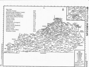
CHAPTER FIVE KENTUCKY IN 1782
Many widows were now made.
Daniel Boone1
The populous colonies of the Atlantic seaboard were lost to the British with the military surrender at Yorktown but control of the wilderness beyond the mountains remained in doubt. The British maintained strategic western outposts at Michilimackinac, Detroit, Niagara and Oswego and, with their Indian allies, kept pressure on the isolated frontier settlements while the diplomats in Paris negotiated boundaries for an ambiguous but critical frontier.2
As they had from the earliest settlement, the frontier families of Kentucky continued to live in fortified villages where they could protect themselves from Indian raids. Called “stations” in Kentucky and “family forts” thirty years later in Missouri, there were approximately sixty of these outposts in Kentucky by 1781. Although they varied in size, the forts shared a common design. Rows of log cabins were built against the inside walls of a rectangular log stockade. The rear walls of the cabins were the walls of the fort and the cabins faced into a large open space where livestock could be protected in time of attack. The log stockade, often twelve feet high, had heavy gates at each end and two-story blockhouses at each corner. The second story of the blockhouse was wider than the first and extended slightly beyond the walls of the fort to enable defenders to shoot at attackers attempting to scale the walls. The settlers lived within the stockade but tended livestock and crops in cleared areas outside the fort.3
The residents of the frontier were dependent on volunteers from nearby stations whenever they were attacked or whenever they needed assistance to punish a raiding party or recover
80
kidnapped settlers and stolen livestock. In joining his neighbor’s party, the frontier settler was assuring that he would receive reciprocal assistance when necessary but he was also reducing the number of defenders left to protect his own fort and family. Col. John Floyd of Kentucky described the continual terror of frontier life in an April 1781 letter to Gov. Thomas Jefferson of Virginia:
We are obliged to live in forts in this country and notwithstanding all the caution that we use, forty-seven inhabitants have been killed or taken prisoners by the savages, besides a number wounded, since January last. .. Not a week passes, and some weeks scarcely a day, without some of our distressed inhabitants feeling the fatal effect of the infernal rage and fury of these excrable hell-hounds.4
George Rogers Clark, writing from his fort, explained the British frontier strategy in a March 1782 letter to the Governor of Virginia,
…we have received very allarming accounts from the enemy at Detroit. They last fall Collected Chiefs from the different Hostile tribes of Indians and Instructed them not to disturb the frontiers, and particularly Kentucky until towards Spring. Then to form small parties and take prisoners to hear what was going on. By which Conduct the Country would be off their guard. That the whole would Embody in the Spring, Reduce this post and lay the whole Country waste, and make one Stroke do for all.5
As Clark had predicted, the Indians, sometimes in collaboration with the British and sometimes on their own, intensified the pressure on the Kentucky settlements during the spring of 1782. The Indians harassed the weakly-defended forts with quick raids stealing or killing livestock and withdrawing into the safety of the wilderness before the arrival of reinforcements from nearby stations. As Daniel Boone explained,
Our affairs became more and more alarming. Several stations which had lately been erected in the country were continually infested with savages, stealing their horses and killing their men at every opportunity.6
Estill’s Defeat
In March, an advance party of Indians from north of the Ohio River attacked Strode’s Station where two settlers were killed and one wounded in a 36 hour siege. Benjamin Logan, the
81
commander of the Kentucky militia, sent fifteen men from Boonesborough to Estill’s Station on Otter Creek where they joined volunteers from other forts. On March 19, Capt. James Estill led a party of forty mounted volunteers in pursuit of the Indians who had attacked Strode’s Station. Approximately 25 Wyandot Indians circled behind Estill’s party and attacked the station where only women, children and slaves were left to defend the fort. The Wyandot killed and scalped a thirteen year old girl who they surprised outside the fort at some sugar trees. They also killed cattle, stole horses and captured “Monk,” Estill’s slave. When the Wyandot withdrew, a boy in the fort rode to notify Captain Estill.
Estill and his party, reduced to twenty-five by men returning to protect their own forts, followed the Indian tracks in a light snowfall. On March 22, Estill and his party caught up to the Wyandot at a crossing of Hinkson Creek, sometimes called Little Mountain Creek, about 1-1/2 miles below the present town of Mt. Sterling in Montgomery County. The frontier sharpshooters quickly killed two Indian leaders. Using a common frontier tactic, Estill divided his force into three units and attacked. In the confusion, Monk escaped and rejoined Estill. The Wyandot responded by attacking Estill’s left flank. The left flank collapsed, exposing the settlers. Seven of the settlers, including Captain Estill, were killed and four were wounded in the 45 minute battle that is remembered as Estill’s Defeat.7
The Siege at Bryant’s Station
The Kentucky settlers were discouraged by the Indian raids during March. Col. John Todd of Fayette Country wrote the Governor of Virginia on April 15 expressing his concern that the embattled pioneers might abandon Kentucky:
The inhabitants of Fayette Country have been so harrassed this spring by Indians, that I was for some time apprehensive that the whole country w’d be evacuated, as Panicks of that kind have proved very catching…8
82
Colonel Todd reported that he had spent 11,000 pounds of his own money, for which he was seeking reimbursement, building a fort at Lexington to protect nearby stations and reassure settlers. The new fort had walls of rammed earth seven feet thick and nine feet high topped with wooden poles. The fort had been constructed in twenty days using hired labor.
The British meanwhile were organizing a major campaign in Ohio and Kentucky to secure their hold on the western frontier. British Capt. William Caldwell and the Pittsburgh Tory Alexander McKee mobilized 1400 midwestern Indians and Canadian Rangers to attack the frontier outposts in Kentucky. While many of the Indians deserted the British force before reaching Kentucky, Caldwell and McKee had between 300 and 600 fighting men under their command when they crossed the river into Kentucky in early August 1782. A detachment of seventy Indians broke off from the main British-Indian force and attacked Hoy’s Station where they kidnapped two young boys before withdrawing toward the Ohio River.
Capt. John Holder organized a rescue party of volunteers from neighboring stations. With approximately seventy mounted men, Holder followed the Indian trail to the Upper Blue Licks on the Licking River where the settlers spotted Indians. Holder divided his force into two units and crossed the river. The Indians, using tactics that had proven effective at Estill’s Defeat, lured the settlers into an ambush. In an exchange of gunfire, two settlers were killed and two received wounds from which they later died. The two captives were not recovered.9
Meanwhile the main British and Indian force under the command of Caldwell and McKee arrived at Bryant’s Station five miles northeast of Lexington.10 According to British sources, Caldwell, McKee and the notorious frontier renegade Simon Girty had an effective force of about 300 Wyandot (also called Huron) and Lake Indians as well as 60 Canadian Rangers and assorted Tories. Bryant’s Station had a resident population of ninety including eleven men with families and twenty-nine single men. The residents of the fort became aware of the impending attack at daybreak
83
the morning of August 15. To gain time, the settlers pretended to carry on their daily routine all the while preparing for attack. The women of the fort, twelve adults and sixteen girls, walked boldly to the spring outside the walls of the fort, as they did every morning, to fetch water. As they walked to the spring on the morning of August 15, 1782, the women and girls knew that their every move was being observed by a raiding party of Indians waiting to attack. This and other diversions enabled the settlers to send riders from the fort to neighboring stations requesting reinforcements.
Although some local volunteers were still away assisting Captain Holder, the settlers responded promptly. They interrupted their farming, collected arms and horses and set out to relieve the garrison at Bryant’s Station. Maj. Levi Todd, the ranking officer in the county in the absence of his brother Col. John Todd, took thirty volunteers to the besieged fort. Boone’s Station sent an additional ten volunteers. The British and Indians approached the fort cautiously. By remaining hidden, they hoped to draw the defenders out of the fort. When this failed, Captain Caldwell ordered a frontal attack. The defenders responded with heavy gunfire forcing Caldwell to pull back. The British and Indians continued firing on the fort while destroying everything of value outside the walls including livestock, crops and outlying cabins.
The siege continued into the afternoon when reinforcements arrived from neighboring stations. Although the British and Indians had surrounded the fort, approximately half of the Kentucky volunteers were able to penetrate the Indian lines and join the defenders within the fort. The others, badly outnumbered, withdrew to await reinforcements. Levi Todd, the acting commander of the Fayette County militia, reported:
…finding the enemy lay round, we attempted forcing our way. 17 men on Horseback rushed in, the greater part of rest being on Foot were prevented & overpowered, obliged to seek safety by flight with the Loss of one killed & 3 wounded, one of which died the next morning The Enemy commanded by Simon Girty made
an attempt to fire the Fort, but were prevented with much Loss. they however kept up a Smart fire till the morning…when they went off 11
84
As Todd explained, the British and Indians continued the siege at Bryant’s Station all day August 15 and all that night. The attackers attempted to set fire to the fort but the defenders, assisted by favorable winds, were able to stop the fires. By the next morning, when the attackers had given up and left, the fort was intact but it was surrounded by smoldering ruins. The raiders had failed to capture the fort but they had severely weakened its economic base.
Captain Caldwell reported to his British superiors that he and his force of 300 Indians and rangers had failed to capture the station but had:
Killed upwards of 300 hogs, 150 head of cattle and a number of sheep, took a number of horses, pulled up and destroyed their potatoes, cut down a great deal of their corn, burnt their hemp and did other considerable damage.12
Within the fort, four were killed and three were wounded. Among the attackers, five were killed and two were wounded.13
To The Blue Licks
Although the British and Indians had departed, additional reinforcements continued to arrive at Bryant’s Station. The defenders of the station and the volunteers who rode to their assistance agreed that the attack could not go unpunished and that a major retaliatory campaign should be mounted immediately against the Indian raiders and their British allies. By Sunday morning, August 18, 182 Kentucky volunteers had assembled at Bryant’s Station. In the absence of Col. Benjamin Logan, the commander of the Kentucky militia, Col. John Todd of Fayette County was in command. He was joined by Col. Stephen Trigg of Lincoln County and Lt. Col. Daniel Boone as well as numerous other experienced frontier officers.14
Benjamin Cooper was then 26 years old and living on the Kentucky frontier. More than ,-.;; fifty years later, he remembered:
“I was Lieutenant in Capt. Scott’s company in Kentucky,, and was in the battle of the Blue Licks, and was of Col. Trigg’s regiment … I joined the Fayette troops at Bryant’s Station the day the
85
Indians left there, and the troops then collected, and marched in pursuit of the Indians toward the Blue Licks.”15
The Indians had made no effort to cover their trail as they moved away from Bryant’s Station. The Kentucky volunteers, most of them on horseback but some on foot, followed the day old trail for several hours before reaching a camp where the Indians had stopped the previous night. Benjamin Cooper recalled, “I was with Col. Boone when he, by counting the Indian fires, concluded there were at least 500 Indians.”16 Aware that they were badly outnumbered, the Kentuckians decided to proceed hoping to catch the retreating Indians by surprise. The Kentuckians followed the Indian trail along a buffalo trace leading toward the Licking River. The volunteers rested briefly at an abandoned station four miles from the Blue Licks before resuming their chase the following morning.
Maj. Levi Todd later reported, “On the morning of the 19th we came within sight of the Enemy about 3/4 of a mile, north of the lower Blue Licks – we dismounted.”17 Indians were visible on a hill across the Licking River at a place where the river made a large horseshoe bend.18 The river was shallow at the foot of the horseshoe where there was a ford but was too deep to cross along the sides of the horseshoe. The Indians who could be seen were several hundred yards beyond the ford in hilly and wooded terrain. Benjamin Cooper reported that the Kentuckians paused while their officers assessed the situation,
When the troops came near the Indians, at the Blue Licks, there was a general council of officers held, at which I was present, and I knew the officers were of opinion and had decided not to fight the battle – that they were too weak and the enemy too strong.19
Fifty years after the battle, Benjamin Cooper remembered that Col. John Todd, Maj. Levi Todd and Daniel Boone had shared his opinion “of the desperate state of our troops contending against so much odds.”20
86
The Direful Catastrophy
That August morning on the Licking River, the Indians had the advantage of position. They were on a small ridge, across a river and protected by ravines, brush and timber. The Kentucky volunteers had lost any advantage that surprise might have given them but were strongly motivated by the desire for revenge against the Indians and British who had terrorized the frontier for several months. They remembered Estill’s Defeat, the recent ambush of Holder at the Upper Blue Licks and siege at Bryant’s Station as well as numerous other indignities. Like Estill and Holder, these experienced frontiersmen may also have underestimated the Indians’ willingness to fight.
Historians have disputed the cause of the disastrous attack that followed. One explanation is that the Kentucky volunteers believed that they would soon be reinforced with additional troops organized by Col. Benjamin Logan. A second explanation is that Colonel Todd took the opportunity to attack the Indians at the Blue Licks because he knew he would not be in command after the arrival of Colonel Logan. Benjamin Cooper appears to have been aware of these explanations in 1836 when he attempted to reinforce the widely-held theory that the attack at Blue Licks was the result of the impetuous leadership of Maj. Hugh McGary.
The action was forced upon us by the act of Major Hugh Magary, who broke from the council, and called upon the troops who were not cowards to follow him, and thus collecting a band, went without order, and against orders, into the action, and in consequence of this act a general pursuit of officers and men took place, more to save the desparate men that followed Magary than from a hope of a successful fight with the Indians.21
Cooper specifically discounts the theories about Logan’s impending arrival or Col. Todd’s desire to exercise command because Logan was not present:
I never heard or knew myself of any expected reinforcement from Colonel Logan, until in the retreat we met Col. Logan with his force six miles in advance of Bryant’s Station, to join us. In the pursuit of the Indians, and in the battle, I never saw or heard any
87
disposition in Col. John Todd to force an action, or hasten it contrary to the known and expressed wishes of the council; and throughout his conduct was prudent and regardful of the safety of his men. I believe that Col. Todd had no motive to anticipate losing the command by Col. Logan’s arrival, for, as I stated, it was not expected that Col. Logan could or would join us in the pursuit.22
Contemporaneous accounts by Daniel Boone and Levi Todd, as well as an account written many years after the battle by Capt. Robert Patterson, suggest that the attack was orderly and planned. The Kentuckians crossed the river, dismounted and approached the Indians in three columns. According to all accounts, Col. John Todd, the commanding officer, was on the right with Colonel Trigg. Major McGary was in the center with an advance party under Major Harlin ahead. Daniel Boone and Captain Patterson were on the left. No troops were kept in reserve.
The Kentuckians advanced to within forty yards of the Indian position before heavy firing began on both sides. The left column of the Kentucky line surged forward but the right crumbled leaving the Kentuckians exposed along their right flank. Major Todd described the battle in a letter to his brother,
The left wing rushed on & gained near 100 yards of ground. But the Right gave way, and the Enemy soon flanked us on that side, upon which the Center gave way & shifted behind the left Wing. And immediately the whole broke in Confusion, after the Action had lasted about five minutes. Our men suffered much in the Retreat, many Indians having mounted our men’s Horses haveing open woods to pass through to the River. and several were killed in the River. Several efforts were made to rally, but all in Vain.23
Daniel Boone reported, in an August 30 letter to Governor Harrison, that the settlers attacked in three columns but the right flank collapsed, “…at the first fire. So the Enemy was immediately on our Backs, so we were obliged to Retreat.”24
From British accounts, the battle was brief and decisive. Alexander McKee reported to Major DePeyster, “at half past seven o’clock we engaged them and in a short time totally defeated them.”25 According to McKee, the British and Indians “were not much superior to them in numbers.”
88
In his report to DePeyster, Captain Caldwell explained that his force at the Lower Blue Licks had dwindled to 200 because of Indian desertions after the siege at Bryant’s Station. Caldwell’s report of the battle, except for his estimate of Kentucky losses, was similar to the accounts of the settlers:
On the 18th…at half past seven they advanced in three Divisions in good order, they had spied some of us and it was the very place they expected to overtake us. We had but fired one Gun till they gave us a volley and stood to it very well for some time, till we rushed in upon them, when they broke immediately. We pursued for about two miles, and as the enemy was mostly on horseback, it was in vain to follow further. We killed and took one hundred and Forty six.26
According to McKee, ten Indians were killed in the battle as well as a British Indian agent named LeBute.
Overrun by the Indians and trapped by the river, the Kentucky lines were in chaos. Their officers killed or wounded, their horses scattered, the Kentuckians were slaughtered as they attempted to retreat across the river. During the fierce but brief battle, at least 60 Kentuckians were killed, seven taken prisoner and many more wounded. Several of the militia officers were among the dead including Col. John Todd, the commanding officer as well as Col. Stephen Trigg and twelve of the twenty-one other officers in the battle. Two additional officers were among the Kentuckians taken prisoner. Daniel Boone, whose son Israel was among those killed, reported “I cannot reflect upon this dreadful scene, but sorrow fills my heart.”27 A week after the battle, Andrew Steele, a private in the Kentucky militia, wrote
We followed them to the Lower Blue Licks where ended the Direful Catastrophy–in short, we were Defeated–with the loss of seventy five Men–among whom fell our two Commanders with many other Officers & soldiers of Distinguished Bravery. To Express the feelings of the Inhabitants of both Counties at this Ruefull Scene of hitherto unparralelled Barbarities Barrs all Words & Cuts Discription short.28
The surviving Kentucky volunteers retreated in disarray until they encountered Colonel Logan’s volunteers on the road from Bryant’s Station. Later that week, Logan and an army of 400 volunteers
89
returned to the Blue Licks to bury the bodies. Levi Todd reported that the burial detail was able to find about fifty bodies. “They were all stript naked, scalped & mangled in such a manner that it was hard to know one from another.”29
At the battle of Blue Licks, the Kentucky settlers suffered a crushing defeat. They lost a substantial number of experienced militia officers and a large number of able-bodied pioneers. The last major engagement of the Revolutionary War was won decisively by the Indians and their British allies.
“This sanguinary and disastrous engagement was the last battle of the Revolution. The contest which began at Lexington, Massachusetts, ended at the Blue Licks, Kentucky…”30
On August 19, 1928, a group of prominent residents of Kentucky gathered at the Blue Licks battleground to dedicate a forty-foot granite monument to what Judge Samuel M. Wilson characterized as “…the high enterprise and daring deeds of the heroes of the Blue Licks.”31 The memorial lists the names of fifteen officers killed in the battle, two captured and seven who survived as well as the names of 49 privates who were killed. The inscription on the south side of the monument lists the names of 93 “privates who escaped” including Benjamin A Cooper. The inscription around the base of the monument lists six Indian tribes that participated in the battle.32
The Miami River Expedition
After their victory at the Blue Licks, the main force of the Indians and their British and Canadian allies withdrew across the Ohio River and dispersed. A small party strayed into Jefferson County and attacked Kincheloe’s Station where several settlers and their families were killed or taken prisoner. The Blue Licks defeat left the Kentucky militia disorganized and demoralized. While some Kentucky residents urged immediate retaliation, the surviving militia leaders proceeded cautiously. They bickered about responsibility for the disaster that Levi Todd described as “…our
90
defeat at the Blue Licks when the Enemy put us wholly to the Rout.”33 Todd explained in a letter to his brother,
The Conduct of the Officers is by some censured and charged with want of prudence in attacking at any Rate, but as we had no chance to know their number, we thought our was not much Inferior & supposed we should by a fierce attack throw them in confusion & break their Lines.34
Col. Arthur Campbell, who was not at the Blue Licks, was more direct in his criticism of the Kentucky militia leaders. He placed primary blame for the defeat on Hugh McGary but was strongly critical of other leaders as well:
Never was the lives of so many valuable men lost more shamefully…and that not a little thro’ the vain and seditious expressions of a Major McGeary. How much more harm than good can one fool do. Todd & Trigg had capacity but wanted experience, Boone, Harlin and Lindsay had experience but were defective in capacity.35
In addition to his criticism of officers at the Blue Licks, several of whom died there, Campbell also disparaged the capabilities of officers who were not at the battle. He described Logan as dull and narrow and General Clark as a “Sot” or worse.
At the same time that they were seeking someone to blame, the Kentucky settlers were also pleading for assistance from Governor Harrison. Virginia was nearly bankrupt and reluctant to commit resources to protect its remote frontier counties. At the urging of George Rogers Clark, Virginia had sent money to build a fort and deploy gunboats on the Ohio River. As the Blue Lick survivors pointed out, these measures were ineffective against the Ohio Indians who entered Kentucky far to the east of Clark’s fort at the Falls of Ohio. Without mentioning Clark by name, nine civil and military officers of Fayette County, included Daniel Boone and Levi Todd, wrote Governor Harrison that the fort and gunboat strategy,
…has a tendency to protect Jefferson County, or rather Louisville, a Town without Inhabitants, a Fort situated in such a manner that the Enemy coming with a design to Lay waste our Country, would
91
scarcely come within one Hundred miles of it, & our own Frontiers open & unguarded.36
In his August letter reporting the Blue Licks defeat, Benjamin Logan, the commanding officer of the Kentucky militia, reiterated conventional wisdom of frontier Indian strategy, reinforced by 150 years of bitter experience,
…a defensive war cannot be carried on with Indians, and the Inhabitants remain any kind of safety. For unless you can go to their Towns and scourge them, they will never make a peace; but on the contrary keep parties consistently in your country to kill.37
The lessons learned by the Virginia settlers in 1622 and 1644 as well as the attitudes of the frontier farmers during Bacon’s Rebellion in 1675, would guide the Kentucky settlers more than a century later.
In the weeks after the defeat at the Blue Licks, Kentucky pioneers were more concerned about the survival of the settlements than about revenge against the Indians. As Daniel Boone explained in a letter to the governor, “The Inhabitants of these Counties are very much alarmed at the thoughts of the Indians bringing another Campaign into our country this fall, which if it should be the case, will Break these settlements.”38 The combination of Indian raids and uncertain land titles demoralized the existing settlers and discouraged the new settlers who were essential to bid up land prices and strengthen the militia. In their letters to Governor Harrison, the settlers described the critical situation in Kentucky while alternating requests for military assistance and the appointment of an official surveyor. Nine Fayette county officials wrote the governor in September warning “…if something is not speedily done, we … will wholly be depopulated.”39
Acknowledging that offensive military action into Indian country might be “impracticable,” the Fayette County officials suggested the construction of forts on the Ohio River to protect existing stations and promote new settlement along the Limestone and Licking Rivers. The Fayette officials reminded the governor “tis now near two years since the division of the County & no Surveyor has
92
ever appeared among us…our principal expectations of strength are from him.”40 William Christian, who represented Kentucky in the Virginia General Assembly, reported that settlers were leaving Kentucky and predicted “If no succour is sent to Kentucky, and the war with the British continues another Year, it is more then Probable the whole of the Inhabitants will be killed, taken to Detroit or driven away.”41 In his letter to the governor, Andrew Steele suggested a more dangerous possibility when he warned that “the wealthy will forthwith Emigrate to the Interior parts of the Settlement & the Poor to the Spaniards.”42
At the same time they were asking for assistance from the Virginia governor, the Kentucky settlers were replacing militia officers killed at the Blue Licks and planning a retaliatory expedition against the Shawnee towns across the river in what would later be the state of Ohio.43 In spite of the resentment about the fort and gunboat near Louisville, the settlers agreed that General George Rogers Clark should command the invasion of Indian country. In addition to his dramatic and successful invasion of the Illinois country during the Revolutionary War, Clark had led the successful campaign against the Shawnee in 1780. John Floyd, the commander of the Jefferson County militia, sent troops out to patrol the Wilderness Road to intercept those faint-hearted settlers who might have considered leaving Kentucky.44
On November 1, the militia from the three Kentucky counties, some volunteers and some drafted, joined Clark at the mouth of the Licking River. Under the command of John Floyd of Jefferson County, Benjamin Logan of Lincoln County and Daniel Boone of Fayette County, more than 1,000 Kentuckians converged at the Ohio River. Along with several other survivors of the Battle at the Blue Licks, Benjamin Cooper was a member of Clark’s 1782 expedition against the Shawnee. Cooper was a Lieutenant and second-in-command of Captain James Downing’s company of 38 men from Lincoln County. Cooper and his company enlisted October 24, 1782 and were discharged November 24, 1782.45
93
General Clark and his army crossed the Ohio River November 2. He had his men build a blockhouse near the river and left a party of two officers and thirty privates to guard the boats and provisions that would be used to return to Kentucky. Clark organized his army into four battalions and marched up the Little Miami River. Slowed by the six pound cannon they were transporting, the troops followed the route Clark had taken two years earlier. The army passed the ruins of Indian towns at Chillicothe on the Little Miami and Piqua on the Mad River, abandoned since they were burned by Clark’s army in 1780. General Clark later reported:
We left the Ohio the fourth, with one Thousand and fifty men, and supprised the principall Shawone Town on the Evening of the 10th Inst…in a few hours two thirds of their Towns was laid in ashes and every thing they ware possest of destroy’d except such articles as most usefull to the Troops, the Enemy not having time to secreet any part of their Riches that was in the Towns.46
Clark and his slow-moving army had been in Indian country for ten days before they reached the Shawnee village of New Piqua. As Clark explained, the attack caught the Indians by surprise. The Indian warriors were able to escape but left the town undefended. The Kentuckians captured New Piqua and the corn that the Indians were saving for the winter. After burning the town, Clark left a guard and divided his army into four units. The largest unit, 500 men under the command of Hugh McGary, now a Lieutenant Colonel in the Lincoln County militia, marched to attack McKee’s Town.47 The Indians, surprised again, fled as McGary’s battalion approached. McGary and his troops rescued two Kentuckians who had been prisoners of the Indians since 1777 and burned the town. Meanwhile Daniel Boone led a detachment of 100 men to Willstown where the Indians also abandon�d. the town. Boone and his troops captured a valuable supply of furs before burning the town. At the same time, Benjamin Logan and 150 men attacked a French Canadian trading post on Laramie’s Creek. Logan’s troops captured furs and trade goods before burning the trading post and its surrounding buildings.
94
The Kentucky militia destroyed three Indian towns, the trading post that supplied Indians attacking the settlements and an estimated 10,000 bushels of corn before withdrawing from Ohio. General Clark later reported to Governor Harrison:
the Quantity of provisions burnt far surpast any Idea we had of their stores of that kind. The loss of the Enemy was ten scalps, seven prisoners and two whites retaken – ours one killed, one wounded. After laying part of four days in their Towns, finding all attempts to bring them to a genl. action fruitless, we retired as the season was far advanced and the weather threatening.48
On November 17, Clark and his army returned to the Ohio River. In the punitive expedition against the Shawnee, Clark and his army were unable to engage the Indians in battle or rescue the prisoners captured at the Blue Licks but the army destroyed the Indians winter food supply and weakened the capacity of the Shawnee to mount attacks against the Kentucky settlements. A year later, the British released eleven prisoners who had been captured at the Blue Licks August 19, 1782. The prisoners, including Jesse Peak, arrived at their homes in Kentucky August 27, 1783.49
The Treaty of Paris
As early as August_ 1779, the Continental Congress had appointed John Adams as plenipotentiary to negotiate peace with Great Britain. The Congress instructed Adams to require as a condition of negotiation that the British recognize the independence of the United States, that the British withdraw all troops and that the boundaries of the United States include all British territory east of the Mississippi River. In June 1781, the Congress acceded to French pressure and appointed additional commissioners including Benjamin Franklin and John Jay. During 1782, the negotiations continued amid rumor and intrigue. The commissioners for the United States remained firm in their demands while the British delayed and the French urged compromise. The French suggested a division of western lands among the British, Spanish, Indians and United States.50
The representatives of the United States avoided the pitfalls of European diplomacy and signed Preliminary Articles of Peace November 30, 1782 and the final Treaty of Peace September
95
3, 1783 at Paris. The Treaty of Paris acknowledged the independence of the thirteen colonies and the boundary “along the middle of said river Mississippi” from Lake of the Woods to the 31st parallel. The treaty also secured certain historic fishing rights in the Atlantic Ocean as well as the cession of hostilities and withdrawal of troops “from every post, place and harbour.”51 The news of the preliminary peace treaty reached the Kentucky frontier in April 1783.52 The British evacuated Savannah and Charleston in 1782 and New York November 25, 1783. In spite of the 1782 agreement, the British continued to maintain frontier garrisons in United States territory at Detroit, Niagara, Oswego and Michilimackinac until 1797. With the Treaty of Paris, Great Britain recognized the independence of the thirteen colonies and United States jurisdiction over the wilderness region lying between the Alleghany Mountains and the Mississippi River. The precarious frontier that the settlers of Kentucky and Tennessee had been fighting to protect was secured by the diplomats at Paris.
96
Kentucky in 1782 Notes
1. Attributed to Daniel Boone, “The Adventures of Col. Daniel Boon” in John Filson, The Discovery. Settlement and Present State of Kentucke (Wilmington, 1784), p. 77.
2. Bemis, Diplomatic History pp. 46-62. In June 1781, the Continental Congress appointed John Adams, Benjamin Franklin and John Jay to negotiate the treaty ofindependence and peace with Great Britain. In addition to defining the boundaries of the new republic, the negotiations included resolution of fishing rights off the New England coast, navigation rights on the Mississippi River and compensation for Loyalist and Patriot property confiscated or destroyed during the war.
3. Durrett, Bryant’s Station, pp. 23-24. Kentucky forts of the late 18th century are also described in Cyrus Townsend Brady, Border Fights and Fighters (New York, 1902), p. 125 and p. 153.
4. Johnson, History of Kentucky. Vol. I, p. 68. Kentucky was part of Virginia until 1792.
5. George Rogers Clark letter of March 7, 1782 to the Governor of Virginia in William P. Palmer, editor, Calendar of Virginia State Papers and Other Manuscripts. 1782-1784, Vol.
m (Richmond, 1883), p. 87.
6. Filson. Kentucke, p. 74.
7. Bessie Taul Conkright, “Estill’s Defeat or the Battle of Little Mountain,” Register Kentucky State Historical Society. Vol. 22, September 1924, pp. 312-320. Using accounts of the battle collected in Lyman Draper’s interviews, Conkright was able to identify all
twenty-five participants in the battle. Joseph Cooper had reported to Draper that his 0
uncle, Benjamin Cooper, had been in Estill’s Defeat (Draper MSS 23 S 138). Cooper may have been among the fifteen members of the Estill party who returned to their forts before the battle but he was not among the twenty-five who fought at Little Mountain.
In recognition and appreciation of his bravery and loyalty, Estill’s slave Monk was freed by his new owner. Monk was the first slave manumitted in Kentucky. Because of his skill making gunpowder, he was much in demand during the pioneer period. Johnson, History of Kentucky. Vol. I, p. 171.
8. John Todd letter of April 15, 1782 to Governor Jefferson in Palmer, Virginia State Papers Vol. III pp. 130-131. Colonel Todd appears to have been unaware that Benjamin Harrison had succeeded Thomas Jefferson as Governor of Virginia onNovember 30, 1781.
9. R.S. Cotterill, “Battle of the Upper Blue Licks,” The History Quarterly. October 1927,
pp. 29-33.
10. Historians have used both “Bryan’s” and “Bryant’s” for the station near the Elkhorn Creek crossing on the Lexington-Paris road. It appears that both names were commonly used in the eighteenth century. John Filson, the first Kentucky historian, used “Briant” in his
97
1784 book and “Bryan” on his 1784 map. Reuben T. Durrett, the leading expert on this battle, acknowledges that the family name was Bryan and that both names were commonly used at the time but he concludes that Bryant’s was the most common name of the station. Durrett , Bryant’s Station, pp. 20-21. Durrett also accepts the August 15th date of the battle reported by the British rather than the August 16th date reported by the Kentucky settlers.
11. Levi Todd letter of September 11, 1782 to Governor Harrison in Palmer, Virginia State Papers, Vol. Ill, p. 300.
12. William Caldwell letter of August 26, 1782 to Maj. Arent S. DePeyster in Bennett H. Young, “The Battle of the Blue Licks” in Durrett, Bryant’s Station, pp. 208-209.
13. Durrett’s 1897 Bryant’s Station remains the most complete account of the battle. The August 1782 attacks are also described in: Richard H. Collins, History of Kentucky (Lexington, Kentucky, 1878), Vol. I, pp. 254-256; Johnson, A History of Kentucky. Vol. I,
pp. 68-77; Samuel M. Wilson, Battle of the Blue Licks (Lexington, 1927), p. 24; Talbert,
�. pp. 154-155.
14. The controversial Battle of the Blue Licks is described in every history of Kentucky since Filson’s 1784 Kentucke. The most complete and balanced accounts are: Col. Bennett H. Young, “The Battle of the Blue Licks” in Durrett’s 1897 Bryant’s Station; Wilson’s 1927 Battle of the Blue Licks: Talbert’s 1%2 Logan. Willard Rouse Jillson, A Bibliography of the Lower Blue Licks. 1744-1944 (Frankfort, Kentucky, 1945) is a comprehensive listing of everything published about the location and the battle over two hundred years.
15. Benjamin A Cooper affidavit of November 9, 1836 published posthumously in the St. Louis New Era in November 1845 and included in Draper MSS 26 CC 56, Wilson, Blue Licks, pp. 55-57 and below in Appendix One.
According to Louis Houc� A History of Missouri (Chicago, 1908), Vol. III, p. 121, Benjamin Cooper fought at the Blue Licks where his brothers-in-law Peak and Woods were killed. Houck also suggests that Benjamin Cooper’s younger brother Sarshel Cooper may have participated in the battle at the Blue Licks. According to Wilson, Pvt. Benjamin A Cooper was one of 45 officers and men who were known to have survived at the Blue Licks. There is no confirming evidence that Sarshel Cooper was in the battle. Houck appears to have been in error about his participation.
Joseph Cooper reported, in an 1868 interview with Lyman Draper, that he was uncertain whether his father Sarshel had fought in the Battle at the Blue Licks but that he knew that his uncle Benjamin had participated and that two of Benjamin’s brothers-in-law, Peak and Woods, had been killed. Draper MSS 23 S 124-125. This 1868 interview, although it is not cited, is likely to have been the source for Houk in 1908. Although the evidence is not conclusive, it appears that neither Peak nor Woods was killed at the Blue Licks. Jesse (or John) Peak was captured during the battle and released in 1783. James Wood was killed by Indians in 1783. It appears likely that Betty Cooper, the sister of Benjamin and Sarshel Cooper married each of the men and was twice widowed.
98
16. Wilson, Blue Licks, pp. 55-56.
17. Levi Todd letter of September 11, 1782 in Palmer, Virginia State Papers, Vol. III,p. 300.
18. The State of Kentucky has established a park at the site of the 1782 battle. The 148 acre park is 40 miles northeast of Lexington along US 68. Blue Licks Battlefield State Park includes picnic and camping areas, a pioneer museum, a gift shop, a fifteen acre nature preserve along the old buffalo trace as well as a swimming pool and miniature golf course. The park is open April through October. A granite monument commemorating the battle is in the northeast corner of the park approximately 150 feet from the highway.
19. Wilson, Blue Licks, p. 56.
20. Ibid.
21. Ibid. Many of the earlier Kentucky histories including Collins (1878) and Johnson (1912) blame Major McGary for the disastrous battle at the Blue Licks. Recent scholars like Wilson (1927) and Talbert (1962) have reexamined the accounts of survivors and concluded that McGary had been blamed unfairly.
22. Ibid.
23. Levi Todd letter of August 26, 1782 to Robert Todd in Palmer, Virginia State Papers, Vol. III, p. 333.
24. Daniel Boone letter of August 30, 1782 to Governor Harrison, Ibid., p. 275.
25. Alexander McKee letter of August 28, 1782 to Major De Peyster in Young, “The Battle of the Blue Licks,” p. 213. The 2000 acres of Kentucky land granted to McKee for his service in the French and Indian War were confiscated after he joined the Tories in the Revolutionary War. The land was eventually transferred to Transylvania University as endowment.
26. William Caldwell letter of August 26, 1782 to Major De Peyster, Ibid., p. 200.
27. Filson, Kentucke, p. 77.
28. Andrew Steele letter of August 26, 1782 to Governor Harrison in Wilson, Blue Licks, p.
53.
29. Levi Todd letter of August 26, 1782 in Palmer, Virginia State Papers, Vol. III, p. 334.
30. Brady. Border Fights and Fighters, p. 146. Historians disagree about which battle was “the last” of the Revolution. One historian wrote that the Battle at the Blue Licks was “often and incorrectly called the last battle of the Revolution, this was a victory of the renegade white terror of the Old Northwest, Simon Girty, over a bunch of foolish frontiersmen…”, Mark Mayo Boatman, III, Landmarks of the American Revolution (Harrisburg,
99
Pennsylvania, 1973), pp. 110. Boatman’s scholarship fails to account for the role of British Capt. William Caldwell and the reports from Kentucky to Maj. Arent DePeyster.
Reuben Durrett, in a footnote, reviewed the claims of other “last battles” including Loughry’s Defeat of August 24, 1781 and the fight at Combahee Ferry in South Carolina of August 27, 1782. He dismisses the former because it was not the last and the latter because it was not a battle. Durrett, Bryant’s Station, p.18n. Another historian claims that a November 14, 1782 skirmish on James Island, South Carolina was the “last battle.” Howard H. Peckham, The War for Independence, A Military History (Chicago, 1958). While the South Carolina incident may have been the last military engagement, it was hardly a battle.
The Tennessee Historical Commission claims that a September 1782 battle near present day Chattanooga was the “Last Battle of the Revolution.” In that battle frontiersmen from eastern Tennessee destroyed the Chickamauga Indian town of Tuskagee on Moccasin Bend in an effort to destroy supplies that the British had provided the Indians. This campaign, much like Clark’s punitive campaign against the Shawnee in November 1782, cannot really be considered part of the Revolutionary War because there is no claim that the British were directly involved. While several states have claimed “the last battle,” the Battle of the Blue Licks in Kentucky was the last in which British officers and agents confronted Patriot militia.
31. Register Kentucky State Historical Society. Vol. 25, p. 323. According to local newspapers, 10,000 Kentuckians attended the dedication of the Blue Licks monument. Filson Club Historical Quarterly. Vol. III, October 1928, p. 13.
32. Reaister Kentucky State Historical Society. Vol. 26, pp. 294-2%. As additional participants have been identified, their names are added to the monument. As of November 1988, 116 of the 182 volunteers in the battle have been identified. The “privates who escaped” inscription includes, in addition to Benjamin Cooper, Henry Higgins, John Peake and Samuel Woods. The “privates who were killed” inscription includes Archibald Woods but does not list anyone named Peake who was killed. At least 65 of those killed remain among the “unknown heroes.”
33. Levi Todd letter of September 11, 1782 in Palmer, Vir2inia State Papers, Vol. III, p. 300.
34. Ibid., p. 301.
35. Arthur Campbell letter of October 3, 1782 to William Davies, Ibid., p. 337.
36. Levi Todd letter ‘of September 11, 1782, Ibid., p. 300.
37. Benjamin Logan letter of August 31, 1782 to Governor Harrison, Ibid., p. 282.
38. Daniel Boone letter of August 30, 1782, Ibid., p. 275.
39. Daniel Boone et al letter of September 11, 1782 to Governor Harrison, Ibid., p. 301.
100
40. Ibid., p. 302.
41. William Christian letter of September 28, 1782, Ibid., p. 331.
42. Andrew Steele letter of September 12, 1782, Ibid., p. 303.
43. The 1782 campaign into Ohio is described in Talbert, Logan, pp. 171-181, and Bakeless Background to Glor_y. pp. 291-303.
44. Talbert, Logan, p. 172.
45. Margery Heberling Harding, editor, George Rogers Clark and his Men: Militar_y Records, 1778-1784 (Frankfort, Kentucky, 1981), p. 189. As a Lieutenant, Benjamin Cooper was paid six shillings a day and earned more than ten pounds for his service in Ohio. Benjamin Cooper included his service in the 1782 Ohio Campaign in his pension application fifty years later. Revolutionary War Pension Application S 16722.
46. George Rogers Clark letter of November 27, 1782 to Governor Harison in Palmer, Virginia State Papers, Vol. III, p. 381.
47. The Indian town was named for Alexander McKee, the British Indian agent. McKee and Simon Girty had been covert Tories until deserting to the British in March 1778. McKee commanded Indians in attacks against Kentucky settlements in 1780 and 1782. He was second in command to the British Capt. William Caldwell at the Battle of the Blue Licks.
48. Clark, letter of November 27, 1782, Ibid.
49. Harding, Clark and his Men, p. xvii. It is unclear whether Jesse Peak is the same person as John Peake and whether either was the Peak who married Betty Cooper Wood, the widow of James Wood and the sister of Benjamin and Sarshel Cooper.
50. Bemis. Diplomatic Histor_y, pp. 46-64. Dale Van Every points out that the Continental Congress voted nine states to two states to instruct the negotiators to accept the Proclamation Line of 1763 as the western boundary (Forth to the Wilderness, p. 19). Fortunately the commissioners ignored these instructions.
51. Commager, Documents of American Histor_y. Vol. I, pp. 117-119.
52. George W. Ranck, Boonesborough
(Louisville, Kentucky, 1901), p. 132
101
APPENDIX ONE
BENJAMIN COOPER AND THE
BATTLE OF THE BLUE LICKS
On November 9, 1836, Benjamin Cooper recounted, under oath, his role in the Battle of the Blue Licks fifty-four years earlier. Cooper’s testimony was transcribed at the time and later discovered by Mann Butler, a Kentucky historian, who transmitted Cooper’s statement to the St. Louis New Era for publication in November 1845. Cooper’s statement, Dr. Butler’s letter of transmittal and the certification of the affidavit were published in the St. Louis New Era, presumably in November 1845 and republished in other newspapers. The copy in the Draper collection, Draper MSS 26 CC 56, is a clipping from another, unspecified newspaper with the complete text of Butler’s letter, Cooper’s statement and the clerk’s certification. The letter, statement and certification are also reprinted, in their entirety, in Wilson, Battle of the Blue Licks, pp. 55-57.
Mann Butler Letter of November 61 1845
“Mr. Editor:–
“Aware of the devotion of the New Era to the history and antiquities of the Western portion of our noble Republic, I subjoin for publication a document, which has, from a variety of mischances, been eight years on its way to my hands.
It is a statement of the venerable and gallant Col. Benjamin A Cooper, of Saline county, in this State. It relates, you will perceive, to the battle of the Blue Licks, memorable for its disastrous results to the brave and hearty backwoodsmen of Kentucky.”
Benjamin Cooper Statement of November 9, 1836
“State of Missouri,
Saline County.
I, Benjamin A Cooper, of this State, formerly a resident of Madison county, Kentucky, state I was Lieutenant in Capt. Scott’s company in Kentucky, and was in the battle of the Blue Licks, and was of Col. Trigg’s regiment. I was married to a relation of Col. Daniel Boone, and was intimate with him. I knew Levi Todd, a Major in command
102
that day, having been in several battles with him. I knew Col. John Todd, who commanded in chief, and I knew generally all the officers in the engagement. I joined the Fayette troops at Bryant’s Station the day the Indians left there, and the troops then collected, and marched in pursuit of the Indians toward the Blue Licks. I was with Col. Boone when he, by counting the Indians fires, concluded there were at least 500 Indians- when the troops came near the Indians, at the Blue Licks, there was a general council of officers held, at which I was present, and I knew the officers were of opinion and had decided not to fight the battle–that they were too weak and the enemy too strong. I knew the opinion of Col. John Todd and Major Levi Todd, to have concurred in that opinion, for I conversed with Levi Todd in the council, and had just before requested him to speak to his brother, Col. John Todd, and inform him, �she commanded, of the desperate state of our troops contending against so much odds, and I heard distinctly Col. John Todd’s opinion. Levi Todd’s and Daniel Boone’s to the same effect. The action was forced upon us by the act of Major Hugh Magarey, who broke from the council, and called upon the troops who were not cowards to follow him, and thus collecting a band, went without order, and against orders, into the action, and in consequence of this act a general pursuit of officers and men took place, more to save the desperate men that followed Magary than from a hope of a successful fight with the Indians. I never heard or knew myself of any expected reinforcement from Colonel Logan, until in the retreat we met Col. Logan with his force six miles in advance of Bryant’s Station, to join us. In the pursuit of the Indians, and in the battle, I never saw or heard any disposition in Col. John Todd to force an action, or hasten it contrary to the known and expressed wishes of the council; and, throughout his conduct was prudent and regardful of the safety of his men. I believe that Col. Todd had no motive to anticipate losing the command by Col. Logan’s arrival, for,
.as I stated, it was not expected that Col. Logan could or would join us in the pursuit.
Given under my hand, November 9th, 1836. (Signed) Benjamin A Cooper”
This statement was certified as follows:
“I, the undersigned Peyton R. Hayden, of Booneville, Missouri, do certify that Col. Cooper, who has made, in my presence, the above statement, retains his mental faculties to a remarkable degree for a man of his age, and seems to have a perfect recollection of the circumstances attending the battle, of which he has spoken in his certificate above.
(Signed) P.R. Hayden”
103
CHAPTBR SIX
LIFE ON THE KENTUCKY-IBNNESSEE FRONTIER, 1782-1800
… thus we behold Kentucke, lately,
a howling wilderness
…become the habitation of civilization
Daniel Boone, 17841
With the end of the Revolutionary War, migration to the frontier in Kentucky and Tennessee accelerated. There was continuing danger from Indian attack, particularly on the · Wilderness Road and in isolated settlements, but the growth of population and stability allowed families to begin building farms, towns, schools and churches. The area that had been struggling to survive but a few years before was quickly changing. Daniel Boone described the transition in his �; 1784 “autobiography,”
…thus we behold Kentucke, lately, a howling wilderness, the habitation of savages and wild beasts, become a fruitful field; this region, so favorably distinguished by nature, now become the habitation of civilization.2
As Boone suggests, the transition from wilderness to civilization was abrupt. By 1784, the population of Kentucky was approximately 12,000 with an additional 10,000 in the Holston settlements and 2,000 in the Cumberland district of Tennessee.3 The change was so great that only one member of the Kentucky Convention of 1785 had fought in defense of Kentucky during the Revolutionary War.4 By the end of 1785, the population in the Cumberland settlements had doubled to 4,000. By the summer of 1788, migration had swelled the population of Kentucky to 60,000.5
While the rapid population growth may have appeared as “civilization” to Daniel Boone in 1784, it was a provocation and irritant to the Indians who saw their lands filling with adventurers and settlements. Kentucky and Tennessee remained remote and dependent on transportation lines over the mountains on the 200 mile Wilderness Road or down the Ohio River by flatboat from
104
Pittsburgh. Each route was difficult and dangerous and each could be choked off by small parties of Indians. By 1786, Indians north of the Ohio River and Indians south of the Cumberland River were becoming increasingly agitated and desperate. Small parties of Indians raided exposed settlements and travelers in what Dale Van Every characterized as “a war fought in the dooryard.”6
During the early part of 1786, Indian raids increased. A large party of Indians, perhaps
as many as 200, attacked flatboats on the Ohio River in May. Indians, in quick raids throughout Kentucky, stole an estimated 500 horses. In July, 500 Indian warriors collected near the old French village of Vincennes, in what would later become Indiana. The Indians surrounded and threatened the tiny settlement. When the weak federal government and army were slow to respond, Patrick Henry, again serving as governor of Virginia, authorized the Kentucky militia to send troops into Indian territory. County militia commanders asked George Rogers Clark to come out of retirement and lead the Kentucky campaign against the Indians on the Upper Wabash.
In September 1786, Clark assembled an army of 1200 Kentucky militia including Benjamin Cooper who reported “I was marched to Post Vincennes against the Indians to relieve the whites who had settled there.”7 The Wabash expedition was a military failure. The strong-willed but inexperienced Kentucky militia refused to follow orders, became demoralized when food supplies were lost and eventually deserted in large numbers. The desertions, primarily in the Lincoln County militia, were attributed to loyalty to Benjamin Logan or to continuing resentment about Clark’s failure to protect the settlements in 1782.
A large army of Indian warriors waited at Pine Creek as Clark’s army, with artillery and mounted troops, advanced toward battle. When mutiny reduced his force by half, Clark was forced to abandon the campaign without a battle. He bluffed the Indians into a truce and withdrew from Indian territory after leaving a token force of 150 to protect Vincennes. Weakened in the field by lack of discipline, Clark was also subverted by political rivals, including particularly the devious James
105
Wilkinson, who used the failure of the Wabash expedition to destroy Clark’s reputation. After the Wabash campaign, Clark never again led men into battle. Undefeated in battle, he retired to a life of bankruptcy and disgrace.8
While Clark and the Kentucky militia were being frustrated on the Wabash, Benjamin Logan commanded 790 Kentucky militiamen in the familiar invasion of the Shawnee towns of Ohio. With many Shawnee warriors on the Wabash to fight the battle that never happened against Clark, Logan’s army was able to bum 200 Indian houses and 15,000 bushels of com while capturing prisoners and livestock during October 1786 in Ohio. As Logan reported, “the Expedition was carried out in a Rapped manner.”9
The militia campaigns of 1786, like similar campaigns in previous years, were ineffective in stopping Indian raids in Kentucky and Tennessee and along the routes from Virginia. By 1790, Henry Innes, a federal judge in Kentucky and Boonesborough pioneer, estimated that Indians had killed 1500 people and stolen 20,000 horses in Kentucky between 1783 and 1790.10 Indian warfare continued intermittently with support and encouragement from British officers and agents at forts on the Great Lakes. In 1791, the United States army and frontier militia combined in two successful expeditions against Indians on the Upper Wabash and an unsuccessful campaign in Ohio. In August 1794, General Anthony Wayne with 1500 troops from the regular army and 1600 from the Kentucky militia defeated an Indian army at the Battle of Fallen Timbers, near present-day Toledo, Ohio. Abandoned by their British allies, the Indians of the Old Northwest surrendered most of Ohio and Indiana to settlement and began the move west.
The People of the Frontier
Many of the earliest settlers on the Kentucky and Tennessee frontiers had been people who had previously visited the area as hunters. They were joined by others who were ambitious to
acquire land, in some cases enormous tracts of land, and by those who were merely restless because
106
of limited opportunity elsewhere or because they were fleeing debts or jail. While the frontier population, like any population, included a mix of backgrounds and types, observers of frontier character were often critical. Daniel Drake, who arrived in Kentucky as a child in 1788, remembered his neighbors as “all country people by birth and residence – all were illiterate, but in various degrees – and all were poor, or in moderate circumstances…”11 An United States agent to the Creek Indians expressed his frustrations concluding “The United States, like most countries, is unfortunate in having the worst of people on her frontiers.”12 Francois Andre Michaux (1770-1855), a French botanist travelling on the frontier in 1802, observed,
The inhabitants of Kentucky…are nearly all natives of Virginia, and particularly the remotest parts of that state…they have preserved the manners of Virginians. With them the passion for gaming and spirituous liquors is carried to excess, which frequently terminates in quarrels degrading to human nature.13
Like other commentators on the frontier character, Timothy Dwight, a stern New Englander and Yale president, was critical while also acknowledging the social role of the frontier and its rough characters. As he pointed out, perhaps somewhat defensively,
All countries contain restless inhabitants, men impatient of labor, men who will contract debts without intending to pay them, who had rather talk than work.14
In the United States, these restless but impatient pioneers were joined on the frontier by people Dwight described as “the discontented, the enterprising, the ambitious, and the covetous.”15 In this view, the frontier was a social safety valve relieving polite society of several types of misfits including both the lazy and the ambitious. Dwight believed that these frontier types were suited by temperament for the work of clearing land, but that they were incapable of the sustained effort necessary to build the sort of community of the New England village. Writing about the frontiersmen he had observed in Vermont, Dwight concluded that the frontiersmen
cannot live in regular society. They are too idle, too talkative, too passionate, too prodigal, and too shiftless to acquire either property
107
or character. They are impatient of the restraints of law, religion, and moraI1.ty…16
For Dwight, the rough frontiersmen played an important role in clearing land but another sort of person would have to follow to plant the crops, improve the land and build community.
While these observations are harsh, they contain an element of truth. Many of the pioneers on the Kentucky and Tennessee frontier, people like Daniel Boone and Simon Kenton, were not suited to civilization. They lost their Kentucky lands to legal processes they did not understand and moved on to new frontiers where they could again be pioneers. At the same time, there were pioneers of another sort on the frontier who brought their culture with them and who immediately set about the task of building the institutions of government, education, and religion that would enrich their lives and that of their families.
Frontier Land
The lure of the frontier was primarily land. The pioneers had prevailed over the claims of the Indians and the British and the settlers followed to claim lands for themselves, often at the expense of the early pioneers. Moses Austin joined the migration in 1796 and described the attitude of his companions on the Wilderness Road from Virginia,
Ask these Pilgrims what they expect when they git to Kentucky, the Answer is land, have you any. No, but I expect I can git it. Have you any thing to pay for land, No. Did you ever see the country. No but everybody says its good land.17
The competition for land resulted in fraud, confusion, and endless litigation. Many of the pioneers, like Daniel Boone, were unable to protect their land claims against settlers who arrived after them but used the legal system to claim and hold land. The early land claims were often informal, poorly surveyed if at all and, because of the distance, never filed officially in Virginia. By the time Michaux visited the area in 1802, he found,
…incredible confusion with respect to property…this incertitude in the right of property is an inexhaustible source of tedious and
108
expensive law-suits, which serve to enrich the professional gentlemen of the country.18
Benjamin Cooper, like other pioneers, lived in a fort when he first arrived in Kentucky. As soon as the Indian threat abated, he and his father filed land claims. In November 1781, Benjamin Cooper claimed 100 acres on White Oak Creek in Lincoln County and his father Francis Cooper claimed 400 acres.19 In December 1782, soon after returning from the Ohio campaign against the Shawnee, Benjamin Cooper filed a claim for 400 acres on the South Fork of Casper’s Run in Fayette County.20 In January 1785, Benjamin Cooper claimed an additional 248 acres on White Oak Creek as well as 52 acres on the Kentucky River.21 In addition to claiming land, Benjamin Cooper also joined with his neighbors in efforts to increase the value of lands. In November 1789, he was one of the “Inhabitants of Woodford County” who signed a petition asking to have the county divided in order to improve the accessibility of the county courts.22
As Kentucky became more settled, the pioneers struggled to protect their land from other claimants, many of them more sophisticated in the legal technicalities of land title. Some of the pioneers had neglected to file claims while others occupied lands that had been “shingled” with overlapping claims. The pioneers, when they could afford it, engaged surveyors to clarify land descriptions and titles. Benjamin Cooper had 42 acres on the East Fork of Simpson Creek in Nelson County surveyed in July 1793 and 216 acres on White Oak Creek in Garrard County surveyed in October 1797. (Garrard Country had been formed out of parts of Lincoln and Madison County, in 1796.) In August 1798, Benjamin Cooper had nearly 1000 acres in Madison County surveyed. These included 200 acres on the Kentucky River, 400 acres on Clear Creek, and 384 acres on Station Camp Creek.23 Despite these precautions, Benjamin Cooper found himself in a dispute over land claims in 1796.24
As soon as pioneers arrived in Kentucky, they burned a piece of land and planted corn among the stumps. At a minimum, the crop would strengthen land claims. If the pioneer decided
109
to bring his family to the frontier, the crop would, along with hunting, sustain them during their first winter. The com, whether ground or pounded, mixed with water or milk and baked or fried was the com bread, hoe cake, spoon bread, mush, Johnny cake, com pone, hominy or grits that dominated the pioneer diet. These were prepared, using whatever ingredients and utensils were available.
The simplest form of bread was that made of meal, salt, and water and known variously as corn pone, hoe cake, or corn dodger…Bread could be cooked as corn was sometimes parched, simply by dropping in hot ashes, or the cook, not caring for the taste of ashes, could use a rock sloped toward the fire…best beloved and most common of all cornbreads was what we have come to know as cornbread, baked in a Dutch oven covered with coals, leavened, and mixed with eggs and buttermilk…the pioneer housewife had no soda or saleratus; instead she used a pinch of lye. Some by tradition made an especial baking lye from corn cob ashes, while others boiled down the same lye water they used for soap or hominy…25
Corn was an ideal crop. It was native to North America, could be planted on unplowed and uncleared land and could be eaten fresh or dried and stored. Pioneers could carry corn when they traveled and prepare it in a variety of forms when they settled. Corn could be pounded, ground or grated, depending on equipment available and eventual use. Nathaniel Hart, who was a child at Boonesborough, remembered that a single mortar, standing in the middle of the fort, was the source of all com meal for all the families in the fort. When the primitive pounding mechanism was replaced a few years later by a hand-operated grinding mill, the mill was in constant operation.26 When corn was abundant, it could be used to fatten hogs or distilled into the whiskey for which Kentucky and Tennessee remain famous.
During this early period, settlers would plow their fields as early as practical and attempt to plant in early March for harvest in July and August. As the frontier became settled, the economy grew increasingly complex. Although most settlers produced crops primarily for their own consumption, others began to grow tobacco or to operate tanneries and grist mills. Since the Wilderness Road was only a trail until the 1790’s, export goods were either transported by pack
110
horse over the mountains or shipped by flatboat down the rivers to New Orleans. By 1795, as travel to Kentucky and Tennessee became relatively safe, merchants from Baltimore and Philadelphia were shipping manufactured goods including nails, glass, linens and books as well as luxuries like coffee, tea, sugar and spices to the overmountain settlements. In exchange, the settlers traded skins; furs, flax, beeswax, butter and tallow.27
Education on the Frontier
Education of young children on the Kentucky and Tennessee frontier was irregular and episodic. As early as 1647, Massachusetts had required frontier communities to provide public education. Each town of fifty or more families was required to hire a schoolmaster and each town of 100 or more families to establish a grammar school.28 The tradition in Virginia, carried on in Kentucky and Tennessee, was that education was a family rather than community responsibility.29 As a consequence, universal public education did not become accepted in either Kentucky or Tennessee until the late nineteenth century and severe problems of adult illiteracy continued into the twentieth century.
The earliest known school on the Kentucky frontier was at Fort Boonesborough where Joseph Doniphan operated a school for seventeen children during the summer of 1779 and a member of the McAfee family operated a school the following year.30 In addition to instruction offered in the fort, several early settlers established schools in their homes. John Filson, who wrote the first history of Kentucky in 1784, supplemented his income by teaching in Lexington after the Revolutionary War. Filson was planning to establish a seminary in 1788 when he was killed by Indians.31 John Crooke, a Virginian who served as surveyor of Madison County from 1795 to 1847, established a school in his home sometime after 1789 where he taught mathematics and surveying from textbooks he prepared. Other schools, called “Old Field” schools because they were located on farm land that was no longer productive, were established during the 1790s in Madison County.
111
All of these were “subscription schools” in which parents agreed to pay tuition, in cash, tobacco, com, whiskey, firewood or other goods, to the teachers.32
The first school in Tennessee was established at Watauga in 1780, near present-day Jonesboro, by Samuel Doak. Doak, whose sermon had inspired the frontiersmen who fought at Kings Mountain, had brought a small library of classics with him to the frontier. The school which Doak established became Martin Academy in 1783 and Washington College in 1795. Thomas Craighead, a Presbyterian minister and Princeton classmate of Doak, established an academy in Nashville in 1785. Samuel Carrick, another minister, established a seminary in the early 1790’s which eventually became the University of Tennessee.33 In middle Tennesse, where Thomas Simpson and his family settled about 1808, schools were established within five years of the first settlement. Quincy Academy was organized in Warren County in 1809 and the following year the Academy erected its own log building in McMinnville. Supported by parent fees, Quincy Academy, later operating as Carroll Academy, continued to 1854. 34
Writing in 1802 about the Kentucky schools, Michaux reported,
…the children are kept punctually at school, where they learn reading, writing, and the elements of arithmetic. These schools are supported at the expense of the inhabitants, who send for masters as soon as the population and their circumstances permit…35
The Kentucky legislature encouraged the development of local schools by setting aside public lands which counties could sell to build schools. In 1798, the legislature allocated 6,000 acres to Madison County for education purposes. Local officials delayed establishing a school until about 1820.36 The development of universal, .public education also proceeded slowly in Tennessee. The Tennessee legislature began setting lands aside for public education in 1806 but a state-financed education system was not established until 1839 and not fully universal, at the grammar school level, until 1873.37
112
Although Kentucky was exceedingly slow to establish public elementary education, Kentucky leaders were concerned about higher education from an early date. In 1780, the Virginia Assembly set aside, for educational purposes in Kentucky, certain lands confiscated from British sympathizers, and established Transylvania Seminary,
to promote the diffusion of knowledge even amongst the most remote citizens, whose situation, a barbarous neighborhood and savage intercourse, might otherwise render unfriendly to science.38
The first students began receiving instruction in 1785 in the Lincoln County home of Reverend David Rice, another Princeton-trained Presbyterian. The school was subsequently relocated to Lexington.
By 1787, the Transylvania trustees, seeking financial support for the fledgling university, attempted to persuade the Virginia Assembly that surveying fees collected in Kentucky and used to support William and Mary College in Virginia should appropriately be devoted to the support education in Kentucky. The Virginia Assembly ignored the argument of the Kentuckians about the surveying fees “appropriated to the University of William & Mary, a Seminary which We greatly respect but from which the Inhabitants of Kentucky are too remote to derive any immediate advantage.”39 Transylvania continued to suffer financial problems. As the trustees explained in a 1790 petition,
“notwithstanding the Indulgence and encouragement they have hitherto experienced from the Legislature with the laudable design of propogating Science in this District they find the funds still so low as to be unable to errect any suitable Buildings.”40
In response, the Virginia Assembly authorized Transylvania to use a lottery to raise up to five hundred pounds to build an academy. The seminary of the eighteenth century continues today as Transylvania University in Lexington, Kentucky.
At the same time Kentucky was struggling to establish schools, merchants were including books in their inventories. A bookstore opened in Lexington in 1792 and Lexington residents organized a subscription library in 1795. By 1801, the library had a collection of 750 books.41
113
Although universal public education was not developed in Kentucky and Tennessee until many years later, educated individuals, preachers, surveyors and others supplementing their incomes as well as individual families organized rudimentary schools during the early period of settlement. These schools were uneven in quality and usually of short duration but they were a part of the effort to transform the frontier into “the habitation of civilization.”
Religion in Early Kentucky and Tennessee
There was little time for religion during the Indian wars and early settlement of the frontier. Preachers were rare on the early frontier where every settler, whether man or woman, was engaged in a constant struggle for survival. As Methodist Bishop Francis Asbury (1745-1816) pointed out in 1797, “not one in a hundred came here to get religion but rather to get plenty of good land…”42 Although the established Episcopal church had long dominated religious life in Virginia, the preachers who appeared on the early frontier were primarily representatives of the evangelical denominations then beginning to compete for adherents in North America. At Watauga, the most populated district of the Virginia-North Carolina frontier, Presbyterian ministers began to arrive soon after the first settlers. The Reverend Charles Cummings and the Reverend Joseph Rhea were active by 1776, followed soon after by Doak, Craighead and Carrick. Baptists, including Matthew Talbot, Jonathan Mulkey and Tidence Lane, also began to organize frontier churches at Watauga during the Revolutionary War. With the end of the Revolutionary War, the Methodists sent circuit-riding preachers, like Jeremiah Lambert, to minister to families scattered throughout the frontier.43
Despite the religious activity at Watauga, preachers were seldom evident on most of the frontier during the period that travel was hazardous and the population confined to life in the forts. The Reverend John Lythe held a religious service at Boonesborough in May 1775 but ministers and religious services were scarce in Kentucky for a decade. The shortage of preachers was particularly
114
a problem because it meant that there was no one to conduct weddings. In 1783, the residents of Lincoln County, Kentucky, petitioned the Virginia legislature for,
…a law authorising some civil power to solemnize the rites of matrimony – as we have no clergy either of the church of England or Presbyterians who compose the greater part of our inhabitants.44
Recognizing the seriousness of the problem, the Virginia legislature promptly passed a law allowing “sober and discreet laymen” to perform marriages on the frontier where there was a shortage of preachers.
As the frontier became more settled, circuit-riding preachers began to visit the area and communities began to organize churches. In 1786, a Methodist, the Revered Jonas Haw, arrived in Madison County, Kentucky, and was authorized to perform marriages. A second Methodist and the first Baptist arrived in 1788. By 1792, when Kentucky became a state, there were five Baptists and three Methodists preaching in Madison County. Although the Presbyterians had been the largest denomination on the Kentucky and Tennessee frontier during the early years, the Baptists and Methodist denominations grew rapidly in the late 18th Century.45 The scattered settlement of the 1780s and 1790s required circuit-riding preachers but, as the pace of settlement accelerated, frontier preachers could form permanent congregations and erect church buildings. In the Middle Tennessee area which became Warren County, where Thomas Simpson and his family settled about 1808, fi churches were organized within the first five years of settlement. The area was opened for settlement in 1805. By 1809, Elder Jesse Dodson, a Baptist, had formed Head of Collins River Church while Primitive Baptists and Methodists were combining efforts to build Shiloh Church.46
Daniel Drake, who lived in Mayslick, Kentucky, during the 1790s, described the preachers of the frontier and their training. According to Drake, most of the Baptist preachers,
were illiterate persons, but some were men of considerable natural talents. They all lacked dignity and solemnity, and some of them now and then uttered very droll expressions in the pulpit…Presbyterian ministers occasionally preached in the village;
115
but found little favor with the (predominant) Baptist people. The objections to them as I well recollect were their advocacy of sprinkling and of infant baptism, and their having been educated in early life to the Ministry as to a profession. The Methodists were, on the main, Marylanders and Virginians – the former predominating. Most of them were among the lamentably ignorant…47
As Drake suggests, many of the pioneers were suspicious of educated preachers and preferred the natural preachers, many of them “lamentably ignorant” and many of them with “considerable natural talents” who felt called to preach to their neighbors. Francis Asbury, the indefatigable Methodist Bishop who made sixty-two trips across the Appalachian Mountains to preach the gospel between 1786 and 1816, despaired of the prospects for religion on the frontier. Writing in his Journal in 1797, he observed,
I am of opinion it is hard, or harder, for the people of the west to gain religion as any other…! think it will be well if some or many do not eventually lose their souls…48
Bishop Asbury was realistic about the pioneers and their single-minded hunger for land but, despite his frequent visits and circuit-riding throughout the settlements, he underestimated the spiritual hunger on the frontier that, within a decade, would make Kentucky and Tennessee host to a great revival of religion and religious expression.
The late 18th century and the early 19th century was a period of active religious debate. Churches divided and denominations split over fundamental issues of religious doctrine. Theological issues identified in Europe or on the American seaboard were hotly debated in the churches and camp meetings of the frontier. Reflecting a schism between “particular” and “general” Baptists in Great Britain, Baptists in the United States divided into “Regular” and “Separate” factions. The Regular Baptists believed in an educated clergy and universal salvation. They discouraged the emotionalism of frontier religious expression and discontinued rituals like laying on of hands and footwashing. The Separate Baptists were decentralized, using untrained lay preachers. They relied
116
exclusively on the authority of the Bible and rejected universal salvation. The Regular Baptists tended to be located in the Upper Bluegrass while the Separate Baptists were most common South of the Kentucky River including Madison County.49 There were recurring efforts to unite these Baptist divisions but there were also religious revivals which reinforced the separations.
Beginning perhaps at James McGready’s Presbyterian Church at Muddy River, Kentucky in 1798 or Red River, Kentucky in 1799 or at the encampment at Cane Ridge, Kentucky in August 1801, the revival movement known in the East as the Second Great Awakening, swept through Kentucky and Tennessee during the early days of the 19th Century.so Michaux reported on the camp meetings he observed in Kentucky in 1802,
These meetings, which frequently consist of two or three thousand persons who come from all parts of the country within fifteen or twenty miles, take place in the woods, and continue for several days. Each brings his provisions, and spends the night round a fire. The clergymen are very vehement in their discourses. Often in the midst of the sermons the heads are lifted up, the imaginations exalted, and the inspired fall backwards, exclaiming, “Glory! glory!” This species of infatuation happens chiefly among the women, who are carried out of the crowd, and put under a tree, where they lie a long time extended, heaving the most lamentable sighs. 51
A 19th century Kentucky historian described the revival meeting as “those extraordinary and disgraceful scenes produced by the jerkes, the rolling, and the barking exercises, and etc.” 52 While some denominations looked on the revivals and camp meetings with disdain, the evangelism spread throughout the region winning converts and invigorating the churches.
William Simpson (1793-1858), the youngest son of Thomas Simpson who signed the v Watauga Petition, was part of the religious life of the nineteenth century frontier. A life-long farmer and lay preacher, he began his ministry and farming as a young man in Warren County, Tennessee about 1813. In the 1820’s, he moved with his family to Missouri where he continued farming and preaching. After moving to Oregon in 1846, he continued preaching to the end of his life.53 As an anti-missionary preacher, William Simpson was part of the “Separate” tradition among Baptists on
117
the frontier. He was a lay preacher whose rigid theology included opposition to revival meetings, missionary activity, and any other innovation not explicitly based on scriptural authority.54 This Separate tradition within the Baptist Church, with its reliance on revealed truth and its distrust of formal education, was the source of the factions which became Primitive or Hard-Shell Baptists.55
The Cooper Family of Kentucky
The settlers on the frontiers of Kentucky and Tennessee in the final decades of the eighteenth century were primarily subsistence farmers. In contrast to the pioneers who lived on the wild game they hunted, supplemented by com and squash grown in small gardens, the farmers raised hogs and cattle as well as com and tobacco for export. The hogs, sometimes fattened on corn, could be eaten fresh or preserved through smoking or salting as bacon, ham, sausage or salt pork,
…there was no time quite like hog-killing time; this meant plenty of fresh, juicy pork, cracklen bread, new lard, and sausage strong with red pepper and sage, as well as souse meat and a fresh supply of soap.56
The French traveller Michaux observed that hogs, allowed to run wild in the woods, were the most common source of meat and expressed surprise that few Kentucky families raised chickens. He also commented on the work of women in Kentucky in 1802,
The women seldom assist in the labours of the field; they are very attentive to their domestic concerns, and the spinning of hemp or cotton, which they convert into linen for the use of their family. This employment alone is truly laborious, as there are few houses which contain less than four or five children.57
Benjamin Cooper and his family, like other pioneer families in Kentucky, settled into the ,:, life of small farmers in the �Middle District” of Madison County immediately south of the Kentucky River.58 This area, which included Fort Boonesborough, had been subjected to Indian attack during the late 1770’s but was somewhat protected in later years as the population increased north of the river. The Coopers had acquired land and other property soon after their arrival in Kentucky. By 1792, Francis Cooper owned six horses and eleven cows. His sons Benjamin, Sarshel and Braxton
118
owned an additional fifteen horses and thirty-five cows. Francis Cooper also owned two slaves, one of them a child under the age of sixteen. None of the younger Coopers owned slaves in 1792.59
Benjamin Cooper and his family, in spite of their pioneering role, left little permanent record in Kentucky. At some time in the 1780s, Benjamin Cooper married Anne Fullerton (1760- 1826).60 As Benjamin Cooper recalled many years later, “I was married to a relation of Col. Daniel Boone.”61 The only surviving record of Anne Fullerton Cooper is a letter addressed to her “near Bryan’s Station.” The letter was left for her at the printing office of the Kentucky Gazette in Lexington in July 1791.62 Benjamin Cooper and Anne Fullerton Cooper had a typically large frontier family including at least seven sons and three daughters.63
Although there is little direct record of the frontier life of Anne Fullerton Cooper, it was likely to have been a life of continual domestic responsibility punctuated by the terror oflndian raids. The pioneer woman of the late eighteenth century, with home-made equipment, made the soap, churned the butter, smoked the ham and bacon, spun and wove the cloth and supervised an active and large household while cooking, cleaning and sewing. During the early period of settlement, the frontier wife, often alone while her husband was away hunting or on a military campaign, would fetch water from the spring or tend her garden or animals knowing that Indians might be in the area. As Harriette Simpson Arnow explained,
It was in these years that women learned to fear the calm and beautiful weather that came after frost and most of the leaves had fallen, but before the deep snows of winter, the last weather suitable for long journeys; it was then the Shawnee came for scalps and horses, and so the frontier settler called the season Indian summer.64
Arnow describes a life of hard work and simple pleasures for frontier women but also a life of brightness and satisfaction in the crafts of the home and the rhythm of the seasons. Arnow contrasts the lifeless “reconstructed” frontier cabins in museums with the original,
119
The pioneer home was alive – cooking smells, wandering dogs, playing children, working men and women. There was even without people, a life and a brightness, impossible to re-create without the smell of new wood…65
and the contrasting colors and textures of furniture like the cherry chest, the poplar safe, the red cedar churn, piggen and pail, as well as the brightly-colored coverlids on the feather beds and the clothing hanging on the walls.
Beyond his frontier skills as pathfinder, hunter and Indian fighter, the frontier man also had to have some familiarity with the tools and skills necessary to clear land, grow crops, care for livestock, build a cabin and maintain the wooden, tin and iron equipment used in the house. Although traveling merchants were active in Kentucky and Tennessee by the 1790’s, the frontier farmer had to rely on his own skills and tools for most construction and repair. In addition to the rifle, axe and hoe necessary for basic survival, the frontier settler would have been likely to have a variety of wood-working tools including a felling axe to cut trees, a maul and wedges to split logs, an adz, drawing knife and a froe to shape and smooth boards and gimlets and angers to drill holes for wooden pegs. Many frontiersmen also had simple blacksmith tools to make nails and horseshoes and to repair hoes, axes and other equipment.66
In addition to farming, Benjamin Cooper also engaged in salt manufacturing in Kentucky. :/ In January 1785, he leased salt works in Lincoln County for one year from David Tanner. The lease required Tanner to provide Cooper “all the kettles or salt boilers…together with all the vessels of convenience…and the free and unmolested use and privilege of as much wood and water as may be necessary for the purpose of making salt for the term of twelve months.”67 Salt was a necessity on the frontier where it was used in curing hides and preserving foods. Its manufacture in Kentucky as it would be in Missouri thirty years later, was hard and dirty work involving cutting firewood and maintaining large cooking fires to boil the salt out of cauldrons of water. Surviving records do not indicate what Cooper paid for Tanner’s 1785 salt franchise, although it is likely that payment was
120
made in salt. Sometime during the year Tanner’s lease was assigned to James French to whom Cooper delivered the equipment, eleven kettles of sixteen gallons and two of twenty gallons, at the expiration of the lease.68
Benjamin Cooper’s younger brother Sarshel was also living in Kentucky during this period. Sarshel had married Ruth Hancock, the daughter of Stephen Hancock. Ruth Hancock had arrived at Fort Boonesborough as a thirteen year old girl and was present during the six-day siege in 1778.69 Her father was among the 27 Kentucky pioneers captured by the Indians while making salt at the Blue Licks in February 1778. In July 1796, the Madison County Court appointed Sarshel Cooper, spelled “Shershal” in the court records, guardian of William Wood.70 Wood is likely to have been the teenage son of Betty Cooper Wood Peak, the sister of Benjamin and Sarshel who had been widowed in a frontier Indian raid in 1783.71
By 1800, the Coopers who had been part of the settlement of Kentucky, had become moderately prosperous landowners. The 1800 census lists Benjamin, Braxton, David, Francis and Shett Cooper living in Madison County.72 Unlike Daniel Boone and others, who had been unable to obtain or hold title to any of their Kentucky land, Benjamin Cooper had successfully perfected land claims in Kentucky but, like Daniel Boone, Benjamin Cooper and his brothers decided, soon after 1800, to move west to a new frontier across the Mississippi River in Missouri.73
Francis Cooper, by this time nearly seventy years old, appears to have returned to Culpeper County, Virginia, rather than move to the new frontier in Missouri.74 He probably died in Culpeper County between 1813 and 1817.75 By the spring of 1806, Benjamin Cooper was settled in Hancock’s Bottom along the Missouri River in St. Charles County. The following year, he was joined by his brothers Sarshel and Braxton Cooper.76 The Coopers, like the thousands of other pioneers who followed, were bound for Boonslick.
121
The Simpson Family in Tennessee
The first member of the Simpson family in America achieved appropriately mythic proportions in family legend by living to the age of 104 and recovering from blindness. He may even have grown a third set of teeth. His long life carried him from Scotland to colonial America before settling on the frontier in Tennessee and later Missouri. Like many myths and legends, the story of Thomas Simpson is difficult to document with any certainty.
Born in Scotland about 1731, Thomas Simpson came to America as a young man leaving, according to his grandson, “a valuable estate in Scotland which his heirs never received.”77 According to one, unconfirmed source,
He was unsuccessful in claiming a family estate in Scotland valued at several million dollars because family papers which would have proven his claim were destroyed by fire.78
Equally apocryphal, another source suggests that Thomas Simpson was the younger son of a Scottish baron who left Scotland and traveled through England and France on his way to Virginia.79 He arrived in North America sometime before the Revolutionary War and lived in Virginia where he may have served as a “colonial soldier of Virginia.”80 He would have been in his mid-twenties during the French and Indian War and lived in Virginia where the colonial militia was activated repeatedly. Thomas Simpson is not listed in the rosters of the Virginia colonial militia.81 He appears to have arrived on the Tennesse frontier at Watauga sometime in late 1775 or early 1776.82
According to one grandson, Thomas Simpson served seven years in the Revolutionary War without injury.83 One family legend, completely without confirmation, places Thomas Simpson at Valley Forge during the winter of 1777-1778, where his son was killed.84 According to another grandson, Thomas Simpson “knew General Washington well.”85 Despite these claims by adult grandchildren who might have heard the stories from an elderly grandfather more than sixty years earlier, there is no confirmation of Thomas Simpson’s service in the war. He is not listed among any
122
of the Watauga militia units whose records have survived like those who fought at Kings Mountain in 1780. Since he would have been nearly fifty years old at the time, it is likely that his service would have been to defend the settlements while younger and more experienced frontiersmen were fighting in South Carolina. Few records were kept during that period and many records were lost. Although he lived fifty years after the end of the war, there is no record that Thomas Simpson applied for a pension for service in the Revolutionary War.86 He is, however, listed as one of the soldiers of the Revolutionary War buried in Missouri.87
It is possible, but not likely, that Thomas Simpson, as his grandson claimed, was acquainted with General Washington. Since Washington never reached the frontier during the Revolutionary War, any acquaintance would have been the result of earlier experiences, perhaps during the French and Indian War when Washington was Commander-in-Chief of the Virginia Regiment and militia. Washington was a well-known figure in Virginia as a result of long public service in military and civil office. He traveled frequently to administer his plantations, to attend General Assembly sessions at the colonial capital at Williamsburg and to lead military campaigns. During the twenty years before the Revolutionary War, Washington traveled extensively along the Virginia frontier.88
During the period after the Revolutionary War, Thomas Simpson and his family moved several times. They apparently lived only briefly in the Watauga area before relocating.89 According to a grandson, the family settled for a time near Charleston, South Carolina before returning to Tennessee and later moving to Missouri.90 The Thomas Simpson family lived for a time on an old cotton plantation in Rockingham County, North Carolina in the 1790’s before moving over the mountains to a farm in Warren Country, Tennessee sometime between 1803 and 1808 when Thomas Simpson would have been over seventy years old.91 The Simpson family may have lived briefly in East Tennessee before settling in Middle Tennessee. A Thomas Simpson was a taxpayer in Blount County in 1801, 92 and a Thomas Simpson was a taxpayer in Anderson County in 1802.93 In each case,
123
Thomas Simpson owned no land nor slaves and lived in a household with a single adult male. In September 1806, Thomas Simpson was, along with John White and twenty-one others, one of the original settlers of White County.94 The following year, White County was divided with the area southwest of the Caney Fork becoming Warren County. Thomas Simpson was not among the 313 residents southwest of the river who petitioned for the division of White County in 1806 nor among the incomplete list of early settlers of Warren County.95 Sometime soon after the formation of the new county, Thomas Simpson and his family settled in Warren County where they lived into the 1820s.96 Tennessee land, tax and census records for the period before 1820 are incomplete. The fragmentary records which survive do not show that Thomas Simpson nor his family owned property in Warren County.97
Warren County was established in 1807 on the highland rim of the Cumberland Mountains in central Tennessee. The area was opened to settlement after the Third Treaty of Tellico Blockhouse in 1805 extinguished Cherokee title to a large area in Central Tennessee and southern Kentucky north of the Cumberland River including most of the Cumberland Plateau. The 1805 Treaty superseded the 1798 Treaty of Tellico in which the United States obtained two parcels of Cherokee land in exchange for an agreement that the Cherokee would possess “the remainder of their country forever.” In 1831, the United States ordered the removal of all Cherokee from Tenessee, the infamous “Trail of Tears.”98 The country was settled during the first decade of the nineteenth century. By 1808, a county government was organized and the following year a county seat had been selected at McMinnville. By 1810, a union church called Shiloh, an Academy and a log school had also been established in Warren County.99 Warren County was settled rapidly. The population reached 5725 by the time of the census in 1810 and 10,348 by 1820. The population continued to grow into the 1830s when out-migration reduced the population by one-third.100
124
According to the family records, Thomas Simpson married twice and had a total of eleven or twelve children.101 Nothing is known about his first wife other than she had three or four children.102 His second wife, whose maiden name was Knight (1752-1837), bore him an additional eight children including six daughters and two sons, James and William.103 William Simpson, the frontier preacher, was born in Rockingham County, North Carolina in 1793 and moved with his family to Tennessee in 1808 where he married Mary Kimsey (1797-1858) in 1813 and established his own Warren County farm.104 Over the following twenty-three years, William and Mary Kimsey Simpson would have eleven children including six daughters and five sons, all born and raised on the frontier of Tennessee and Missouri.105 The youngest of eight children of James and Mary Croly Kimsey, Mary Kimsey Simpson was born in Virginia.106 Her mother and father, James and Mary Kimsey, had immigrated from Ireland and settled in Virginia about the time of the Revolutionary War.
The Kimsey family originated in Scotland where Benjamin McKimsey, an older brother of James born in 1725, fought at the Battle of Culloden and fled to safety, with his family to Ireland. According to family legend, McKimsey and his party crossed Ireland on foot before catching a ship to Maryland where both Benjamin and his brother James, with their name simplified to Kimsey, settled. Before 1750, the two brothers relocated to Virginia where Benjamin settled in Augusta County and James in Henry County. About 1768, James moved to Augusta County near his brother where both lived during the Revolutionary War. The brothers, after some delay, swore loyalty to Virginia in 1778. About 1785, the brothers moved again. James Kimsey and his family settled on the Duck River in what is now Tennessee where two Kimsey daugh�ers married Simpson sons.107 Called “Polly” by the members of her family, Mary Kimsey married William Simpson and her older sister Elizabeth Kimsey married William’s older brother James Simpson.108 James Kimsey was killed
125
in the War of 1812, presumably in Tennessee. Mary Kimsey, the daughter of James Croly, moved, with her daughter and her Simpson in-laws, to Missouri where she died in 1835.109
After several years of economic expansion and prosperity, the United States economy collapsed in 1819. Credit vanished, commodity prices fell, land values evaporated and banks failed. In Kentucky and Tennessee, where the economy depended on credit and land speculation, the Panic of 1819 was particularly severe and persistent. Farmers who had borrowed money to buy land during the boom years found themselves with crops they could not sell and loans they could not repay. Although opinion was divided, both Kentucky and Tennessee enacted debtor’s relief measures in 1819 to delay or prevent forced sales of property or equipment to repay loans.11°For many families, the relief was too little or too late. They had lost their farms in foreclosure or were burdened with hopeless debt. For many such families, the economic collapse stimulated migration toward places ,;, where cheap land might be available and where a pioneer could start anew.
Sometime between 1820 and 1823, three generations of the Simpson family moved from Warren County in central Tennessee to Howard County in central Missouri.111 The family included the elderly Thomas Simpson, now ninety years old, and his wife, as well as their son William with his wife Mary and their children Ellen, Thomas, and Benjamin. The extended family also included the widow, Mary Croly Kimsey, as well as James and Elizabeth Simpson and their children. Like many other families, the Simpsons were bound for the Boonslick region of Central Missouri.
126
Life on the Kentucky-Tennessee Frontier – Notes
1. Attributed to Daniel Boone, Filson, Kentucke, p. 49.
2. Ibid.
3. Dale Van Every, Ark of Empire (New York, 1963), p. 30.
4. Ibid., pp. 36-37.
5. Ibid., p. 81, p. 189.
6. Ibid., p. 158.
7. Benjamin A Cooper, Revolutionary War Pension Application S 16722.
8. Bakeless, Back�ound to Glory. pp. 319-323. Clark hagiography tends to neglect the 1786
campaign.
9. Benjamin Logan letter of December 17, 1786 to Governor Edmund Randolph of Virginia in Palmer, Vir2inia State Papers, p. 204. The 1786 Ohio campaign is described in Talbert,
Logan, pp. 208-214. During the invasion, Lt. Col. Hugh McGary, the hot-headed leader at the Blue Licks, murdered the defenseless old Shawnee Chief Moluntha who had surrendered wrapped in an American flag. McGary was court-martialed, found guilty and suspended from the militia for one year.
10. Ibid., p. 247.
11. Daniel Drake, Pioneer Life in Kentucky, 1785-1800, in Louis B. Wright, Culture on the
Movin2 Frontier (Bloomington, Indiana, 1955). p. 51.
12. James Seagrove in Van Every, Ark of Empire, p. 25.
13. Francois Andre Michaux, “Travels to the West of the Allegheny Mountains”, in Reuben Gold Thwaites, ed., Early Western Travels, 1748-1846 (New York, 1966), p. 247.
14. Timothy Dwight, “The Restless Frontiersman” in The Annals of America, Vol. 4, 1797- 1820 (Chicago, 1968), p. 280. The essay was originally published as part of Dwight’s Travels in New En2land and New York, 1823. Dwight served as president of Yale College 1795 to 1817.
15. Ibid., p. 279.
16. Ibid.
17. Moses Austin memorandum of December 1706 inRidge and Billington America’s Frontier Story. p. 235. Austin and his son subsequently became pioneers in Texas.
127
18. Michaux, “Travels”, pp. 227-228.
19. Willard Rouse Jillson, Old Kentucky Entries and Deeds (Louisville, Kentucky, 1926), p.24.
20. Ibid., p. 88.
21. Ibid., p. 24.
22. Lucas, The Register of the Kentucky Historical Society. Vol. 21, pp. 359-360.
23. Willard Rouse Jillson, The Kentucky Land Grants (Louisville, 1925), p. 164.
24. Karen Mauer Green, The Kentucky Gazette, 1787-1800 (Baltimore, 1983), October 12, 1796. Lawsuits over land claims fill five volumes of the records of the Circuit Court for Madison County. Jonathan Truman Dorris and Maude Weaver Dorris, Glimpses of Historic Madison County, Kentucky (Nashville, 1955), .p. 43. Some Kentucky land disputes were finally not resolved until the 1850’s. For territories organized after Kentucky, the Land Ordinance of 1785 required surveyors to follow a system of townships, ranges and mile-square sections of 640 acres each. Commager, Docum_e_n_ts of American Histo,n:, pp. 123-124.
25. Arnow, Seedtime on the Cumberland, pp. 394-395, see also p. 153, pp. 322-324.
26. Nathaniel Hart, Jr., Draper MSS 17CC 191-209.
27. Mary U. Rothrock, ed., The French Broad-Holston County (Knoxville, 1946), pp. 73-74.
28. Blum, The People, p. 63.
29. Dorris and Dorris, Madison County. p. 78.
30. George W. Ranck, Boonesborough (Louisville, 1901), p. 109. Joseph Doniphan was the father of Colonel AW. Doniphan, the commanding officer of the Missouri volunteers who captured Chihuahua in 1847 as part of the Mexican War. The McAfee family established their own Kentucky station in 1779.
31. Wright, Culture on the Moving Frontier, p. 57.
32. Dorris and Dorris, Madison County. pp. 79-80.
33. Corlew, Tennessee, pp. 119-120.
34. Walter Womack, McMinnville at a Milestone, 1810-1960 (McMinnville, Tennesse, 1960),
pp. 226-228.
35. Michaux, “Travels”, p. 250.
128
36. William E. Ellis, H. E. Everman and Richard D. Sears, Madison County: 200 Years in Retrospect (Richmond, Kentucky, 1985), pp. 78-79.
37. Dykeman, Tennessee, pp. 164-167.
38. Wright, Culture on the Moving Frontier, p. 61. In 1792, David Rice published the first abolitionist book in Kentucky, Slaveiy Inconsistent with Justice and Good Policy.
39. Petition of the Trustees of the Transylvania Seminary of November 1787 in Robertson, Petitions of the Early Inhabitants, p.112.
40. Petition of the Trustees of the Transylvania Seminary of November 1790 in Robertson Petitions of the Early Inhabitants, pp.160-161.
41. Wright, Culture on the Moving Frontier, p. 72.
42. Dykeman, Tennessee, p. 4.
43. Corlew. Tennessee, pp. 121-122.
44. Lincoln County petition ca. May 1783 to the General Assembly of Virginia in Robertson, Petitions of the Early Inhabitants, p. 69.
45. Ellis, et. al., Madison County. pp. 68-69.
46. Womack, McMinnville, pp. 198-203.
47. Daniel Drake in Wright, Culture on the Moving Frontier, p. 52.
48. Bishop Francis Asbury Journal entry for March 1797 quoted in Dykeman, Tennessee, p. 4.; Corlew, Tennessee, p. 122.
49. H.E. Everman, “Religion in Early Madison County, 1786-1836,” The Filson Club Histoiy Quarterly. October 1985, p. 428. Ellis, et. al.; Madison County, p. 70.
50. Martin E. Marty, Pilgrims in Their Own Land: 500 years of Religion in America (New York, 1986), pp. 175-176, p. 196. The first Great Awakening occurred in the 1730’s and 1740’s when a revival movement, initiated by Jonathan Edwards and spread by George Whitfield, swept the North American colonies. Ibid., pp. 108-121.
51. Michaux’s “Travels”, p. 249.
52. Lewis Collins, Histoiy of Kentucky, rev. Richard H. Collins, Vol. I. (Covington, Kentucky, 1878), p. 417.
53. Donation land claim #263, in Genealogical Material in Oregon Donation Land Claims. Vol. I (Portland, Oregon, 1957), p. 11
129
54. Clifford R. Miller, “The Old School Baptists in Early Oregon”, Oregon Historical Society Quarterly. December 1957, pp. 307-327.
55. Dykeman, Tennessee, p. 125. In addition to the divisions among Baptist Churches regarding missionary activity, other factions split among the Baptists including those called Secret Order, Hard Side, Progressive and Two-Seeder Baptists.
56. Arnow, Seedtime on the Cumberland, pp. 400-405. Mrs. Arnow describes methods of killing hogs and preparing hams, bacon, sausage, lard and soap. Apart from the killing, butchering and fire-building, the preparation of pork and by-products was generally the work of women.
57. Michaux, “Travels”, p. 248. Large families were common among frontier settlers. Arnow attributes part of the success of the Kentucky-Tennessee settlements to the large size of American frontier families and the consistently small families of the French and Indians in the same area at the same time.
58. Madison County was formed in 1785 from part of Lincoln County, one of three original Kentucky counties along with Fayette and Jefferson. In 1790, Madison County included all of what is now Madison, Owesley and Jackson Counties as well as parts of what is now Bell, Breathitt, Clay, Estill, Garrard, Harlan, Lee, Leslie, Perry and Rockcastle Counties. Charles B. Heinemann and Gavis M. Burmbaugh, First Census of Kentucky, 1790 (Washington, D.C., 1938), pp. 1-5. Kentucky was part of Virginia in 1790. The 1790 census found 73,677 people in the Kentucky District of Virginia. Most of the records of the 1790 census in Kentucky were destroyed when the British burned Washington during the War of 1812.
59. “Madison County Tax Llsts, 1792”, Register Kentucky State Historical Society, Vol. 23, May 1925, p. 126. The 1792 tax list spelJs Francis “Francess”, Braxton “Branton” and Sarshel “Sershal”. The 1792 list also incJudes Lindsey Carson, whose son Christopher Houston Carson would be born in Madison County, Kentucky in 1809. The Carson family will follow the Coopers to the Boonslick region Missouri where Lindsey will be killed in an accident in 1818 and young Christopher wi1l run away from an apprenticeship to become the frontier scout Kit Carson.
60. DAR number 47-226 and number 51-410. The dates of the birth and death of Anne Fu1lerton Cooper are from Shirlie Simpson, The Oregon Pioneer: Benjamin Simpson and his Wife Nancy Cooper (Palatine, Illinois, 1982), p. 6.
61. Benjamin Cooper affidavit of November 9, 1836. The relationship of the Coopers and Boones was uncJear. According to Joseph Cooper, Benjamin Cooper’s mother was a Russell and Benjamin a cousin of the Grants of Kentucky including John and Squire Grant. Joseph Cooper, Draper MSS 23 S 137. The Grants were relatives of William Grant (1726-1804) who married Elizabeth Boone (1732-1825), one of Daniel Boone’s older sisters. Grant was a Highlander who left Scotland after the rebel1ion of 1745-1746 and the defeat at the Battle of Cu1loden in April 1746. He settled on the Yadkin in North Carolina and later moved to Kentucky. Hazel Atterbury Spraker, The Boone Family (Rutland, Vermont, 1922), p. 277.
130
62. Green, Kentucky Gazette, July 9, 1791.
63. Houts, Revolutionary Soldiers, p. 59. The sons were Francis, Benjamin Jr., William, Tobias, Sarshel, John, and David. The daughters were Sallie (who married Ephraim McClain), Nancy (who married James Sappington) and Ruth (who married Elisha Estes).
64. Arnow, Seedtime on the Cumberland, pp. 138-139.
65. Ibid., p. 383.
66. Ibid, pp. 250-269. Arnow analyzed inventories of the estates of Kentucky and Tennessee pioneers to identify the equipment commonly owned by settlers of modest means.
67. Draper MSS 12 CC 208.
68. Ibid.
69. Stephen Cooper 1889 interview, Draper MSS 11C92.
70. Ardery. Kentucky Court Records, Vol. II, p. 69.
71. See chapter 4 above. It appears likely that Betty Cooper Wood Peak was widowed a second time before moving to Missouri. Two of her sons, Andrew Wood and John Peak, served in the militia under Sarshel Cooper defending the Booneslick forts in Missouri. See Chapter 4 of Part II, below.
72. Garrett Glenn Clift, “Second Census” of Kentucky 1800 (Baltimore, 1966) pp. 62-63. Like
the 1790 records, many of the 1800 census records for Kentucky were destroyed. Surviving C records show Benjamin, Braxton, Francis and “Sherswell” (Sarshel) Cooper living in Madison County in 1800. The surviving records are incomplete.
73. The extensive documentation of the Coopers in Missouri before 1810 is described below in Chapter Two of Part II, “Early Settlement of Boonslick Country.”
74. Ronald V. Jackson, David Schaefermeyer and Gary R. Teeples, Viq�inia 1810 Census Index (Bountiful, Utah, 1976), p. 69. The surviving part of the 1810 census for Virginia shows Francis Cooper, a man over 45 (the oldest category), living in Culpeper County in a family with a woman over 45, a woman between 26 and 45, a man between 16 and 26, a girl between 10 and 16 and one slave. Francis Cooper does not appear in the 1820 census for Culpeper County, Virginia. Ronald V. Jackson, Gary R. Teeples and David Schaefermeyer, Viq�inia 1820 Census Index (Bountiful, Utah, 1976), p. 52.
75. Dorothy Ford Wilfeck, Culpeper County. Vir�inia. Will Books B and C (n.p., 1962), index to Will Book G (1813-1817), p. 81 and p. 310. Although the will book for 1813-1817 has been lost, an index for that period shows that the Francis Cooper will and inventory were entered in Will Book G.
131
76. Joseph Cooper in Draper MSS 238125. Sylvester Simpson (1844-1913), a great-grandson of Benjamin Cooper, reportedly asserted that Carter Braxton, a signer of the Declaration of Independence and Virginian, was an ancestor, Simpson, Oregon Pioneer, p. 58. There is no confirmation of this relationship beyond the fact that Benjamin Cooper’s younger brother and two nephews were named Braxton Cooper. Carter Braxton (1736-1797) was an aristocratic planter and reluctant rebel whose Chericoke Plantation was in King William County far from Culpeper County.
77. Benjamin Simpson letter of April 12, 1897 to Sylvester C. Simpson, possession of the author.,’C:
78. John Clark Hunt, “Oregon’s Fertile Lands” from Journal of Northwest Living Magazine, July 24, 1955 in Simpson. Oregon Pioneer, p. 44.
79. SamL Simpson, Five Couples (Masset, Queen Charlotte Islands, British Columbia, 1981), p. 8.
80. Williams, Tennessee During the Revolutionazy War, p. 18n.
81. Crozier, Virginia Militia. Simpsons who served in the Virginia colonial militia include: William and Solomon who served in the 1st Virginia Regiment under Colonel George Washington (William was killed), p. 51; Daniel who served under Colonel William Byrd; James and Benjamin of Brunswick County, John of Botecourt County, and William, p. 58; Samuel of Fauquier County in 1761 and John of Middlesex County in 1676, p. 89. There is no record of Thomas Simpson serving in the Colonial militia of Virginia.
82. Ramsey, Annals of Tennessee, p. 119. There is no direct evidence that the Thomas Simpson who was at Watauga in 1776 was the same person who later settled in Warren County, Tennessee. Although the age and migration pattern would support the conclusion that there was one person, Shirlie Simpson concludes from her research that the Thomas Simpson of Watauga was not the same Thomas Simpson who later settled in Warren County.
83. David Simpson letter of March 26, 1897 to Sylvester C. Simpson, possession of the author.
84. Simpson, Five Couples, p. 8.
85. Benjamin Simpson, Ibid.
86. Max Ellsworth Hoyt, et.al., Index of Revolutionazy War Pension Applications, 4 vol., (Washington, D.c., 1966), p.1035. Thomas Simpson is not listed among the Revolutionary ‘) War soldiers in Louis A Burgess, ed., Virginia Soldiers of 1776, 3 vol. (Richmond,
Virginia, 1929, reprinted Spartanburg, South Carolina, 1973) or Eighth Annual Report of the Library Board, Revolutionazy Soldiers of Virginia (Richmond, 1912). Pensions were approved for Revolutionary War service of three men named Thomas Simpson. These were paid in Maryland (540436), Massachusetts (W15336) and New Hampshire (511395). None of these was Thomas Simpson of Watauga. National Genealogical Society, Index of Revolutionary War Pension Applications in the National Archives (Washington, D.C., 1976), p. 511.
132
87. Houts, Revolutionary Soldiers, p. 220.
88. Washington’s early travels are described in detail in Freeman, George Washington, Vols. I-III. Someone named Gilbert Simpson was a tenant of George Washington at Hunting Creek Plantation beginning in 1761 when he paid Washington rent of 1888 pounds of tobacco. John C. Fitzpatrick, The Diaries of George Washington, Vol. I, (Boston, 1925),
p. 167. In 1772, when Washington needed an experienced manager to develop land he had acquired on the Youghiogheny River in western Pennsylvania, he entered a partnership with Simpson, then a Loudoun County farmer. That fall, Simpson, accompanied by slaves owned by Washington, traveled to the western lands where they cleared, fenced and planted six acres and built an eighteen foot cabin. Simpson encountered several difficulties, including the strong objection of his wife to frontier living, and returned to Loudoun County in June 1773 without having built the mill Washington had planned. Washington was angered by Simpson’s failure to carry out his part of the agreement. Freeman, George Washington, Vol. III,pp. 308-309 and pp. 324-325. There is no known relationship between Gilbert Simpson of Loudoun County and his Virginia contemporary Thomas Simpson. ”
89. Pat Alderman, The Over-Mountain Men: Early Tennessee History (Johnson City, Tennessee, 1970), pp. 58-59. Thomas Simpson is not listed among the Washington County Lists of Taxables, 1778-1801. This suggests he did not remain in the Watauga area long enough to acquire property but may have left as early as 1777 or 1778.
90. David Simpson, Ibid. The 1790 United States Census reported three Thomas Simpson families living in South Carolina but none in the Charleston area. These Simpson families, each with two sons, were living in Camden District, Chester County (p. 15), Camden District, Claremont County (p. 17) and % District, Laurens County (p. 75). These counties are all in the north-central and northwestern region of South Carolina.
91. David Simpson, Ibid. Donation land claim, #263. Rockingham County is on the North Carolina-Virginia border approximately 75 miles east of the Watauga area of eastern Tennessee. Rockingham County was organized in 1785. Simpson, Five Couples, p. 8, concludes that the move to Tennessee was “about 1803.”
92. Pollyanna Creekmore, “Early East Tennessee Taxpayers, II, Blount County” The_ East Tennessee Historical Society’s Publications, Vol. 24, 1952, p. 149.
93. E.G. Rogers, Memorable Historical Accounts of White County and Area, (Collegedale, Tennessee, 1972), p. 3.
94. Pollyanna Creekmore, “Early East Tennessee Taxpayers, I, Anderson County, 1802” The East Tennessee Historical Society’s Publications, Vol. 23, 1951, p. 123.
95. Womack, McMinnville, pp. 15-18, 122-124.
133
96. Ronald V. Jackson and Gary R. Teeples, Tennessee 1820 Census (Provo, Utah, 1974), p.
482. In 1820, there were five Thomas Simpsons and eight William Simpsons in Tennessee. The Thomas Simpson in Warren County was over 45 years old and lived with a boy and girl under ten and a woman between the ages of 16 and 26. The 1820 census in Tennessee does not show any woman over the age of 26 in the Thomas Simpson household. Surviving records show that a David Simpson, whose relationship to Thomas Simpson is unknown, was commissioned Ensign in the Warren County 29th Regiment in December 1808. Mrs. John Trotwood Moore, ed., Record of Commissions of Officers in the Tennessee Militia, Vol. 3, p. 184.
97. Byron and Barbara Sistler� Early Tennessee Tax Lists (Evanston, Illinois, 1977), p. 183. There are no complete census records for Tennessee before 1830. Tax lists for Warren County have survived for 1805, 1812 and 1817. None lists Thomas Simpson or William Simpson. Most Warren County marriage records for the period before 1852 have been lost or destroyed Marriage Records. Warren County, Tennessee (McMinville, Tennessee, 1965).
98. Corlew, Tennessee, p. 146; Rogers, White County. p. 36.
99. Will T. Hale, Early History of Warren County (McMinnville, Tennessee, 1930), pp. 28-32. Incomplete country records show the marriage of Rebecca Simpson to a Mr. Lysenby in 1817, James Simpson to Polly Hammer in 1819 and Jeremiah Simpson in 1821.
100. Womack. McMinnville, p. 124.
101. Benjamin Simpson, Ibid.
102. Benjamin Simpson, a grandson of Thomas Simpson, reported that he never saw any of the children of the first marriage of Thomas Simpson, Benjamin Simpson, Ibid. Thomas 0
Simpson of Watauga would have been in the middle of his second marriage in August 1801 when another man of the same name announced his divorce from “Sarah” in the Tennessee Gazette. Harriette Simpson Arnow reports “The Simpsons, no different from many other families, showed a deplorable sameness in their choice of given names; thus we cannot be certain this was the same Thomas Simpson who signed the Watauga petition in 1776.” Arnow speculates that the divorced Thomas “may have been a son of the other Thomas.” Harriette Simpson Arnow, Flowering of the Cumberland (originally published New York, 1963; republished Lexington, Kentucky, 1984), p. 51. Herself a Simpson, the late Mrs. Arnow was a superb observer of frontier life in Kentucky and Tennessee.
103. According to the Benjamin Simpson letter, his grandmother Knight was English. According to the David Simpson letter, she was born and raised in Scotland. David Simpson does not appear to have been aware of the first marriage of Thomas Simpson. The dates of the birth and death of ________ Knight Simpson are from Simpson. OregonPioneer, p. 6.
104. Donation land claim, #263. The William Simpson-Mary Kimsey marriage was April 13, 1813.
134
105. Simpson, Five Couples, p. 6. The eleven children were Eleanor (1814-1878), Thomas (1815-1852), Benjamin (1818-1910), Harriet (1820-n.d.), Cassia (1822-1846), Mary Ann (1824-1849), Elizabeth (1826-n.d.), David (1828-n.d.), Martha (1830-n.d.), James (1833- 1914) and Barnett (1836-1925).
106. Platte County Record, February 1866, p. 409-410. The Kimsey family name appears variously as Kimsey, Kimzey, Kimzy and Kinsey in Missouri and Oregon records. It is Kimsey in Hodges, Marriage Records of Platte County, Oregon Land Donation Claim #2136, Portrait and Biographical Record of the Willamette Valley. Oregon and the Benjamin Simpson letter. It is Kimzy in Oregon Land Donation Land Claims #552 and #553. It is Kinsey in the otherwise-reliable David Simpson letter. Kimsey appears to have been the most frequent spelling.
107. Simpson, Five Couples, pp. 8-9. Simpson obtained his information about the Kimsey family before 1800 from C. Mel Bliven who is descended from the union of James Simpson and Elizabeth Kimsey. The Kimsey move to Tennessee may have been as late as 1810.
108. Nadine Hodges and Mrs. Howard W. Woodruff, Abstracts of Wills and Administrations. Platte County. Missouri (1969), p. 46. See also Platte County Record, p. 410. James Simpson died in Platte County, Missouri in April 1852. He and his wife, Elizabeth Kimsey Simpson, had seven children: Mary Hicks, Nancy Liggett, Ezeriah McCracken, Mary Kimsey, Gillie Price, Phereba Buff, Preston Simpson.
109. David Simpson, Ibid. The Benjamin Simpson letter reports that his mother, Mary Kimsey, was born near Selma, Alabama, and that her family was Welsh and English. There is no confirmation of either fact. The Platte County Record confirms the Tennessee and Howard County origins of the “Kimseys of Platte” but confuses the chronology by reporting birthdates of 1802 and 1803 for older brothers of Mary Kimsey Simpson. Either the dates or the birth order is inaccurate. The 1797 birth of Mary Kimsey Simpson is confirmed by the 1850 census, her 1858 obituary and the 1897 David Simpson letter. Mary Croly Kimsey was buried in the same Johnson County, Missouri cemetery as Thomas Simpson and his wife.
110. Murray N. Rothbard, The Panic of 1819: Reactions and Policies (New York, 1962), pp. 43-56. Rothbard points out that there were two banks in Kentucky before 1817 and 46 new banks chartered in 1817-1818. By 1820, all of the new banks in Kentucky had failed. Ibid., p. 98.
111. Benjamin Simpson, Ibid. The David Simpson letter reported that the move to Missouri occurred in 1923. Since Benjamin participated in the move and David was not born until 1828, Benjamin is somewhat more likely to be accurate about the date. The 1820 date is also used by John T. Simpson, the oldest son of Benjamin Simpson, in an interview with Oregon journalist Fred Lockley in Simpson, Oregon Pioneer, p. 21.
135
AFTERWARD
Part II of this narrative, “Missouri, 1800-1846” should be completed in 1991. It will continue the Cooper-Simpson story and include chapters on the settlement of Boonslick, the fur trade, Missouri during the War of 1812, the Santa Fe Trail and the settlement of central and western Missouri. While much of the research has been completed, I welcome information, documents, leads or suggestions from anyone familiar with this period and place or with the Cooper, Simpson and related families.
Kirke Wilson
172 Hancock Street
San Francisco, California 94114
136
INDEX
Adams, John, on Revolution, 41; and Treaty of Paris, 94
Aix-la-Chapelle, Peace of, 11
Alamance, Battle of, 25
Anti-missionary Baptists, and William Simpson, 116-117
Ashbury, Bishop Francis, opinion, 113, 115
Austin, Moses, observations, 107
Baptists, on frontier, 113-117;
Regular and Separate factions, 115-116, William Simpson, 116-117
Bacon’s Rebellion, 4-5
Bald of the Roan, crossed 1780, 66
Bean, William, in Tennessee 1769, 24
Bird, Capt. Henry, invades Kentucky, 63-64
Blackfish, captures saltmakers, 58; at Boonesborough siege, 59
Blue Licks, saltmakers at Lower Blue Licks, 58; patrolled 1779, 69; Battle of Upper Blue Licks, 82; Battle of the Lower Blue Licks, 84-89; battle monument, 89; Battlefield State Park, 98; last battle of the Revolution, 98-99; monument inscription, 99
Boone, Daniel, explores Kentucky, 26; in Culpeper County, 27; in Dunmore’s War, 31; saltmakers, captured, 58; escapes, 59; siege of Boonesborough, 59; in 1782, 80; Battle of the Blue Licks, 84-88; criticizes strategy, 90-91; Ohio campaign of 1782, 92-93; autobiography, 103; relation to Cooper family, 118, 129 ·
Boone, Elizabeth, marries William Grant, 129
Boonesborough, fort established, 27; Indian attacks, 57-58; siege of 1778, 59; and Benjamin Cooper, 69; Society of Boonesborough, 76; location, 76; assists Bryant’s Station, 83, school established, 110; 1775 religious service, 113
Boston, Massacre of 1770, 43
Bouquet, Col. Henry, order of 1761, 16
Bowman, Col. John, arrives in Kentucky, 58; Ohio campaign of 1779, 60; in Kentucky, 1779, 68
Bowman, Lt. William, in southwestern Virginia, 68
Braddock, Maj. Gen. Edward, 1755 defeat, 12
Braxton, Carter, life and alleged relation to Simpson family, 131
Brown, Capt. William, in Culpeper militia, 9, 14-15
Brown, Samuel, and Benjamin Cooper, 71
Bryant’s Station (also Bryan’s Station), siege, 81-84
Cahokia, established, 10; captured, 61
Caldwell, Capt. William, invades Kentucky, 82; at Bryant’s Station, 83-84; at the Battle of the Blue Licks, 88
Camden, Battle of, 49
Camp Charlotte, Treaty of, 33
Campbell, Arthur, in Dunmore’s War, 31; on Battle of the Blue Licks, 90
Campbell, William, at Battle of Point Pleasant, 33; to Kings Mountain, 65
Cane Ridge, 1801 revival meeting, 116
Carroll Academy, Warren County school, 111
Carrick, Samuel, establishes school, 111
Carson, Christopher (Kit), birth and family, 129
Carson, Lindsey, in Madison County and Missouri, 129
Carter’s Valley, settlement, 25; Cherokee attack; 54
Charleston, invasion repelled, 45; surrender, 49; British evacuate, 95
Cherokee, campaign of 1776, 54
Chillicothe, invaded 1779, 60; invaded 1780, 64; locations, 73; abandoned, 93
Christian, William, 1782 report, 92
Clark, George Rogers, at Battle of Point Pleasant, 33; represents Kentucky, 55-56; Illinois campaign, 60-63; Ohio campaign of 1780, 64-65; on British strategy, 80; Kentucky strategy, 90; Ohio campaign of 1782, 92-94; Wabash campaign of 1786, 104-105
Clinch River, settlements, 30; in Dunmore’s War, 31
137
Committee of West Fincastle (Kentucky), 45-46
Concord, 1775 battle, 44
Connolly, John, appointed 1774, 29; proclamation, 29
Continental Congress, First, 44; Second, 44-45
Cooper, Abraham, 1750 land transaction 8; in Dunmore’s War, 31
Cooper, Anne Fullerton, marriage and family, 118
Cooper, Benjamin A, born, 9; Ohio campaign of 1779, 60; Ohio campaign of 1780, 64; ranger in southwestern Virginia, 68; to Kentucky in 1779, 68; returns to Virginia, 69; moves family to Kentucky, 69; pioneer at Boonesborough, 69; claims land, 70; in Lincoln County militia, 70; Revolutionary war pension, 71; heirs receive land, 71; in Capt. Samuel Scott’s company, 71; Battle of the Blue Licks, 84-89; Ohio campaign of 1782, 92-93; and Estill’s Defeat, 96; pay during Ohio campaign, 100; Blue Licks affidavit, 101-102; in Wabash campaign of 1786, 104; land in Kentucky, 108; signs petition, 108; land dispute, 108; property, 117-118; marriage, 118; salt manufacturing, 119-120; move to Missouri, 120
Cooper, Betty (Betty Cooper Wood Peak), marries James Wood, 9, 71; Indian attack, 72; marries Jesse or John Peak, 72; widowed, 77; life, 97; mother of William Wood, 120
Cooper, Braxton, son of Francis, 20; in Kentucky, 76, 117-118; move to Missouri, 120
Cooper, Frances Scott, 1750 and 1764, 8
Cooper, Francis, probate witness, 8; 1756 militia, 9, 14; buys land, 9; literacy, 19; in Dunmore’s War, 31, 37; to Kentucky 1779, 69; land in Kentucky, 108; property, 117-118, return to Virginia and death, 120; in Virginia, will, 130
Cooper, George Frederick, in Kentucky, 75
Cooper, James, killed, 55, 75
Cooper, John, 1749 and 1750 land transactions, 8
Cooper, Joseph, recollection, 129
Cooper, Judith, wife of John, 8
Cooper, Phillip, in Kentucky 1773, 75
Cooper, Robert, killed 75
Cooper, Ruth Hancock, childhood and marriage, 120
138
Cooper, Sarshel, born 9; marries Ruth Hancock, 73; and Battle of the Blue Licks, 97; property, 117� 118; marriage and guardianship of William Wood, 120; move to Missouri, 120
Cooper, Stephen, life, 75
Cooper, William, in Kentucky 1775, 75
Cooper’s Run, land claim, 70
Corn, cultivation and preparation, 108-109
Cornstalk, Chief, at Battle of Point Pleasant, 31; killed, 58
Cornwallis, Maj. Gen. Charles, at Battle of Camden, 49; at Yorktown, 50
Coronado, in Southwest, 2
Cowen, William, in southwestern Virginia, 68
Cowpens, Battle of, 49
Craighead, Thomas, establishes school, 111
Croghan, George, at Treaty of Easton, 16
Croly, James, father of Mary Croly Kimsey, 125
Croly, Mary, marriage and family, 124; moves to Missouri, 125
Crooke, John, Kentucky surveyor and teacher, 110
Culpeper County, Virginia, formed, 6-8; St. Mark’s Parish, 8; 1756 militia, 9, 13-15; Daniel Boone in, 27; Stamp Act petition, 42
Culpeper, Thomas Lord, 7
Cumberland District, in 1784, 103
Cumberland Gap, named, 26
Cummings, Charles, Watauga preacher, 113
Deerfield, Massachusetts, Sack of, 11
Delaware, and Treaty of Fort Stanwix, 17; 1780 invasion of Kentucky, 63; at Piqua, 64
de Peyster, Maj. Arent, at Detroit, 63
140
DeQuindre, at Boonesborough siege, 59
Dinwiddie, Gov. Robert, in French and Indian War, 12-13
Doak, Rev. Samuel, 1780 sermon, 65, establishes school, 111
Dodson, Jesse, forms church, 114
Doniphan, Joseph, 1779 school, 110
Downing, Capt. James, Ohio campaign of 1782, 92
Dragging Canoe, prophetic remarks of 1775, 26; attacks Long Island, 54
Drake, Daniel, observations on Kentucky, 106; on Baptist preachers, 114
Drake, Sir Francis, discovers California, 3
Draper, Lyman Copeland, frontier collection, 20
Duncan, Capt. John, in southwestern Virginia, 68
Dunmore, Lord, land speculation, 27; opinion of Americans, 28; appoints John Connolly, 29; orders Andrew Lewis, 30; after Battle of Point Pleasant, 33; chased out of Virginia, 33
Dunmore, War of 1774, 27-33
Dwight, Timothy, observations on frontier character, 106-107
Easton, Treaty of, 16
Education on the frontier, 110-113
Estill, Capt. James, killed, 81
Estill’s Defeat, 80-81
Estill’s Station, attacked, 81
Fairfax proprietary, 8
Fallen Timbers, Battle of, 105
Falls of the Ohio, see Louisville
Ferguson, Maj. Patrick, at King’s Mountain, 49, 66; proclamation, 66
Filson, John, frontier teacher and historian, 110
141
Fincastle County, Virginia, in Dunmore’s War, 31
Fleming, William, at Battle of Point Pleasant, 32; Kentucky land commissioner, 70
Floyd, John, at Battle of Point Pleasant, 33; at Boonesborough, 55; 1781 report, 80; Ohio campaign of 1782, 92
Forbes, Brig. Gen. John, captures Pittsburgh, 15
Forks of the Licking, patrolled 1779, 69
Forks of the Ohio, see Pittsburgh
Fort Duquesne, 1754, 11
Fort Stanwix, Treaty of, 17, 28
Fort Union, established, 30
Franklin, Benjamin, land speculation, 27; and Treaty of Paris, 94
French and Indian War, Culpeper militia in, 9; 10-15
French, James, land lease, 120
Frontier, cabins, 34-35; furnishings, 35; tools and skills, 119
George Ill,proclamation of 1763, 16
Germain, Lord George, Indian policy of 1777, 56-57
Girty, Simon, invades Kentucky, 63; at Bryant’s Station, 82-83
Glade Hollow Fort, in Dunmore’s War, 31, 37
Gourd Vine River, Culpeper County, 8-9
Grants of Kentucky, John, Squire, William, 129
Greene, Gen. Nathaniel, campaign of 1780-1781
Guilford Courthouse, Battle of, 50
Hamilton, Lt. Col. Henry, at Vincennes, 61-62
Hancock, Ruth, marries Sarshel Cooper, 73, 120
Hancock, Stephen, life, 73, 120
142
Hanging Rock, Battle of, 49
Harrod, Maj. James, Kentucky militia 1779, 68
Harrodsburg, gunpowder arrives, 56; Indian attacks, 57-58; land commission, 70
Haw, Jonas, Madison County preacher, 114
Head of Collins River Church, established, 114
Henderson, Judge Richard, forms Transylvania Land Company, 26; hires Daniel Boone, 27
Henry, Patrick, in 1776, 56; approves Illinois campaign, 61
Hinkson Creek (also Little Mountain Creek), Estill’s Defeat, 81
Hogs, on the frontier, 117
Holder, Capt. John, at Upper Blue Licks, 82
Holston, settlement, 25; in 1784, 103
Hoy’s Station, attacked, 82
Innes, Col. James, on Virginia frontier, 12
Innes, Judge Henry, summary of Indian activity, 105
Intolerable Acts, colonial response, 43-44
Iroquois, and Treaty of Fort Stanwix, 17, 28
Jamestown, settlement, 1
Jay, John, and Treaty of Paris, 94
Jefferson, Thomas, approves Illinois campaign, 61; declines to invade Detroit, 62
Jones, John Gabriel, represents Kentucky, 55-56
Kaskaskia, established, 10; captured 61
Kennedy, Ann (Ann Kennedy Wilson Page Lindsay McGinty) on frontier, 67
Kentucky, exploration, 26; in 1776, 55; land law of 1779, 69-70; rifle, 74; map, 78; stations, 79; first bookstore and library, 112; women of, 117
Kimsey, Elizabeth, marries James Simpson, 124; moves to Missouri, 125
143
Kimsey, James, marriage and family, 124; killed in War of 1812, 125 Kimsey, Mary Croly, marriage and family, 124; moves to Missouri, 125
Kimsey, Mary (Polly), marries Thomas Simpson, 124; moves to Missouri, 125
Kimseys of Platte, 134
K.incheloe’s Station, attacked, 89
King George’s War, 10-11
King William’s War, 10-11
Kings Mountain, Battle of, 49, 65-66
Lafayette, in Virginia, 50
Lake of the Woods, and Treaty of Paris, 95
Lambert, Jeremiah, frontier minister, 113
Lane, Tidence, organizes frontier churches, 113
La Salle, claims Mississippi Valley, 10
Lewis, Andrew, 1774 militia commander, 30; in Revolutionary War, 33
Lexington, 1775 battle, 44
Lincoln County, Kentucky, Coopers settle, 69; militia, 70; petition for clergy, 114
Little Mountain Creek, see Hinkson Creek
Lochaber, Treaty of, 25
Logan, Benjamin, Lincoln County militia, 70; Battle of the Blue Licks, 84-89; frontier strategy, 91; Ohio campaign of 1782, 92-93; cause of desertions, 104; Ohio campaign of 1786
Logan, Chief John, family massacre, 30
Logan’s Fort (St. Asaph’s), Indian attacks, 57-58
Long Island, Battle of, 47
Loramie’s Creek, trading post destroyed, 93-94
Louisiana, French claim, 10; ceded to Spain, 15
144
Louisville, and Illinois campaign, 61
Lythe, John, religious service at Boonesborough, 113
McAfee, 1780 school, 110
McClellan’s Fort, Indian attacks, 57
McDowell, Col. Charles, at Thicketty Fort, 65
McGary, Hugh, Battle of the Blue Licks, 86-87; blamed, 90; Ohio campaign of 1782, 93; murders Chief Moluntha, 126
McGready, James, 1798 revival meeting, 116
McKee, Alexander, invades Kentucky, 63-64; at Bryant’s station, 82; Battle of the Blue Licks, 87-88; McKee’s Town destroyed, 93
McKimsey, Benjamin, in Scotland, Virginia, Tennessee, 124
McKimsey, James, in Virginia, marries Mary Croly, 124
McQueen, John and Elizabeth, land sale, 9
Madison County, Kentucky, Cooper land, 108; first schools, 110-111; first preachers, 114; Baptists in, 116; formation, 129
Martin Academy, established, 111
Martin’s Station, captured, 64; prisoners, 65
Mason, George, approves Illinois campaign, 61
Massachusetts, early education, 110
Michaux, Francois Andre, observations on Kentucky, 106, 107; on camp meetings, 116; on frontier women, 117
Mingo, and Treaty of Fort Stanwix, 17, 28; at Battle of Point Pleasant, 31; at Piqua, 64
Moluntha, Chief, at Boonesborough siege, 59; murdered, 126
Monk, captured, escapes, 81; manumitted, 96
Monmouth Courthouse, Battle of, 48
Moore, Ensign Hendly, in Dunmore’s War, 31
145
Moore, Capt. Patrick, at Thicketty Fort, 65
Morgan, Daniel, in Dunmore’s War, 33; at the Cowpens, 49
Mt. Sterling, Estill’s Defeat, 81
Mulkey, Jonathan, organizes frontier churches, 113
Musgrove’s Mill, battle of, 65
Myles, Capt. William, at Battle of Point Pleasant, 32
Nolichucky, settlement, 25
Northern Neck of Virginia, 7; described, 19
Old Abram, attacks Watauga, 54
Old Field schools, 110
Ohio River, in 1784, 103-104; 1786 Indian attacks, 104
Ottawa, at Battle of Point Pleasant, 31
Panic of 1819, 125
Paris, Treaty of 1763, 15; Treaty of 1782, 94-95
Patterson, Capt. Robert, Battle of the Blue Licks, 87
Peak, Betty Cooper Wood, see Betty Cooper
Peak, Jesse or John, marries Betty Cooper Wood, 72; released by British, 94; and Battle of the Blue Licks, 97
Pendergrass, killed on frontier, 67
Pine Creek, battle of, 102
Piqua, battle of 1780, 64; abandoned, 93; New Piqua invaded, 92
Pittsburgh, Pennsylvania, 1754, 11; captured by Forbes, 15
Point Pleasant, march to, 30; Battle of, 31-33, 38
Powell, Ambrose, explores Kentucky, 26
Primitive Baptists, 114
147
Proclamation Line of 1763, 15-17, established 16; George Washington attitude, 17; and Watauga, 25; and Continental Congress, 100
Queen Anne’s War, 10-11
Quincy Academy, established, 111
Raleigh, Sir Walter, establishes Roanoke, 3
Ramsour’s Mills, Battle of, 49
Raven, The, attacks Carter’s Valley, 54
Regulators, Battle of Alamance, 25, 36
Revival movement, begins on frontier, 116
Rhea, Joseph, Watauga preacher, 113
Rice, David, establishes school, 112; publishes abolitionist book, 128
Roanoke Colony, established and demolished, 3
Robertson, James, Watauga militia, 46; Kings Mountain, 65
Ruddle, Isaac, Kentucky militia, 1779, 68
Ruddie’s Station, captured 63; prisoners, 65
Russell family, relation to Grants, Boones and Coopers, 129
Russell, Lt. Col. William, in Culpeper militia, 9, 14
Russell, William, in Dunmore’s War, 30; summary, 37
St. Mark’s Parish, Culpeper County, 8; Francis Cooper land, 9
Salt manufacturing, in Kentucky, 58, 119
Sapling Grove, settlement, 25
Saratoga, Battle of, 48
Savannah, capture of, 48; British evacuate, 95
Scioto Valley, and Shawnee, 28
Scott, Anthony, land transaction, 8
147
Scott, Capt. Samuel, and Lincoln County militia, 70-71; Battle of the Blue Licks, 84
Second Great Awakening, 116
Seven Year’s War, in North America, 11-15
Sevier, Col. John, Kings Mountain, 65-66
Shawnee, and Treaty of Fort Stanwix, 17, 28; plans to invade, 30; at Battle of Point Pleasant, 31; at Treaty of Camp Charlotte, 33; capture saltmakers, 58; siege at Boonesborough, 59; invaded 1779, 60; invade Kentucky, 63-64; invaded 1780, 64-65; Battle of the Blue Licks, 84-89; invaded 1782, 92-94; invaded 1786, 105
Shelby, Evan, at Sapling Grove, 25; in Dunmore’s War, 30
Shelby, Isaac, at Battle of Point Pleasant, 32-33; Kings Mountain, 65-66
Shiloh Church, established, 114
Simpson,_____ Knight, second wife of Thomas Simpson, 124
Simpson, Benjamin, birth and move to Missouri, 125
Simpson, Elizabeth Kimsey, marriage and family, 124-125
Simpson, Gilbert, and George Washington, 132
Simpson, James, childhood and marriage, 124; moves to Missouri, 125
Simpson, Mary Kimsey (Polly), marriage and family, 124-125
Simpson, Sylvester, alleged relationship to Carter Braxton, 131
Simpson, Thomas, signs Watauga Petition, 46; member Washington District Court, 47; early life 121; and Revolutionary War, 121-122; and General Washington, 121-122; at Watauga and Rockingham County, North Carolina, 122; in Tennessee, 122-123, marriage and family, 124; moves to Missouri, 125
Simpson, William, anti-missionary Baptists preacher, 116-117; marriage, family, and move to Missouri, 124-125
Simpsons, in colonial militia of Virginia, 131; receiving Revolutionary War pensions, 131; in South Carolina, 132; in Tennessee, 132-133
Smith, Capt. Daniel, in southwestern Virginia, 68
Smith’s Station, occupied 1779, 69
148
Spaniards, exploration and colonization, 1-2
Stamp Act, colonial response, 42
Steele, Andrew, Battle of the Blue Licks, 88; prediction, 92
Strode’s Station, attacked 80-81
Subscription schools, 111
Sycamore Shoals, settlement, 25; Treaty of, 26; Doak’s sermon, 65
Talbot, Matthew, Watauga preacher, 113
Tanner, David, leases salt works, 119
Tea Act of 1773, 43
Teeter, Samuel, and Benjamin Cooper, 71
Tellico Blockhouse, Treaties of, 123
Tennessee, exploration, 24; first settlement, 24-26; map, 40, first school, 111
Thicketty Fort, captured, 65
Todd, Col. John, 1782 report, 81-82; Battle of the Blue Licks, 84-88
Todd, Maj. Levi, at Bryant’s Station, 83-84; Battle of the Blue Licks, 85-90
Townshend Acts, colonial response, 43
Transylvania University, established as seminary, 112; financial problems, 112
Trigg, Col. Stephen, Kentucky land commission, 70; Battle of the Blue Licks, 84-88
Valley of Virginia, in French and Indian War, 14
Valley Forge, winter 1777-1778, 48
Vincennes, established, 10; captured 1778, 61; siege of 1786, 104
Virginia, established, 1, 3; Indian attack of 1622, 3; Indian attack of 1644, 4; Bacon’s Rebellion, 4-5; in French and Indian War, 11-15, map 23
Walker, Thomas, explores Kentucky, 26
Wabash, campaign of 1786, 104-105
149
War of Austrian Succession, 10
War of the League of Augsberg, 10
War of Spanish Succession, 10
Warren County, Tennessee, first school, 111; first churches established, 114; established, 123
Washington College, established, 111
Washington County, established 1777, 47
Washington District, formed 1776, 46-47; members of District Court, 47
Washington, George, surrenders at Fort Duquesne, 11; in Braddock’s defeat, 12; appointed commander of militia, 12; in 1756, 13; and Culpeper militia, 14; with Forbes, 15; attitude toward Proclamation Line, 17; land speculation, 27; appointed to command Continental Army, 45; in Revolutionary War, 47-48; at Yorktown, 50-51, and Thomas Simpson, 122; and Gilbert Simpson, 132
Watauga, settlement, 25; Association of 1772, 25; purchase, 26; Petition of 1776, 46; Cherokee attacks, 54; and Kings Mountain, 65-66; school established, 111; first religious services, 113
Wayne, General Anthony, Battle of Fallen Timbers, 105
White County, Tennessee, established, 123
Wilderness Road, established, 27; in 1776, 55; during Ohio campaign of 1782, 92; in 1784, 103-104; in 1790, 109
Wilkinson, James, and Wabash campaign of 1786, 104-105
Williams, William, obtains Cooper land, 70
Willstown, burned 1782, 93
Winchester, Virginia, in French and Indian War, 14-15
Women, on frontier, 117-119
Wood, Betty Cooper, see Betty Cooper
Wood, James (or Michael Woods), marriage, 71; killed, 72, 77
Woodford County, Kentucky, petition, 108
Wyandot, at Battle of Point Pleasant, 31; at Piqua, 64; at Strode’s Station and Estill’s Defeat, 81; at Bryant’s Station, 82
150
Yale College, Revolutionary activity, 42; Timothy Dwight on frontier character, 106-107 Yorktown, Battle of, 50
Yorktown, Battle of, 50